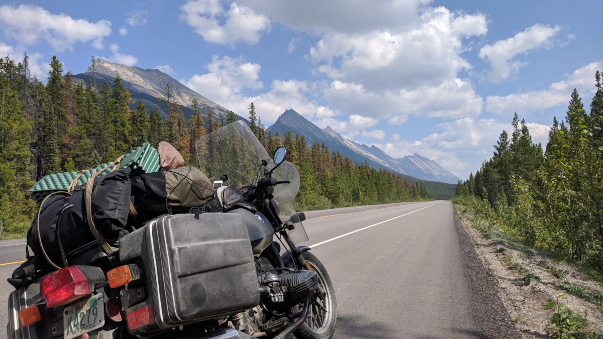
In order to visit Glacier National Park, I returned to America. The roads got worse as soon as I crossed into Montana, and filled with cows.
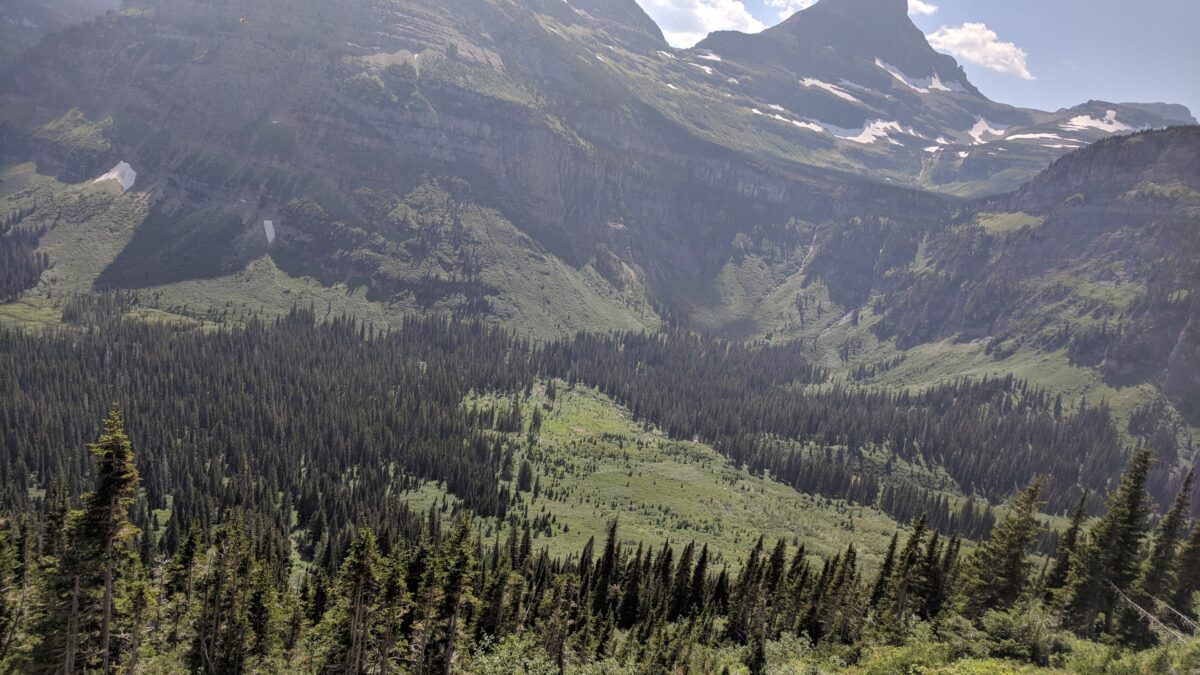
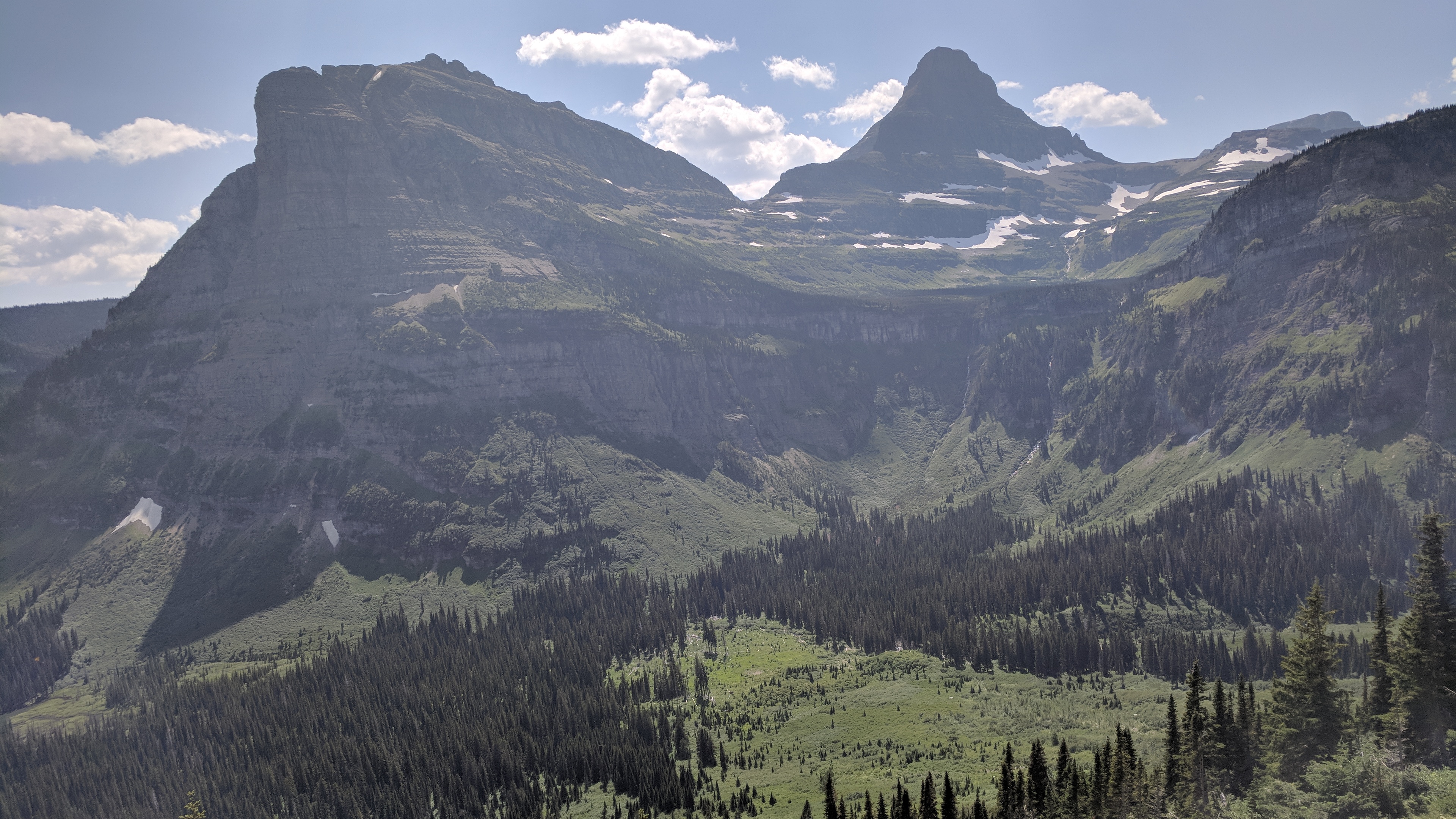
The Going-to-the-Sun Road is a spectacular road by any measure, 50 miles of delicate 2-lane mountain road winding through some of the most beautiful mountain landscapes one could imagine, sheer drops on one side and sheer cliffs up the other. In some places, glacial runoff sprays right down over the road, and in at least one place I could have ridden through it if I’d been quicker-thinking.
Thirty miles of it, though, was vertigo-inducing, hard to ride in the heavy traffic — don’t look up too high, or down too low, while navigating that wispy thread of road, surrounded by other sightseers.
There’s something to be said for the astonishment of the vertical panorama. Wide horizons we at least have precedent for, but a vertical swath from the sky down into the belly of the Earth is disorienting, like being able to see from space to the bottom of the sea in one glance, from Heaven to Hell in one fresco, too much for mortals.
There were two full-stop traffic jams on the way out, one for half an hour while we waited for a helicopter to evacuate a hiker, and another for a few minutes while a park ranger stalked the bushes carrying a bright pink long gun, presumably looking for tourists to put down.
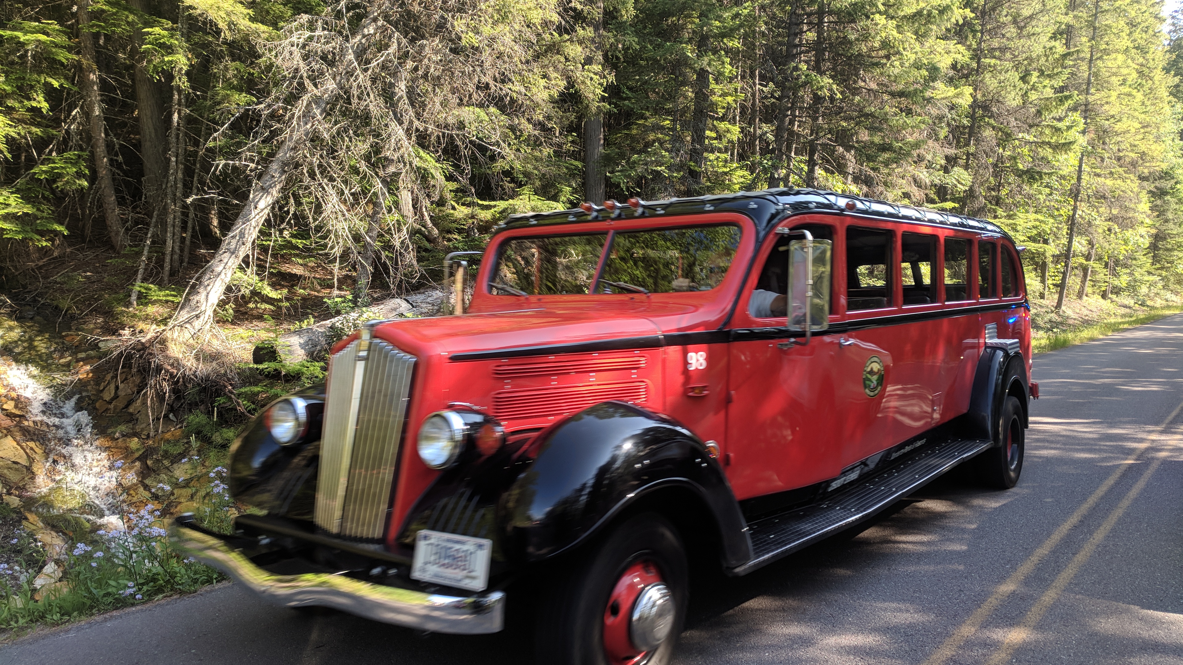
The bright red, retro-styled park buses seem like the way to go — let someone else drive along the cliffs of madness, sit back and gawp at the wonder of the land.
Glacier National Park.The road, etched into the side of the mountain.The buses of Glacier National Park.
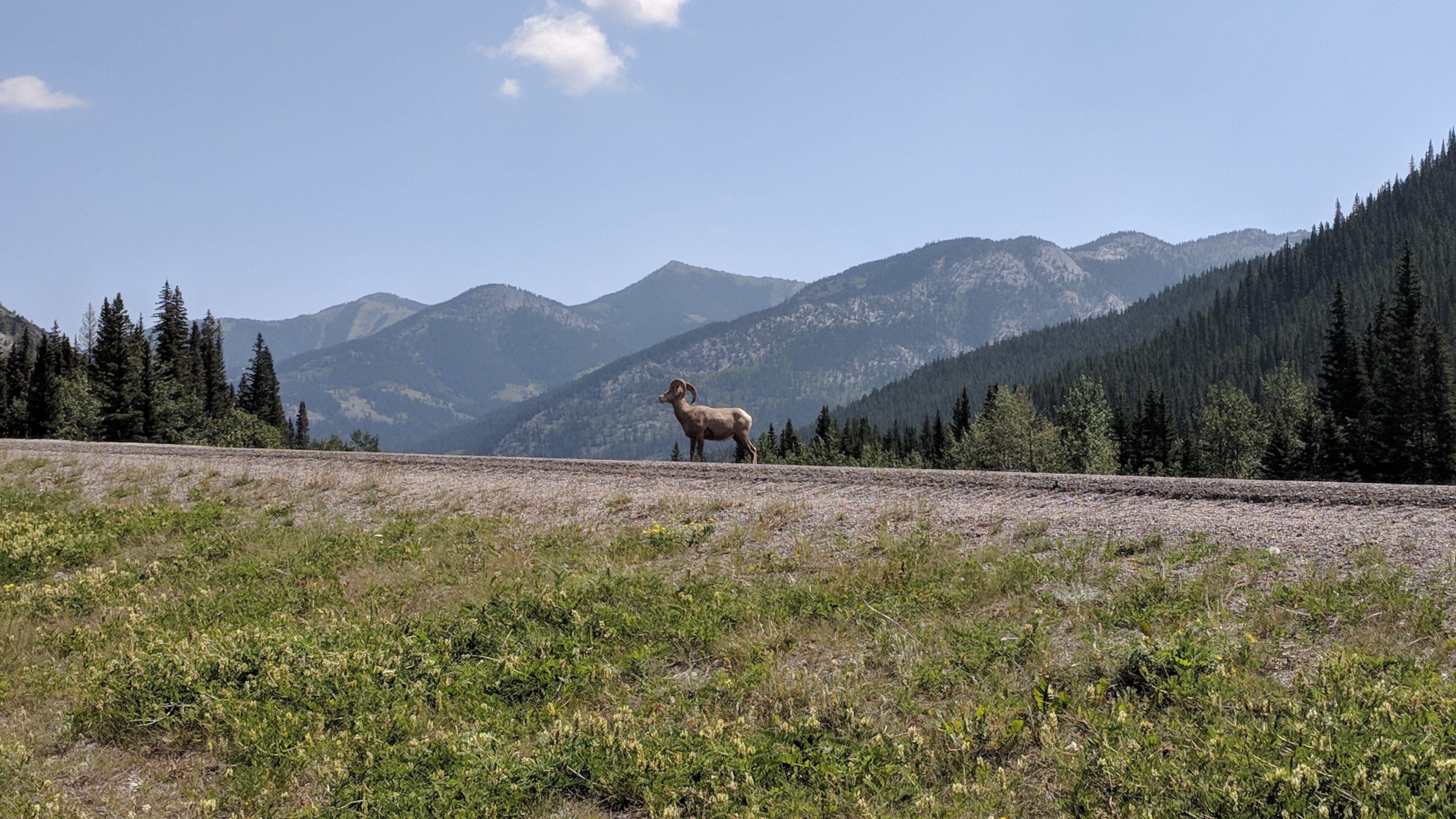
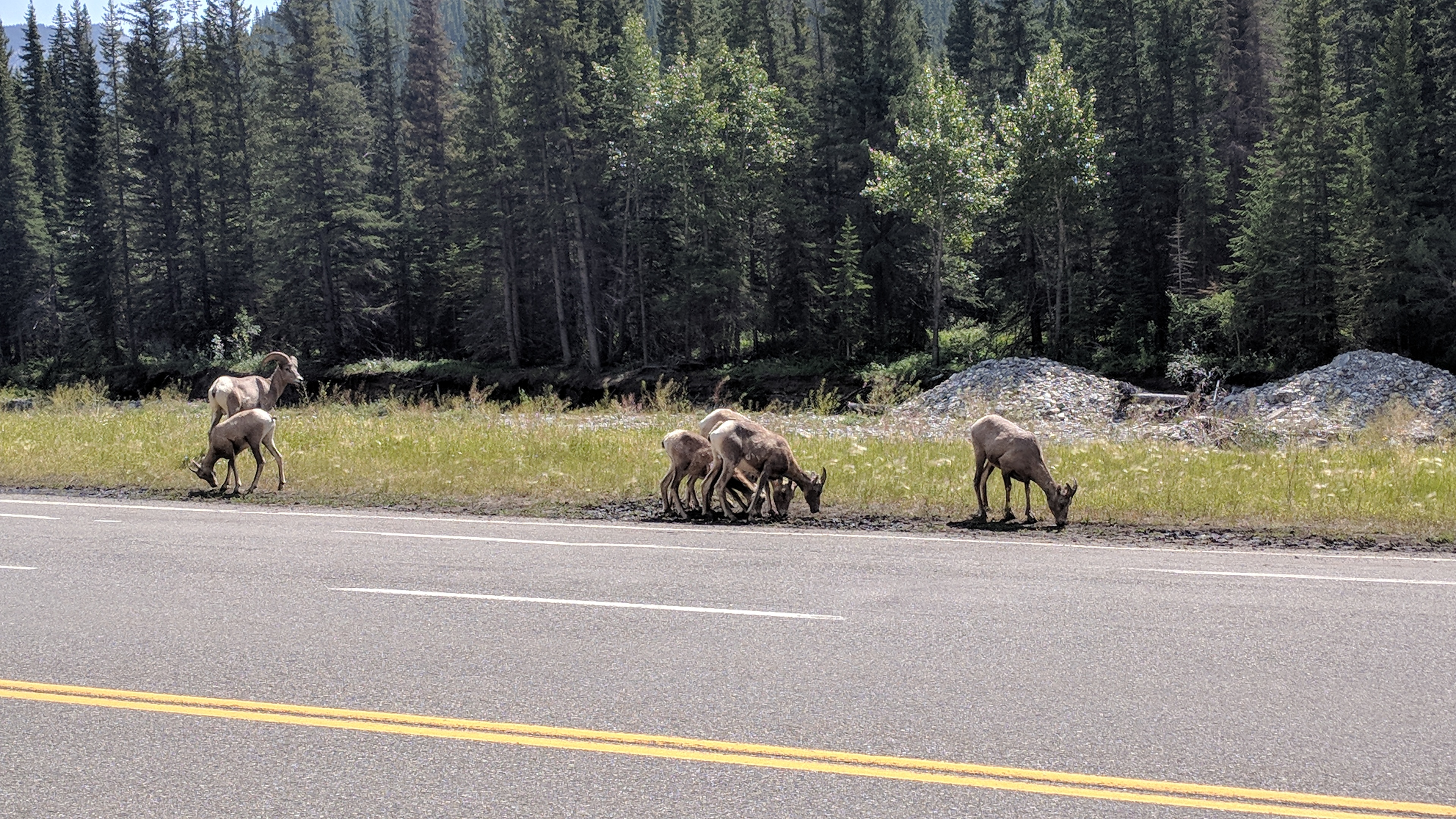
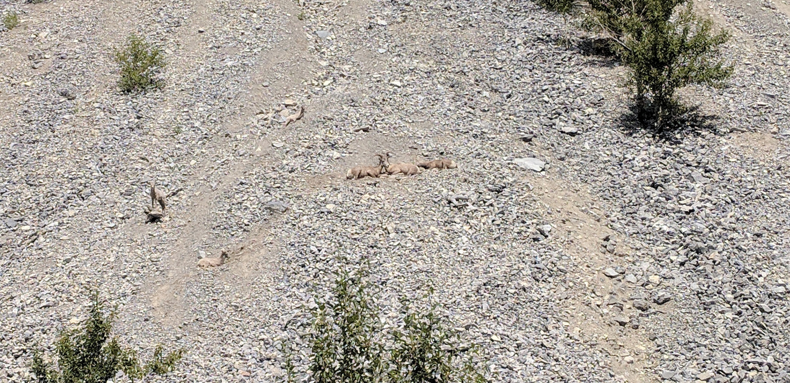
I was hoping nothing would happen today, just for the break. Instead, I saw two batches of bighorn sheep in the road while coming down 40 from Banff, one of them with probably 20 sheep dawdling back and forth across the highway, rams, ewes and little ones, licking mud and then scrabbling way up the high, sandy slope. Some of them were just ensconced up there, legs folded up under them as they watched over the rest of the turmoil, sphinx-like.
Switching over to 22, I was suddenly dropped into cattle country, rolling grassy ranches as far as the horizon. At one point, two enormous cows stood in the road, one red and one black.
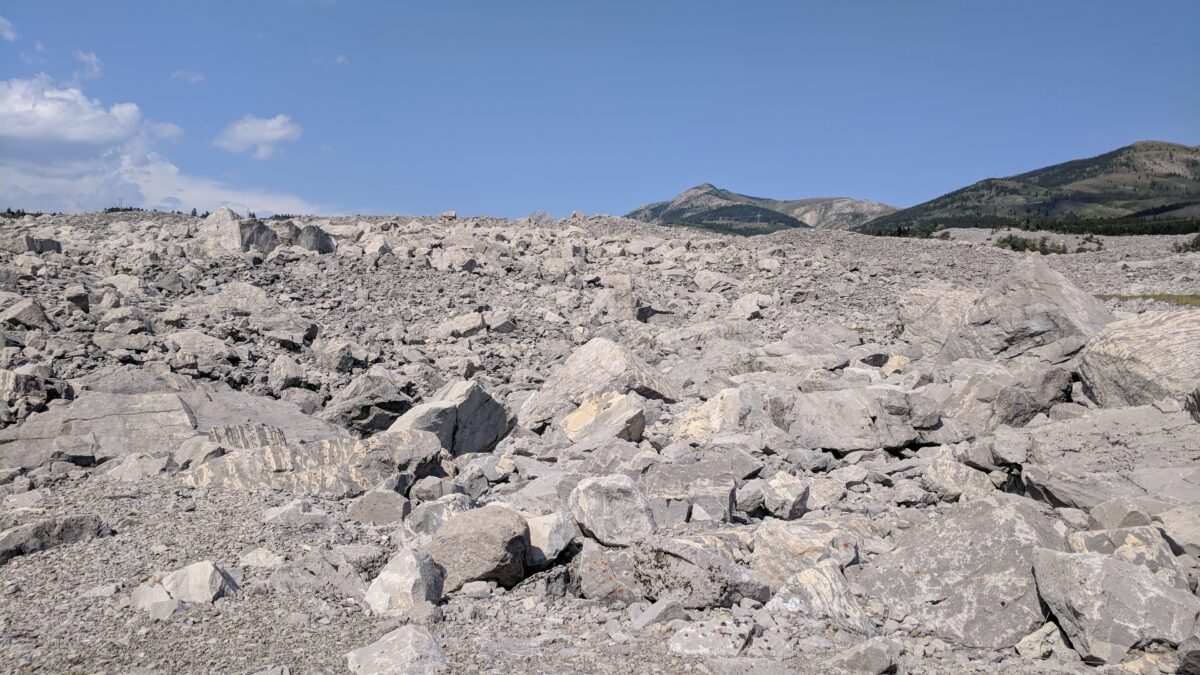
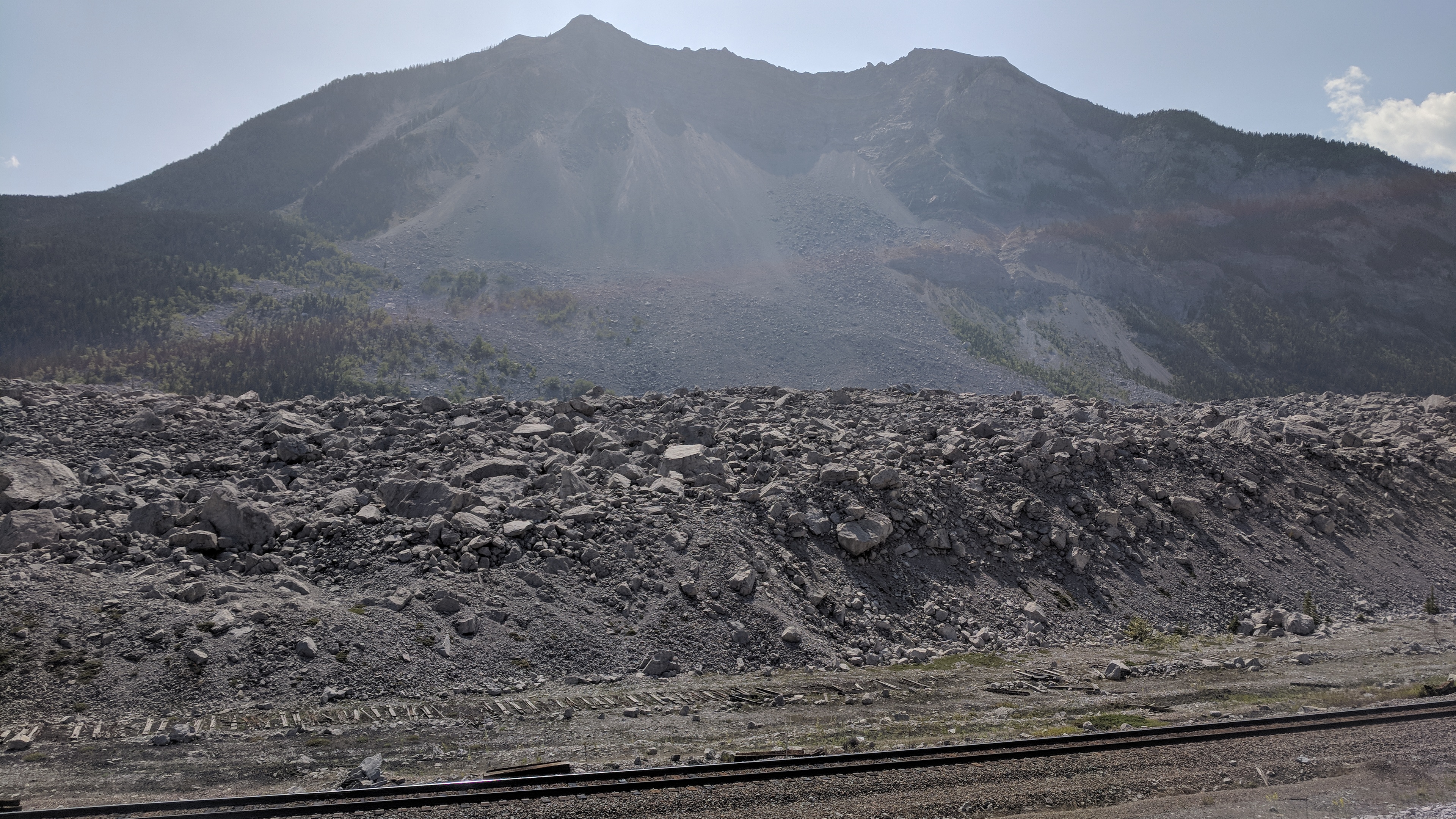
Then, at Crowsnest Pass, the Frank Slide. In 1903, a one-kilometer slab of rock broke free from Turtle Mountain, crumbling as it fell into a great wave of boulders that crushed the mining town below.
You can still see it, the rubble field, vast and jagged and fresh as if it had just fallen; time stopped. It’s a roadside vista of an apocalypse, a world-ending event, a plain of fresh rocks and no town.
They never fixed it — there’s no mending it when a mountain falls over on you — they just built around it. Eventually, they threw a road over it. It’s a story of erasure and the Earth’s might.
A bighorn sheep on the road.More sheep on the road.Sheep on the hill.The Frank Slide, and the mountain it came from.
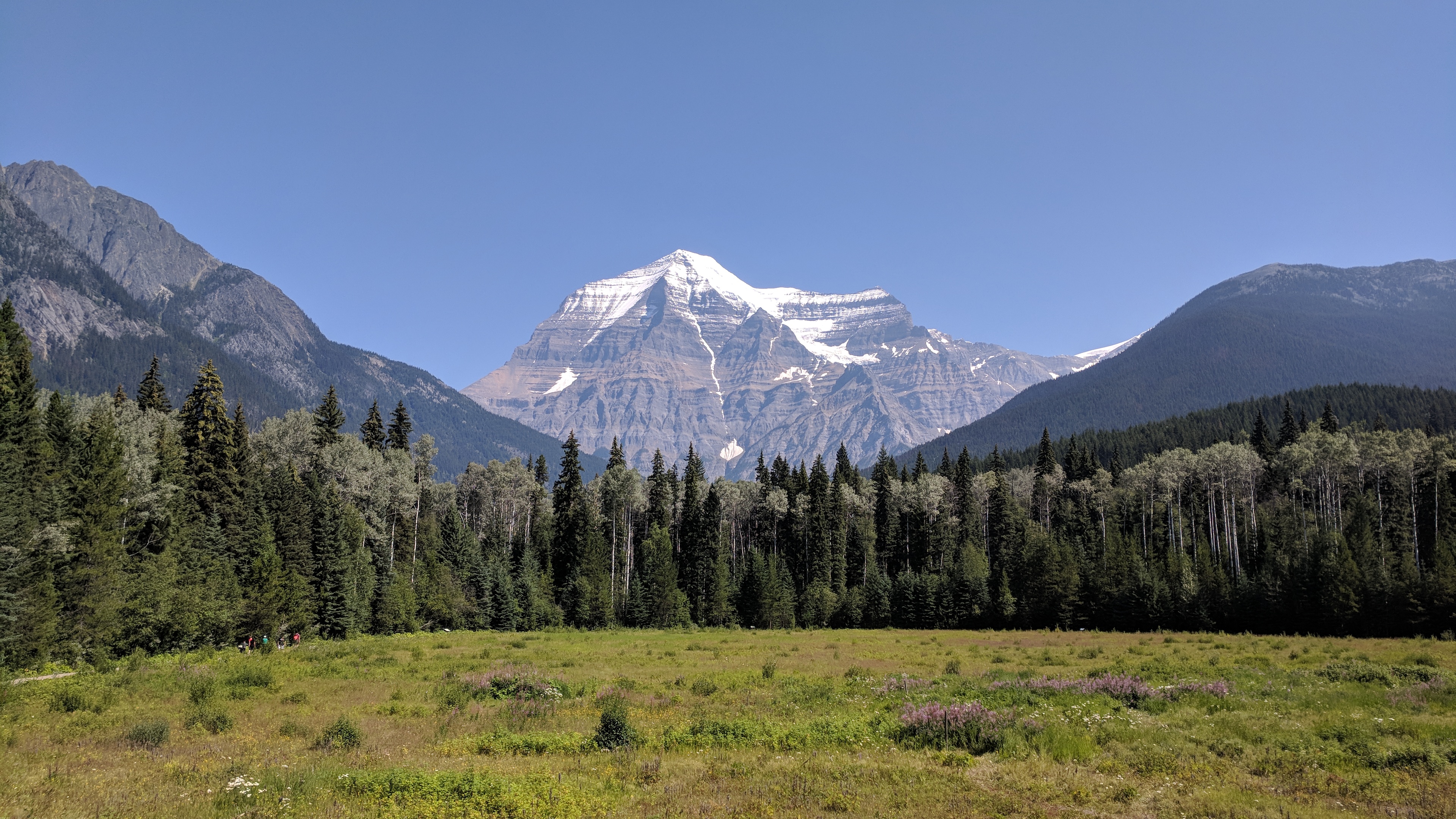
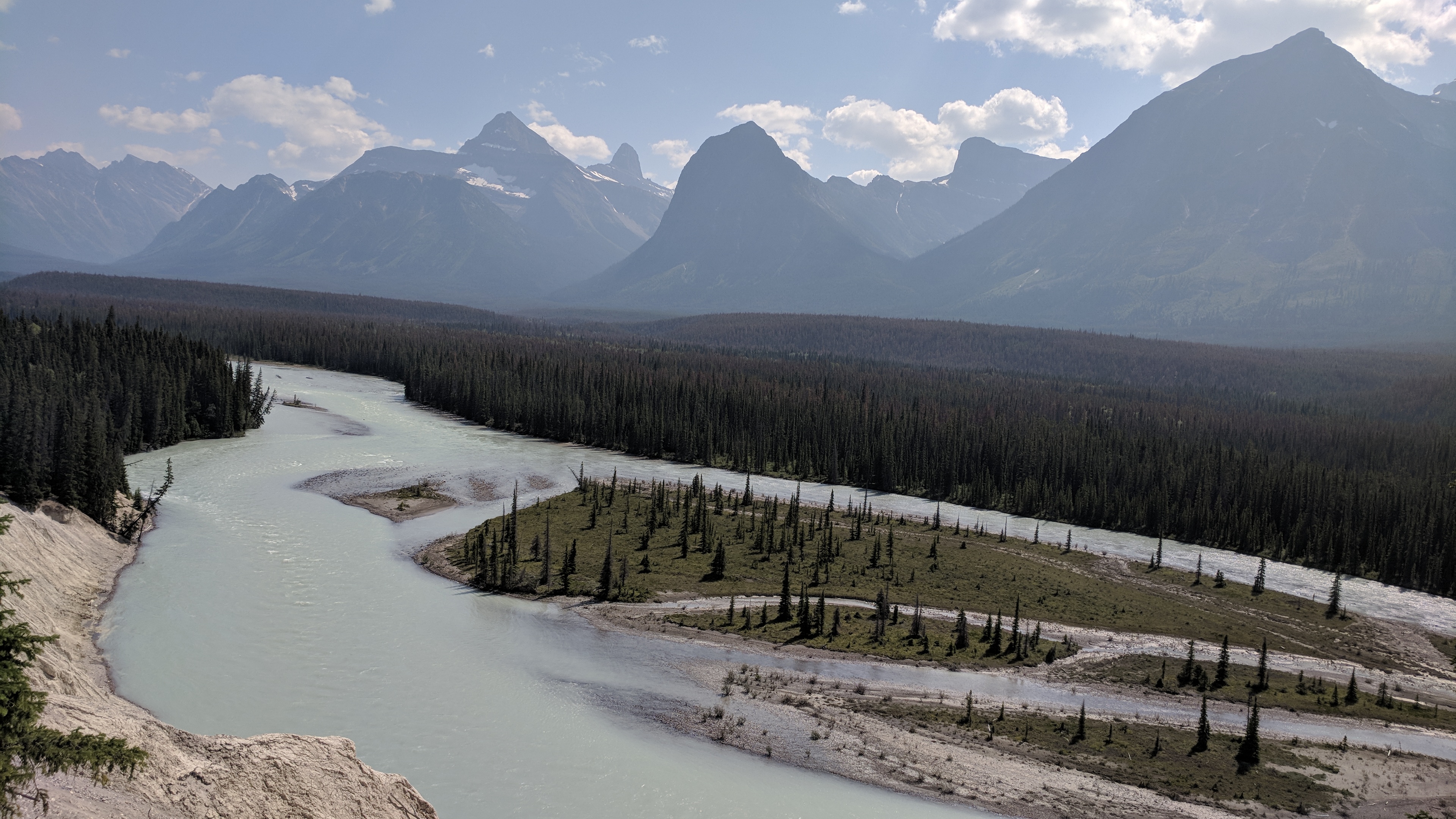
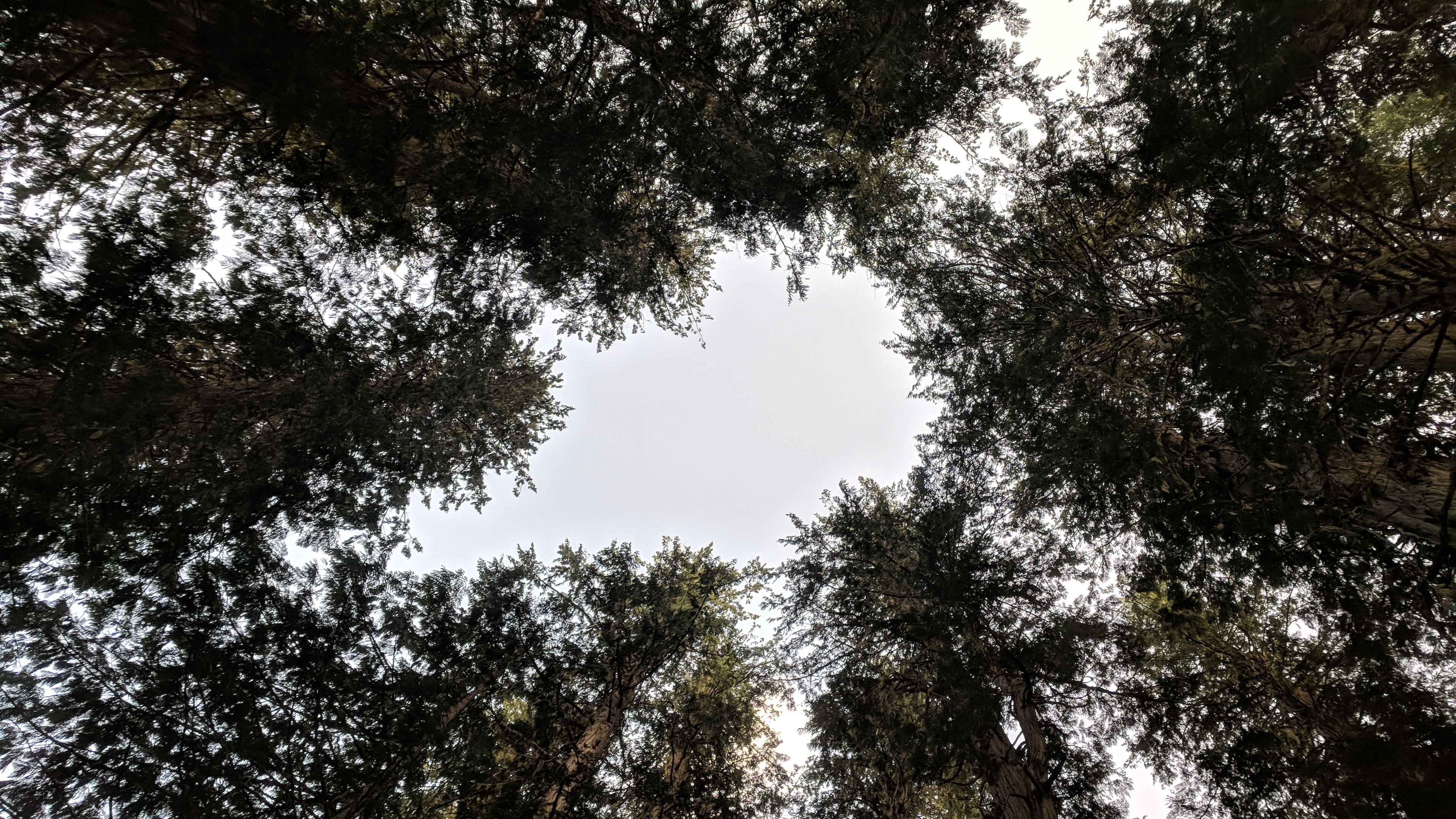
Mt. Robson signals the shift into the Canadian Rockies, a great snowy peak looming into view. It also signals the imminent crossover from British Columbia to Alberta and into Jasper National Park. It’s a sunny, beautiful day, the sky bright and blue and puffed with clouds.
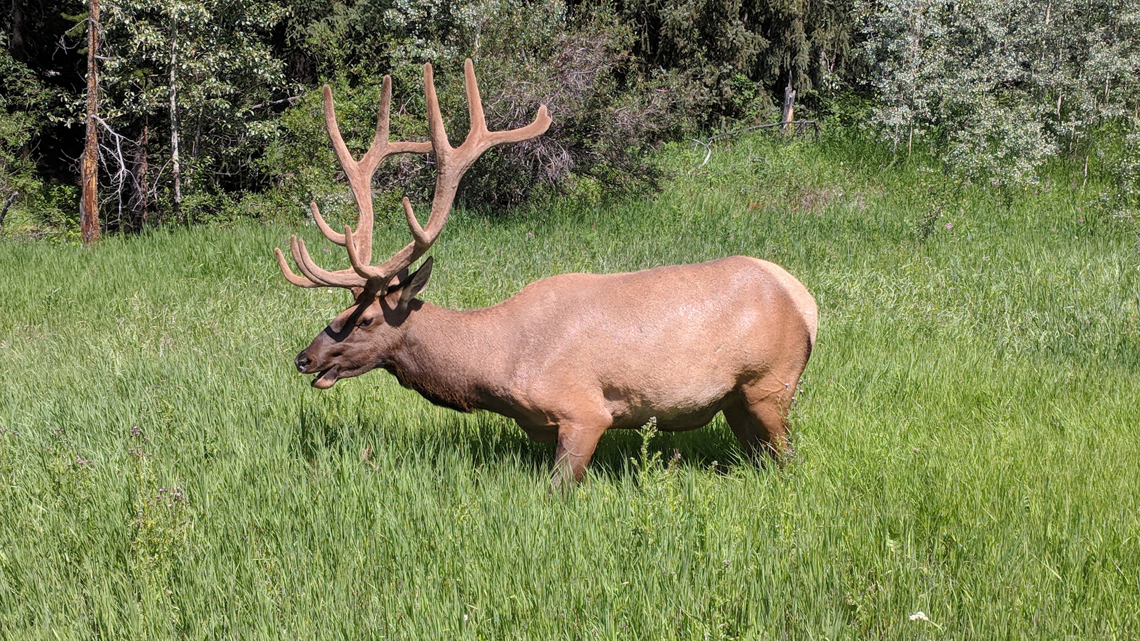
Just inside the park, two huge, beautiful elk graze by the side of the road, glowing and perfect as if newly-made. The antlers shimmer with fuzz, textured and rippled like wood covered in moth’s scales, or great long bones glistening with enchanted moss.
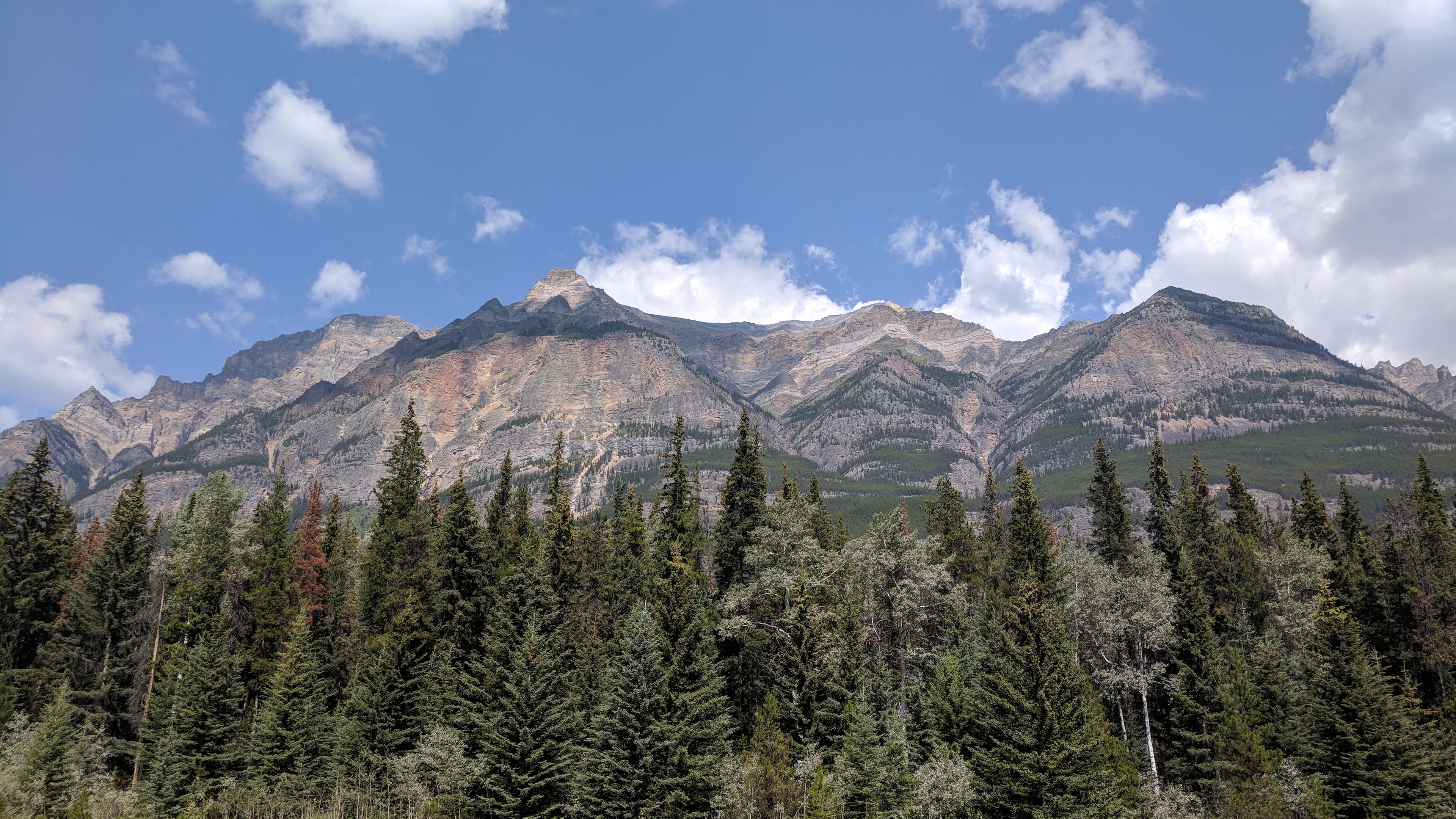
Then the Rockies simply explode, above and below the road at the same time, taking up so much of the sky they might qualify as a third kind of creation, heavens/earth/mountains, as vast as twilight. The rivers are creamy blue with froth, the color of warm ocean surf.
All of the elements are familiar, peaks and snow and glacial rivers, but the combination is new and more. The mountains are vast and each unique, each doing its own thing, ridges and spires and turrets cavorting, dancing with the sky as the road bobs up and down, around and through.
It’s like being surrounded by laughing gods.
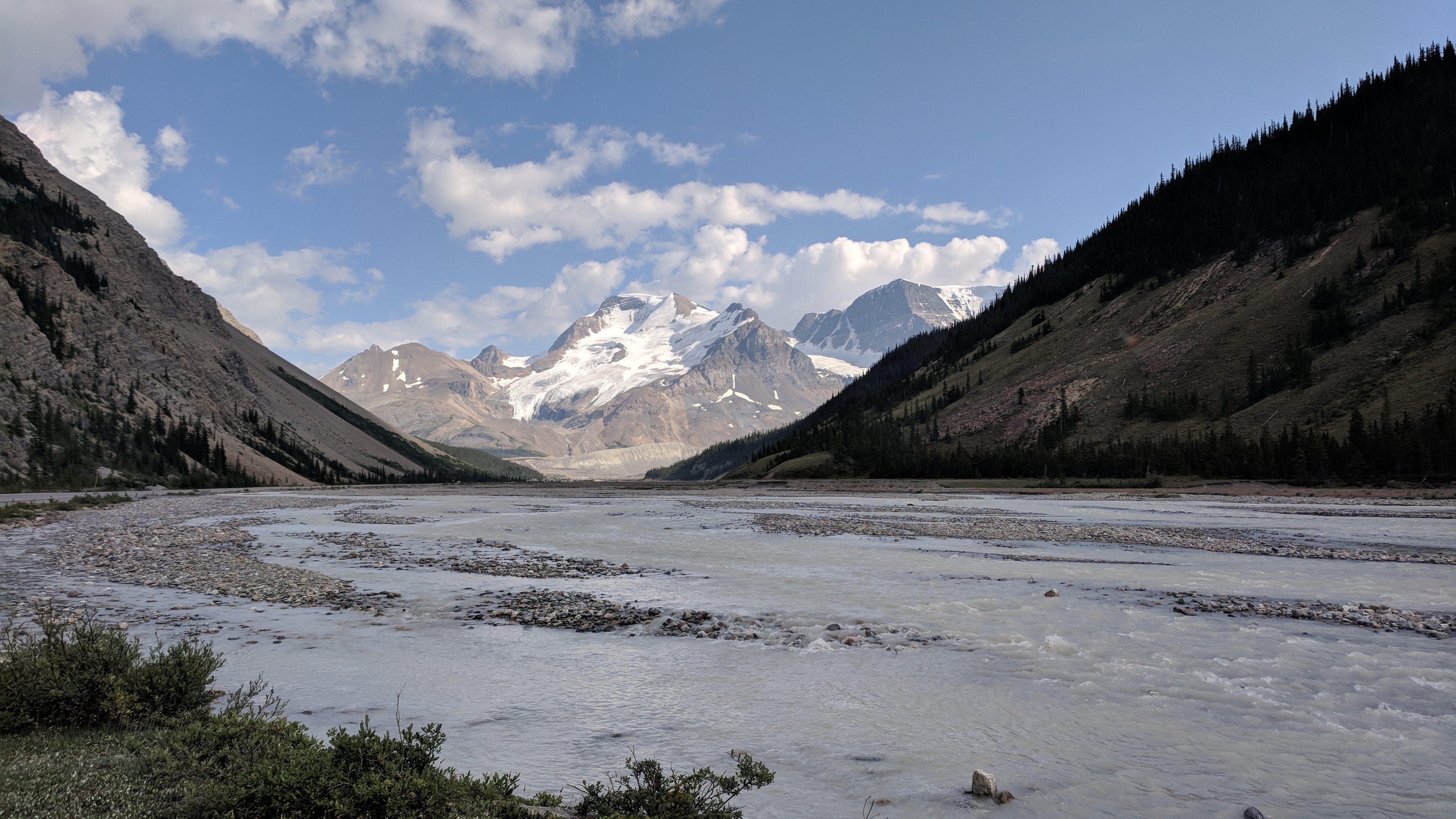
I stop at a park sign that says “Goats and Glaciers” and after a hundred-foot walk, there they are. Glaciers trail out of the ridge beyond, blue glacial streams ripples across the riverbed below, and along one edge tiny, snowy-white mountain goats the size of grains of rice drink from the river, picking their way along the shore.
It’s only mid-day and I feel like I’ve seen too much. I need it to stop, I need a break, a dark room, silence. It’s as if things are accelerating and now I will be struck down by wonder not just every day, but every half-day; soon every hour, then every minute knocked to my knees, endlessly writhing in the rapture of the holy, a broken Shaker, another madman.
Mt. Robson.Brand-new elk.A few of the laughing gods.Like the sign says: goats and glaciers.
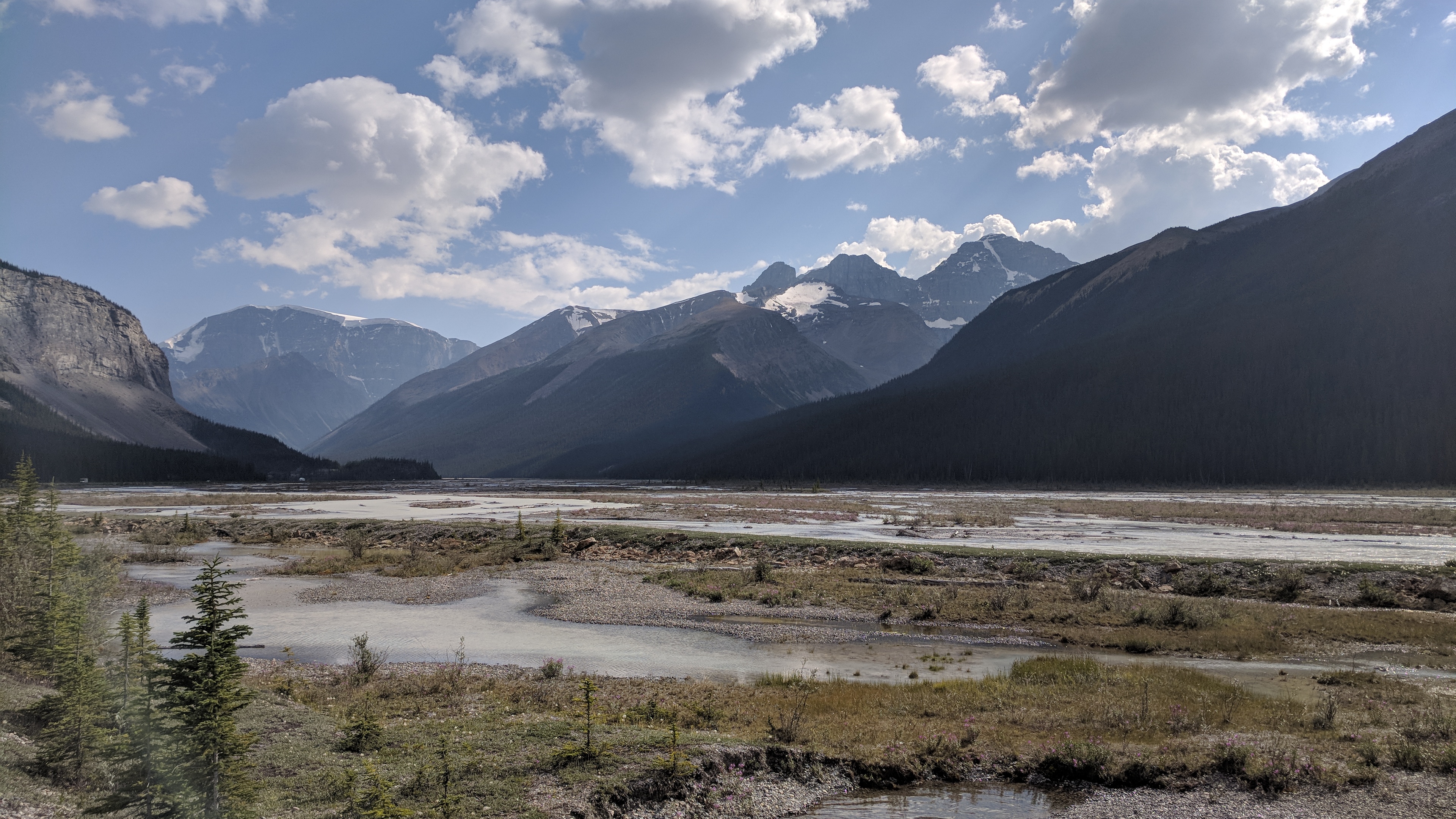
But it doesn’t stop, and three glaciers pour down onto the visitor center as I drink my coffee. I’ve only made it a few miles. I don’t know how I’m going to get out of here. I only have a day pass; if I don’t reach the edge of the park by dark I’ll have to live here forever.
I pass wide, flat riverbeds where the colors are all wrong, light frothy greens and purples skimming across pearly stone beds, delicate alien puffballs swaying in the wind. The whole thing feels unearthly, habitats remixed and refracted into each other and painted with the colors of Faerie by a mad Maxfield Parrish.
There’s a stone field where the sharp pieces of gravel are larger than trees, or maybe the trees are tinier than rocks. It’s hard to tell since the perspective is broken.
Icefields and tundra flowers, tiny streams and roaring planes of water, perfect smooth stones and mountains out of myth are all mixed together in the sky and preserved in a brine of sunlight.
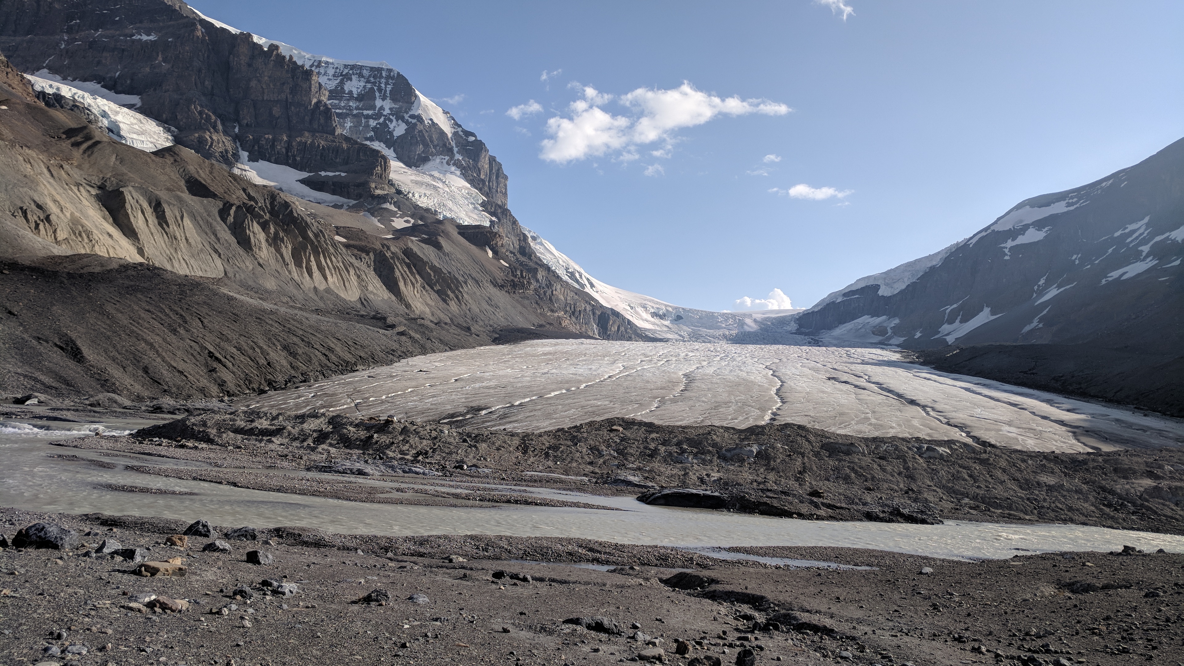
By the time I reach the toe of Athabasca glacier, I am laughing and crying and can barely look at it. A moon-path leads right up to it, its great wrinkled skin dirty and icy and ancient like the surface of Europa.
A river comes right out of it, not some slow watershed-wide process of accumulation, but right there, you can see a river created, sprung fully formed from the glacier’s side to run off down the valley. Creating rivers is a great magic.
These are the only times I’m happy, the only times I’m really alive, when I cease to exist and become wholly myself, both.
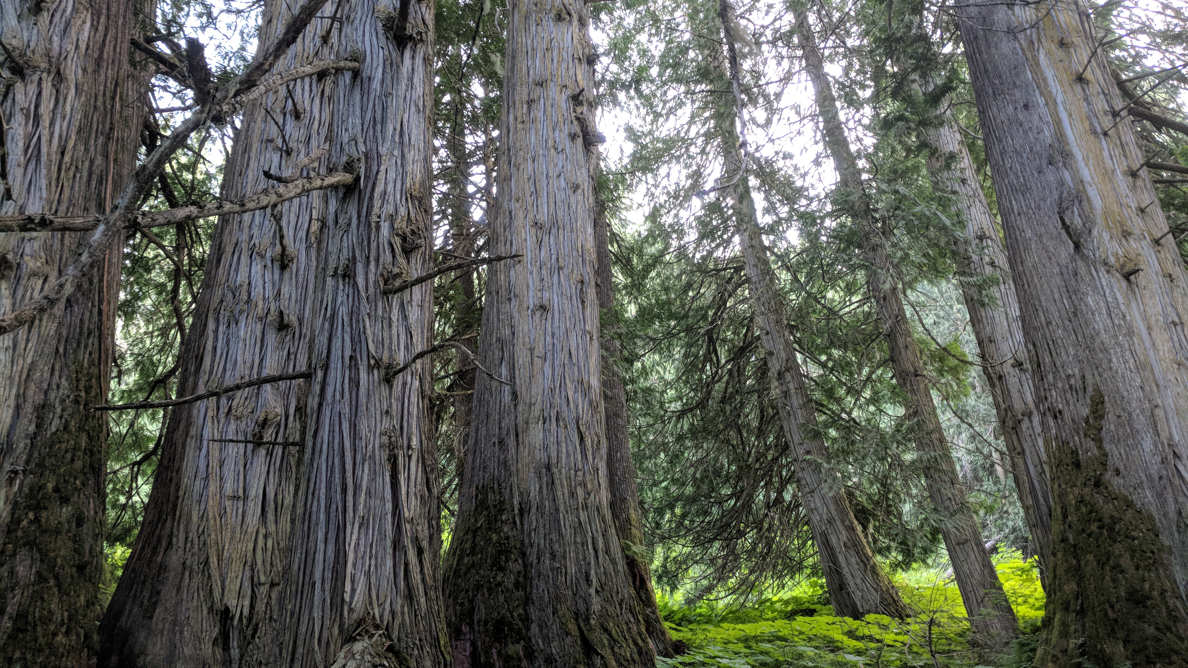
I was ready to call it, a nice enough but mostly unremarkable day of riding, but then I pulled over at Ancient Forest Provincial Park, partly to use the pit toilet.
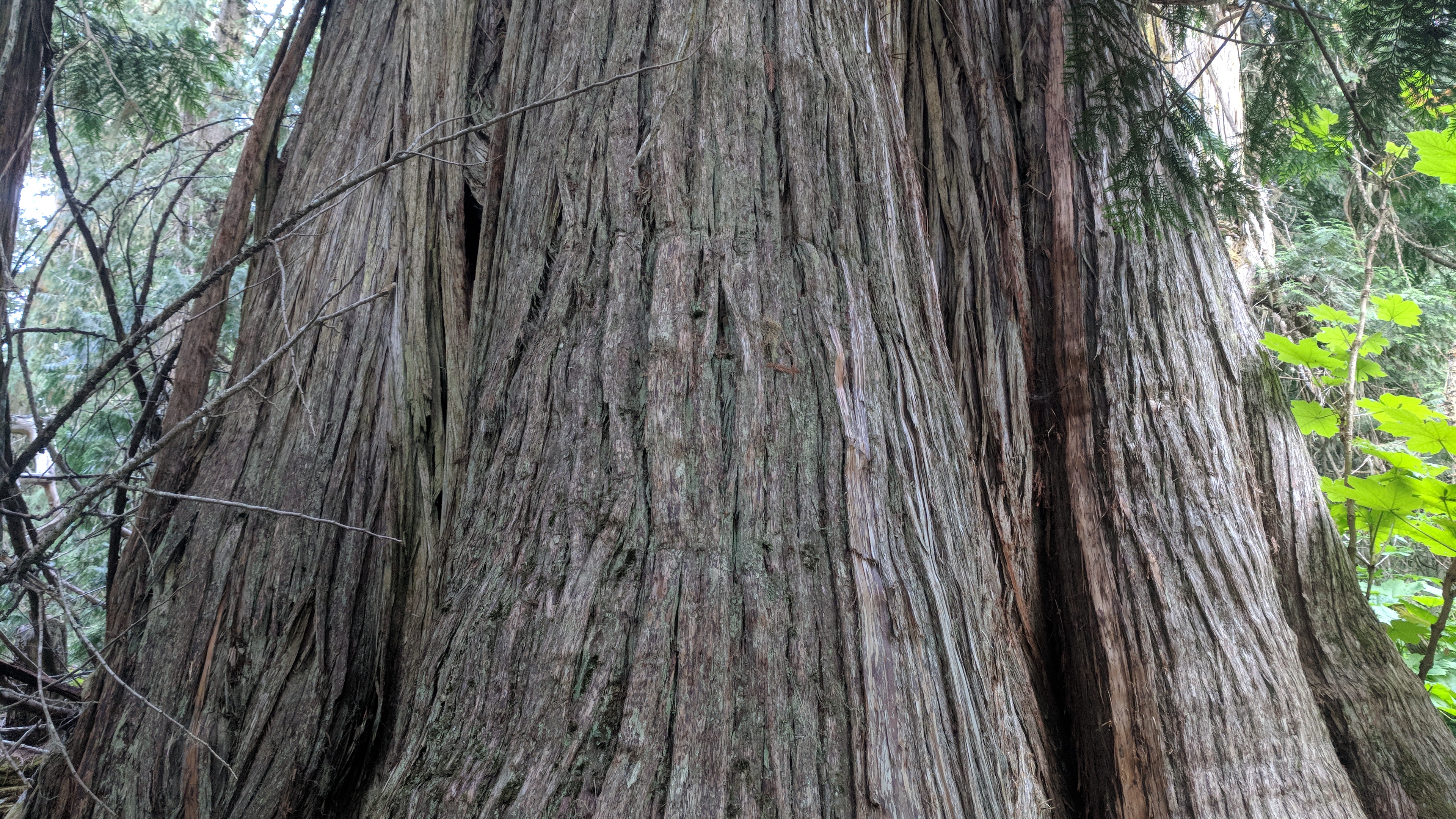
At end of a short boardwalk the forest blooms, ancient old-growth cedars that are hundreds, even thousands of years old. It’s a rare pocket of inland rain forest and they’re not even sure how old the trees are; the big ones could be one millennia old, or maybe two.
The cedar forest feels safe. Their bark is soft and spongy, almost woolly, with accents of orange-yellow lichen. The biggest one is 16 feet in diameter. I don’t usually trust trees very much, but these seem stable and thoughtful and smell nice. They would make fine Ents, or upstanding members of the Parliament of Trees. A thousand years ago this forest might have looked the same; it might even have had the same trees. They’re living in tree time, a humbling scale, and for the moment I believe in trees.
Ancient Forest Provincial Park, British Columbia.The Big Tree, a cedar with a diameter of 16 feet.Looking up through a ring of cedars.
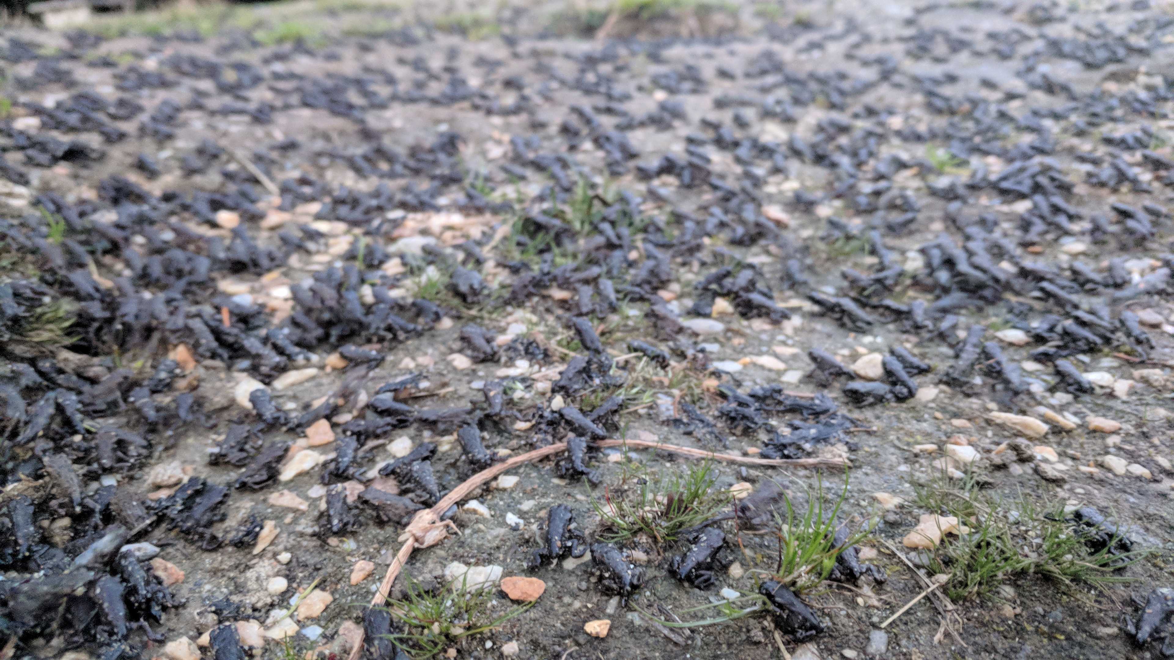
Further down the road I pull into a campground by a pond. As I circle though the campsites, tiny black shapes scurry across the ground and I think they are crickets, but the light is failing and then no, I think they are spiders and I worry.
But they are frogs. Tiny dark frogs the size of dimes, the size of fingernails, and they are everywhere, there are thousands of them. They are in every campsite, they are in the road, they are in the grass, it is amazing but I don’t know what they are doing or where they are going. It is hard to avoid stepping on them so I stand on a bench, high ground in a plague of frogs.
Then down by the shore I see where they are so thick, they have made the ground black. It’s a carpet of tiny frogs, writhing, ecstatic, lost in some arcane frog ritual.
Despite my best efforts, I kill so many frogs. I take as few steps as possible, but they are everywhere and constantly moving. I consider abandoning the whole campground, but it is late and I am tired and I have no idea when I’ll find another place to camp.
It is upsetting. The cedars felt like peace, but this is the opposite, this is tens of thousands of lives spent wastefully, lost in the churn, this is nature’s ruthless profligacy. But it only seems different; of course it is really the same.
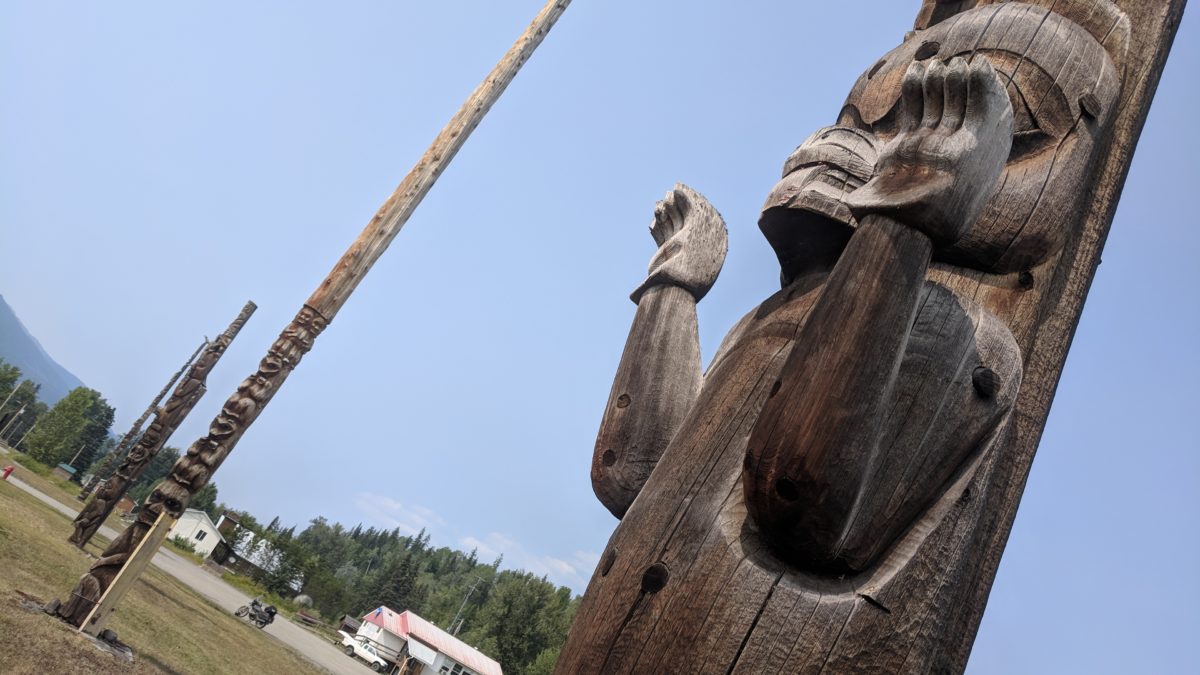
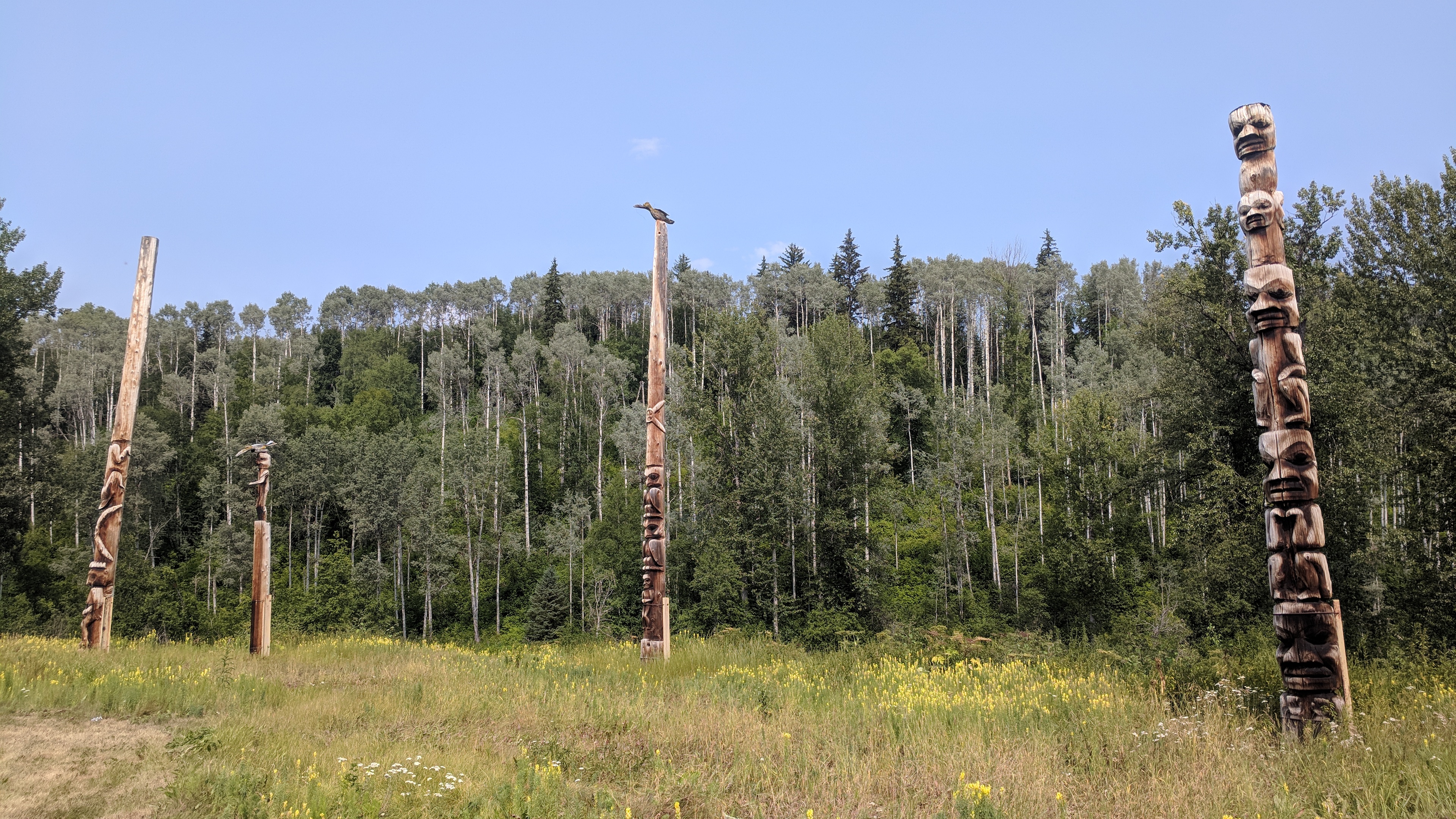
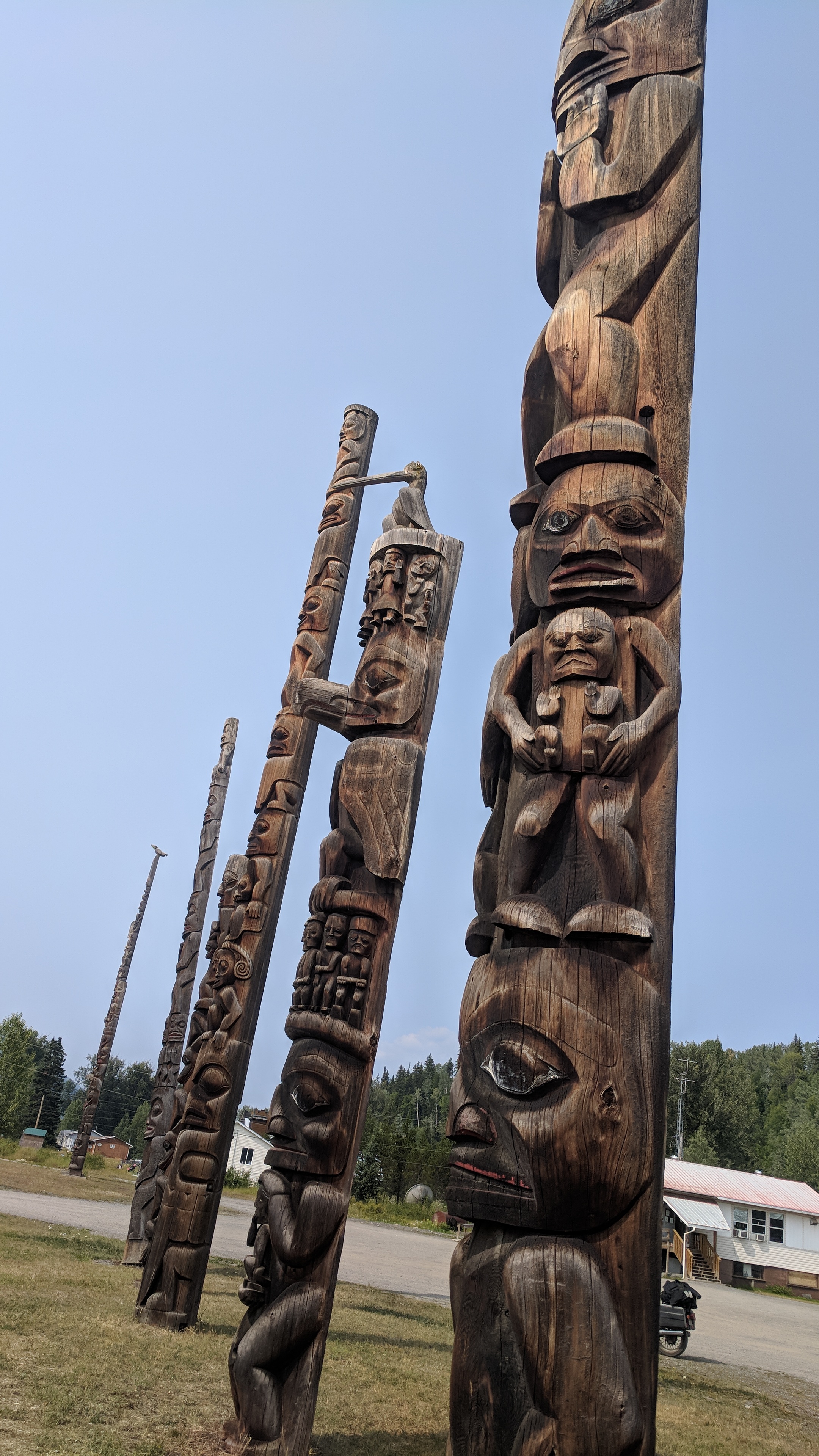
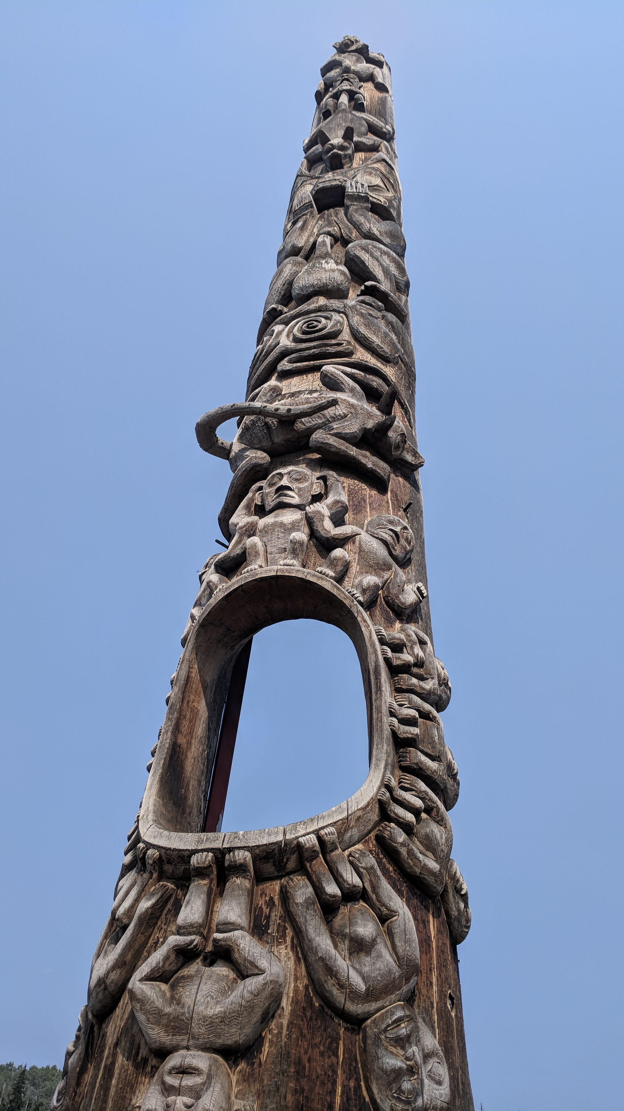
From the road, Gitanyow is just a road sign and a vague promise of gasoline, but it’s hot and I’m tired so it seems worth a shot. A half mile along and suddenly huge totem poles burst out of a field, enormous, maybe 50 or 100 feet tall, dark brown and weird and carved with different patterns.
The interpretive center is closed so I don’t learn much. Braced with metal, they can’t be too old, but I don’t know how old totem poles are supposed to be anyway. They cant slightly in different directions, great strange story trees. Some were only carved part way up, presumably with more story to tell.
The totem poles of Gitanyow.
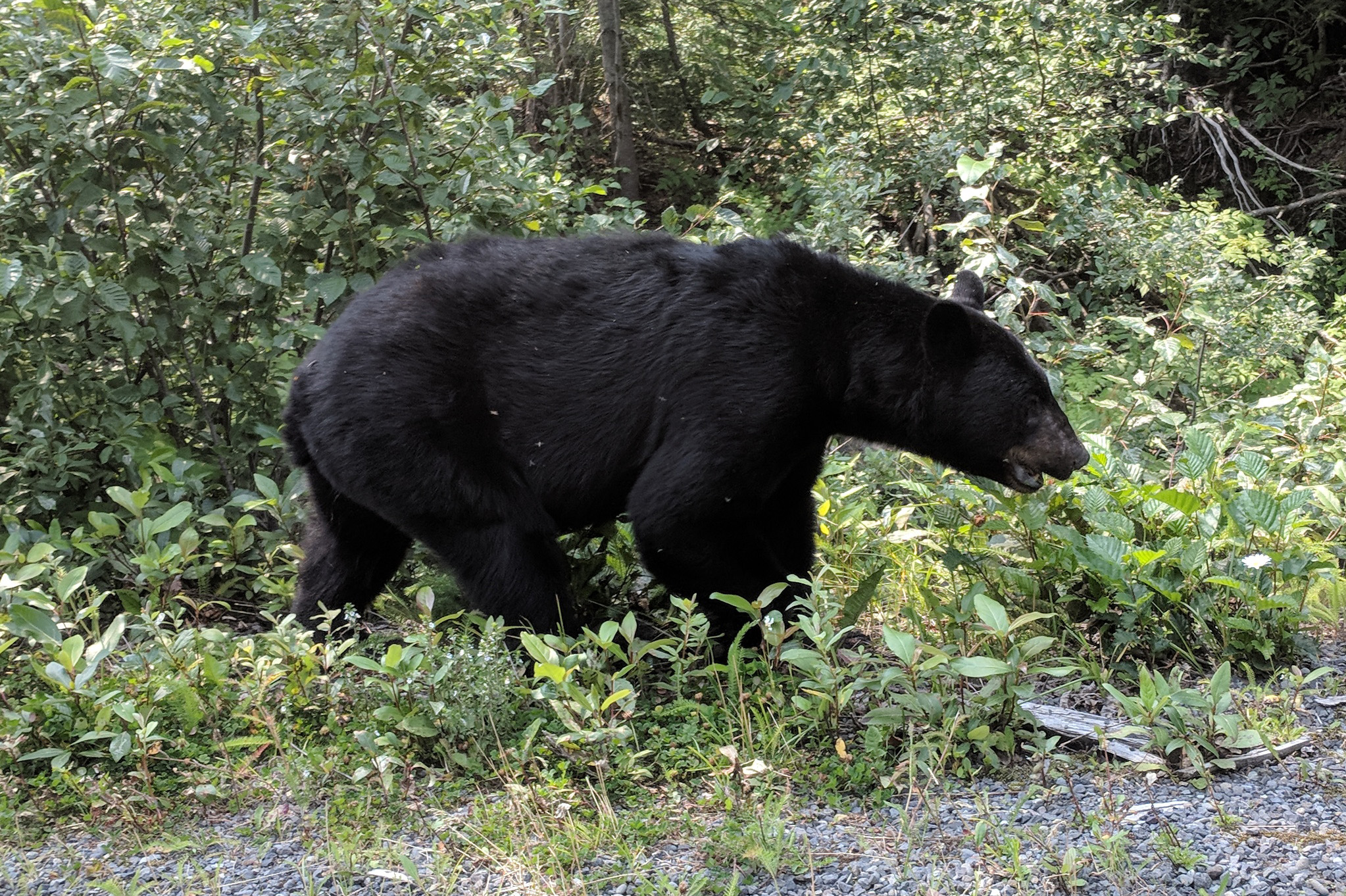
Further south, a woman at a native crafts shop shows me pictures of a spirit bear she’d seen once. A recessive gene occasionally renders a black bear into a creamy white, but only in the southwest BC area. They’re not albinos, and the cubs might again be black, but occasionally — spirit bears.
So many bears; different colors, different species, different clans. I have seen more bears than anything else, two more again today. One looked tormented by flies and heat and ignored me as he chomped clover; the second one was a little way down a dirt road, and more wary, popping his head up from the tall grass to watch me when my engine got loud.
Every trash can for two thousand miles is bear-proof. There might be more bears than people in Canada. Maybe the bears are the actual people. As far as I can tell, everything is made of bears, the hot ground, the woods, the shadows, the storm clouds, all bears.
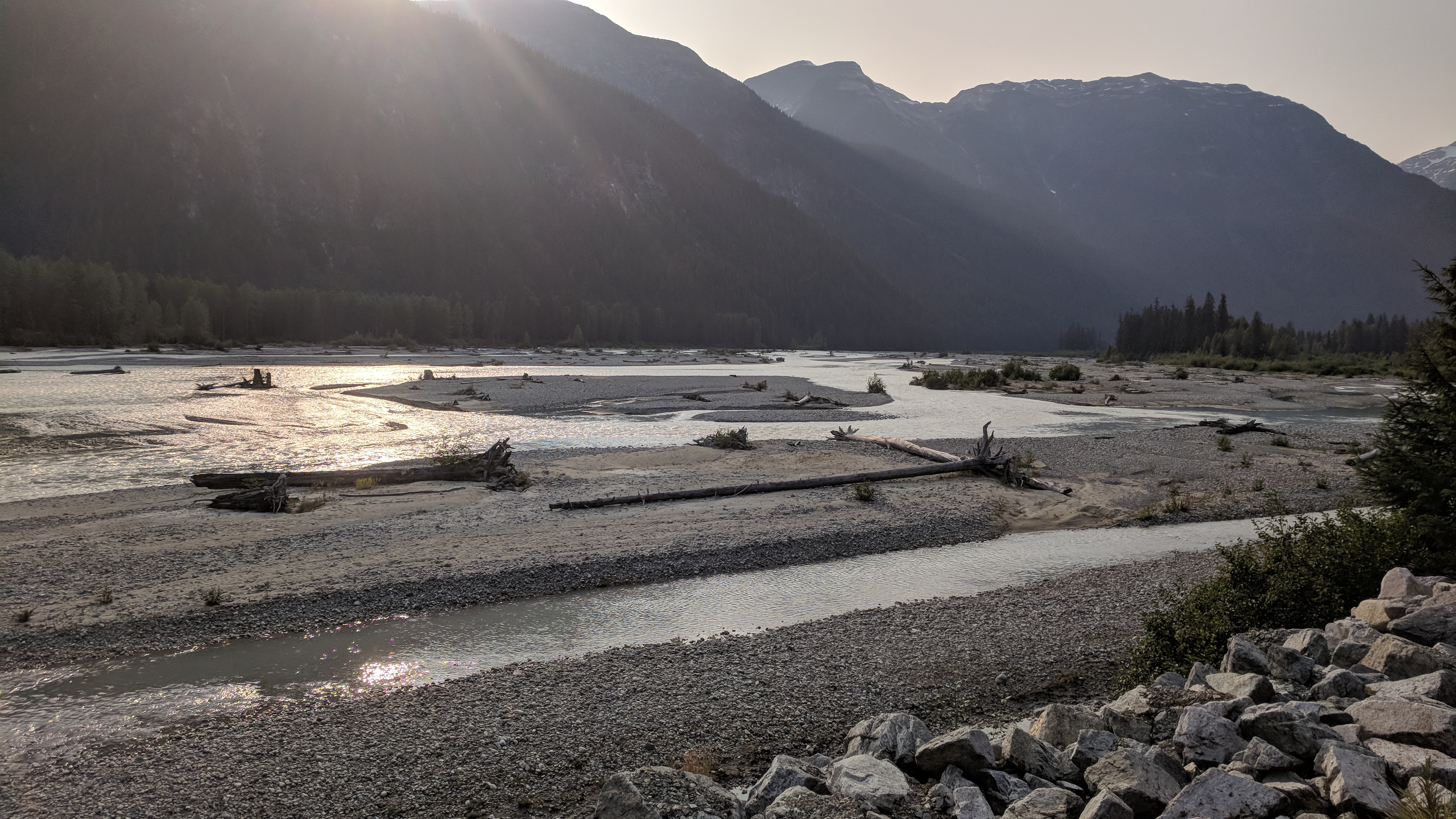
Started the day on the ground, a beautiful campsite by a river off Highway 37 in British Columbia, but when you sleep on the ground the ground gets into you, the rocks start to turn you and you wake up slower, stiffer, with less life in you. Rocks know nothing but pain.
I saw three bears, a brown bear on the left side of the road and two black bears grazing along the right. The brown bear might have been a cinnamon, though, a black bear with brown-frosted fur. He was very brown, but with black underneath, so I’m not sure. There are many different flavors of bear.
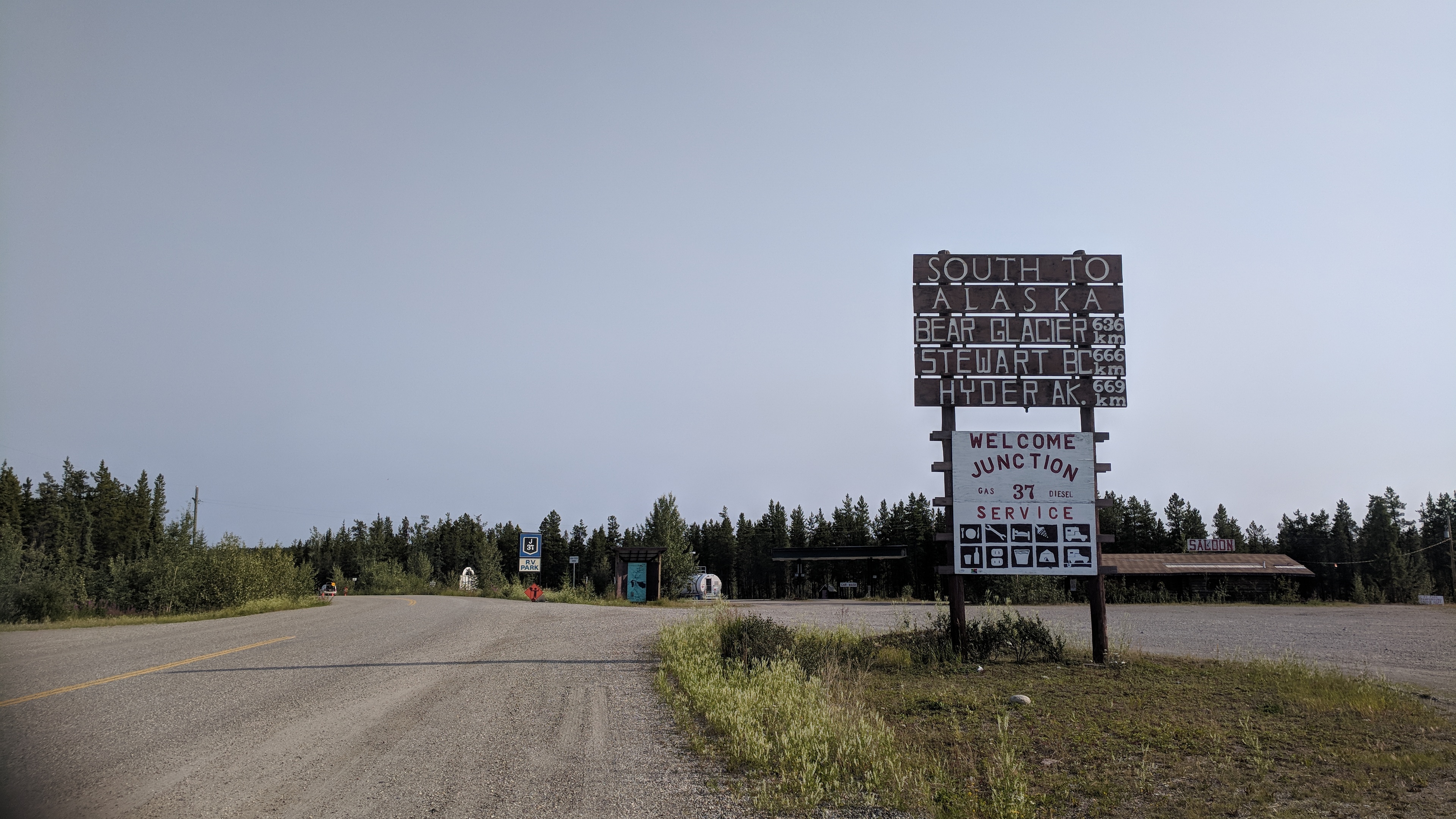
The Stewart-Cassiar Highway (37) is beautiful, a painfully remote, winding ribbon of road between mountains and along silver lakes, dropping south through the province.
The dots on the map that usually mean towns are very far apart. Some of the dots turn out to be just one building. Some turn out to be nothing visible at all. No internet or electricity for me, anywhere.
The start of the Stewart-Cassiar Highway.
It’s hot, and the flies make it hard to stop and rest. At one point when I fuel up, a swarm of hornets descends on the fairing to pick through the bodies of the dead. I’d wanted to take a break and get some coffee, but there are so many hornets that it’s alarming, dozens of them swarming over the bike like something out of a horror movie. Unsettled, I get going again, watching them blow away one by one.
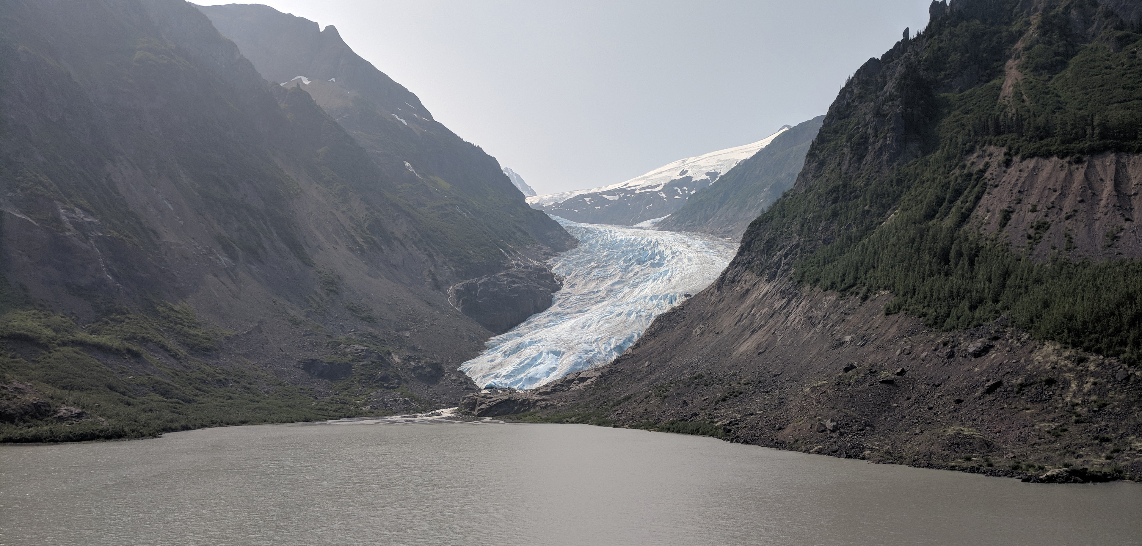
When I turn onto 37A, suddenly I am deep in the glacier-riddled mountains of the coast. The air gets cooler. Bear Glacier hangs over the road in fat, rumpled glory, the second glacier of that name on this trip. Then there is the smell of the sea.
The view from the ground.Bear Glacier, near Stewart, BC.
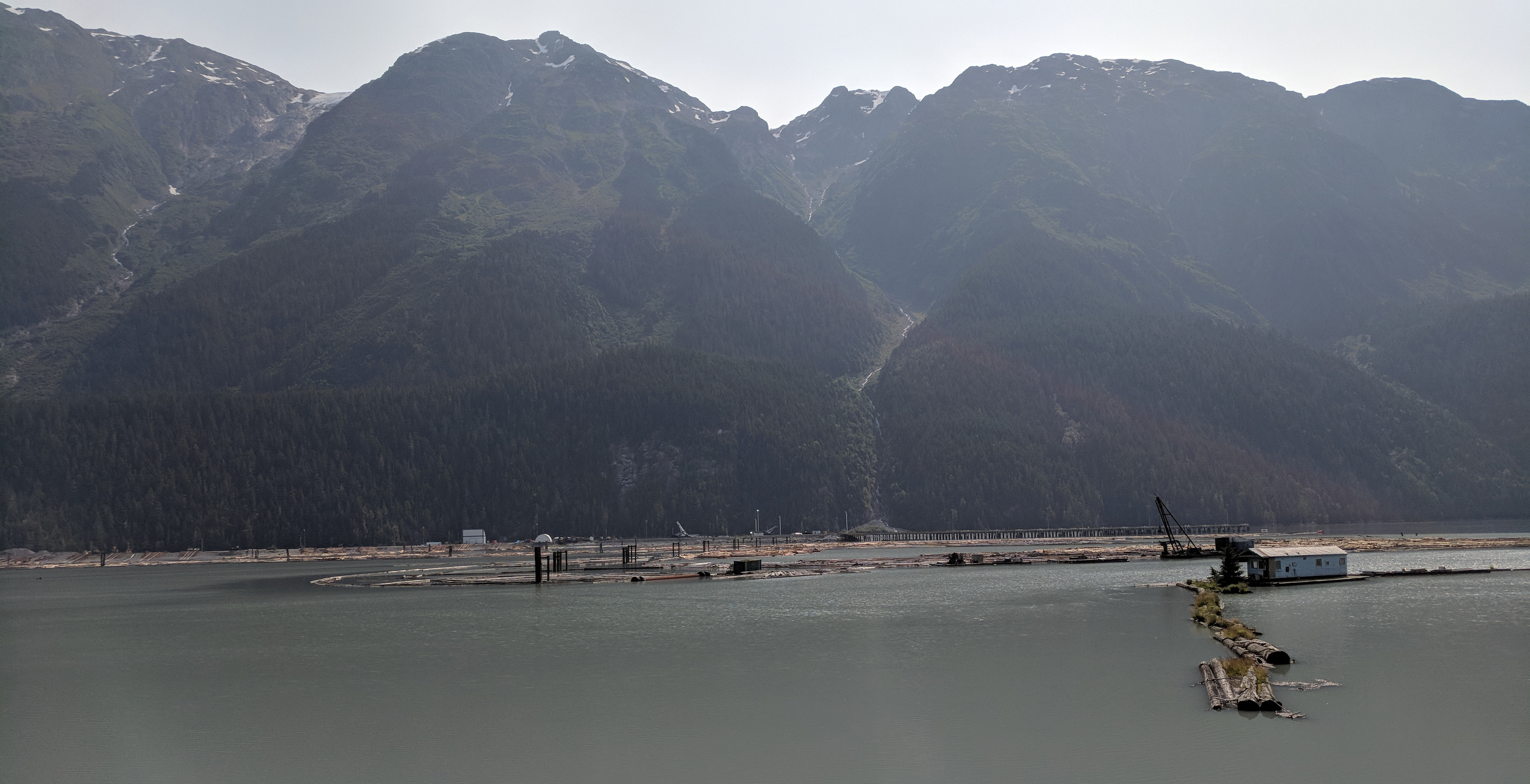
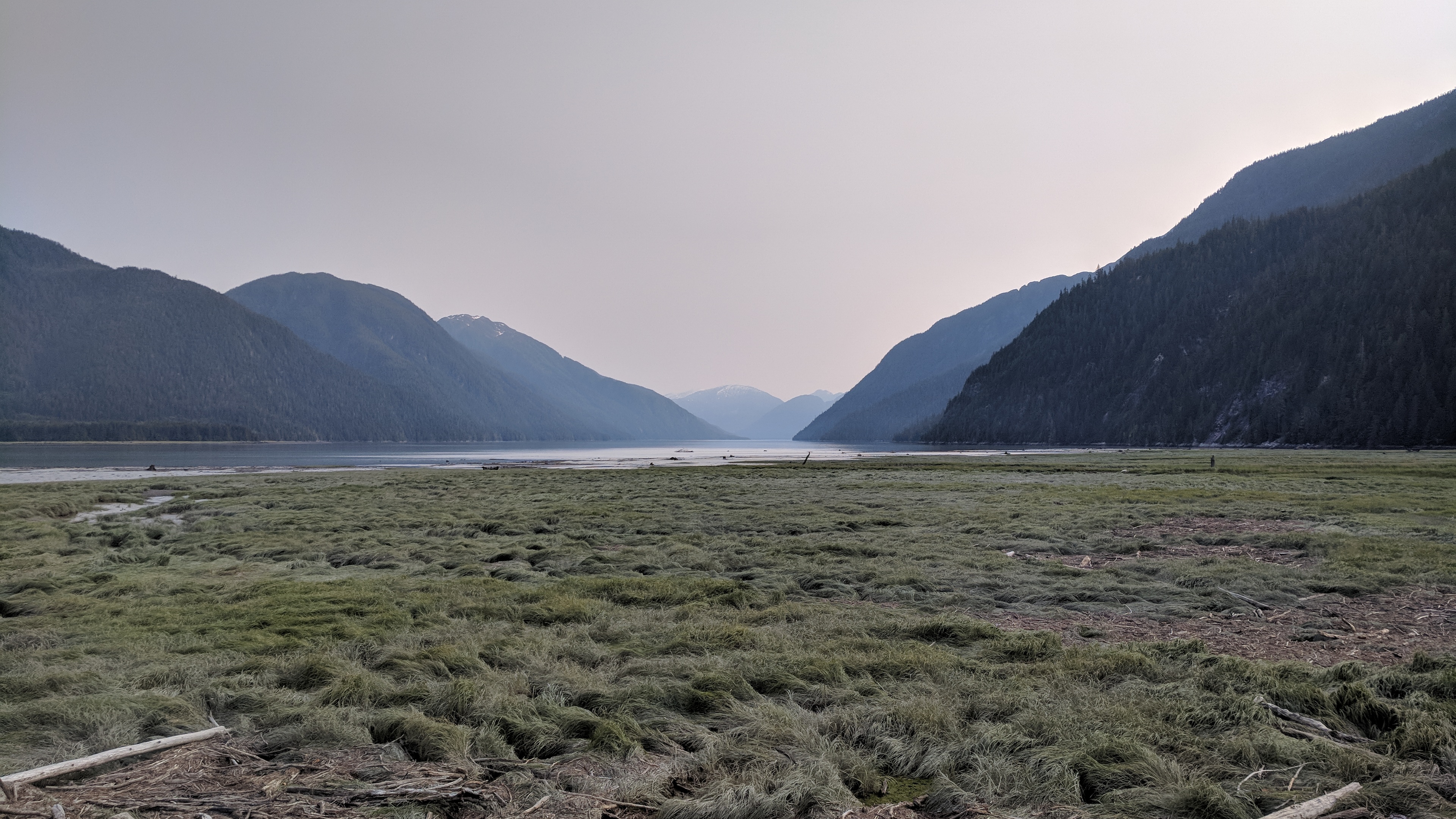
Stewart, British Columbia, is beautiful, tucked between huge peaks and at the end of a crazy long inlet. It seems a bit out of time, civilized enough to function but not wholly in the present. The grocery store is awkwardly stocked. A spectacular wooden walkway runs far out into the salt marsh, affording views of the mountains, the estuary, the snow, the town.
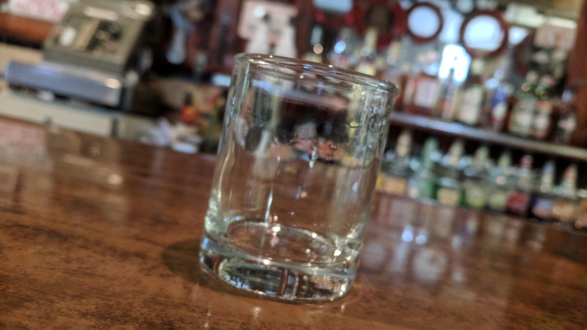
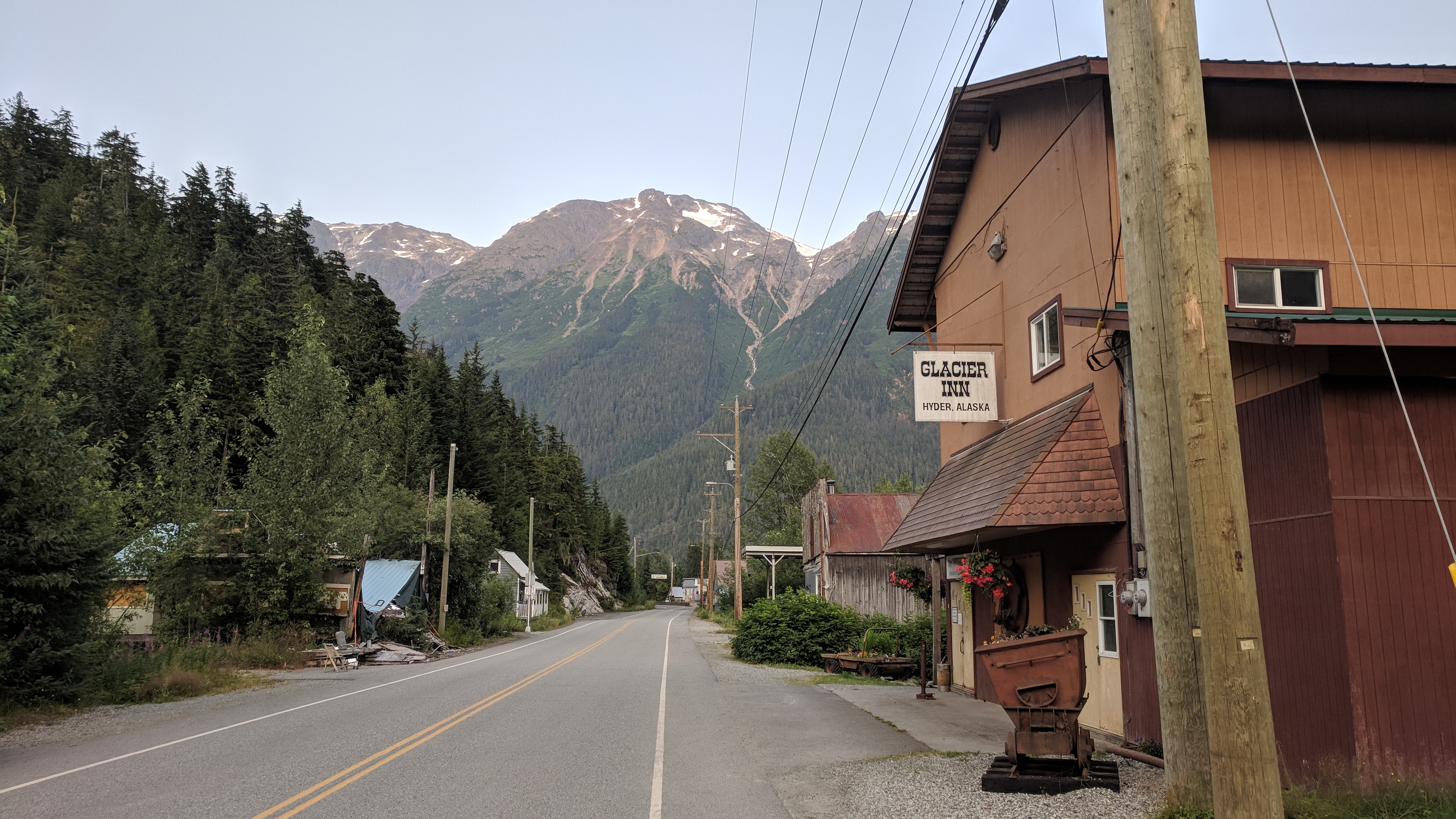
Four kilometers away is Hyder, Alaska, a loophole sort of town. It’s the southernmost part of Alaska accessible by road, except that road doesn’t then connect to any other part of Alaska. Hyder is a town of less than 100 people on the coast with no land access to the rest of the state, or the U.S.
Because of this, it became a destination for bikers who wanted to tag Alaska, and because of that the local bar started a tradition whereby a biker becomes “Hyderized” by drinking a shot of a clear, unidentified liquor, straight back, no testing — then they tell you what it was.
Of course the staff got sick of this game a long time ago, and the woman behind the bar could not be more bored by my arrival. But I’ve crossed to the edge of the continent, I’m doing their dumb tourist thing. The halibut ceviche is delicious.
A couple miles up the road in Tongass National Forest, there is a walkway over Fish Creek where dozens of tourists wait for bears. This location is famous for its grizzly viewing; the bears come down to catch fish right in front of everyone, and sure enough, there are big fat salmon sitting in the clear water, just waiting to be eaten. No grizzlies today, though.
The Stewart/Hyder border is only guarded in one direction, coming back into Canada. There is no U.S. customs station at all. There is, however, a U.S. post office in Hyder, so one could bring contraband from Canada into Hyder and then send it back to the U.S. without ever going through customs. I am very excited by the smuggling possibilities presented by this, but can’t think of anything to smuggle except candy bars.
It’s a beautiful evening to ride around with the luggage off the bike. There are eagles in the trees, and the evening light fills the marsh, the hills, the water. This stuff, this end-of-day glory, I could do forever.
Hyder, Alaska.Fish Creek.The estuary at Stewart, BC.Another view of the estuary at Stewart, BC.
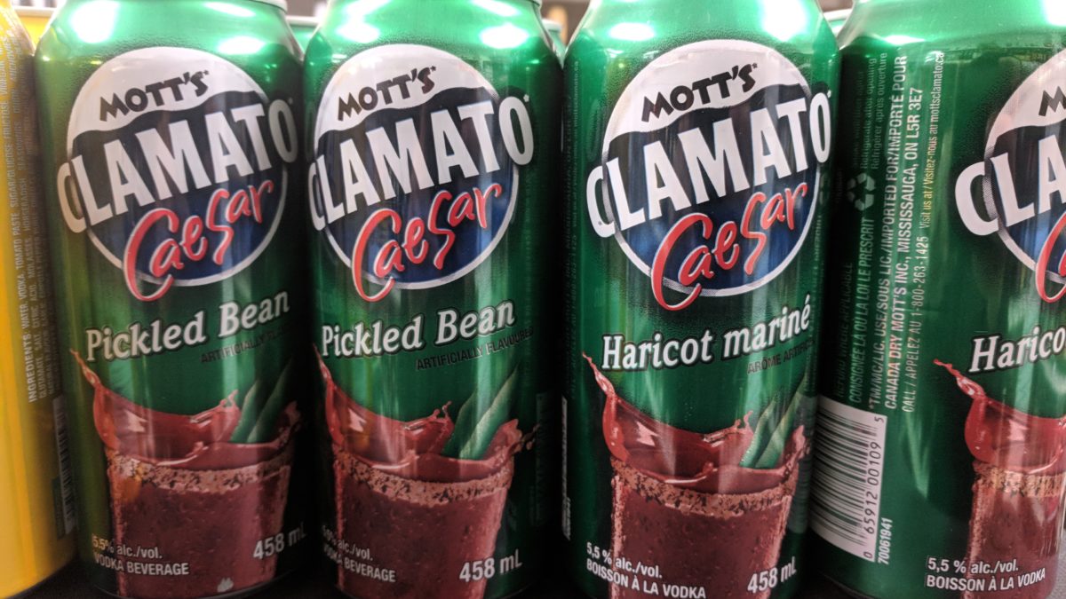
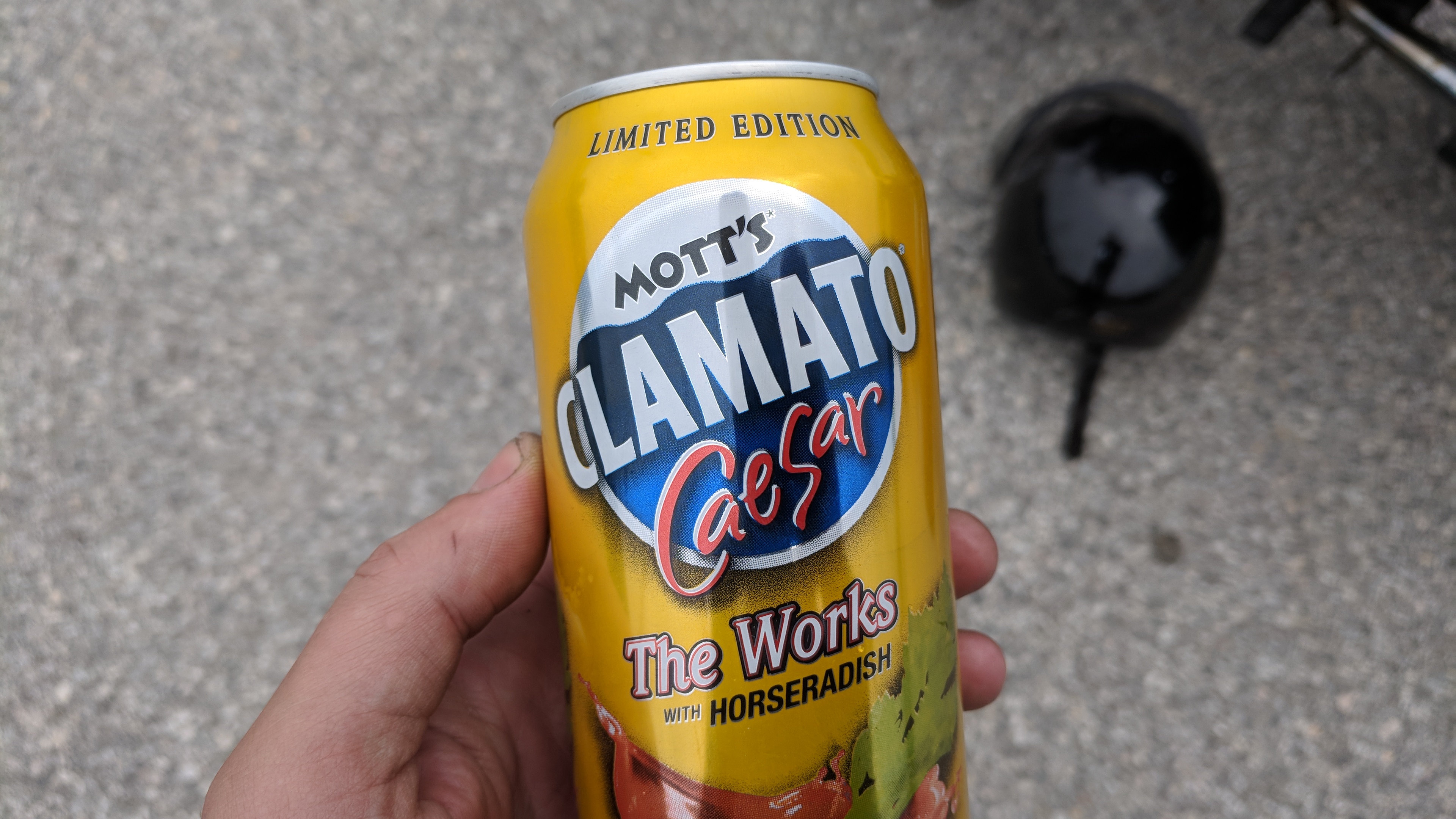
Cans of Hires root beer “with vodka” is the kind of fun variation one would expect from Canada. But what the heck is “Mott’s Clamato Caesar — The Works with Horseradish”?
There is so much to unpack there. Why is Mott’s making an alcoholic drink? Why did they choose to add clam juice? What the blazes is a Caesar when it’s not a salad, an emperor or a gruesome method of having babies? Why doesn’t “The Works” already include horseradish?
For all that, it basically tastes like a Bloody Mary in a can. Then I find the “Pickled Bean” version, and nothing in my world makes sense anymore. I spend an afternoon trying to imagine the marketing meeting.
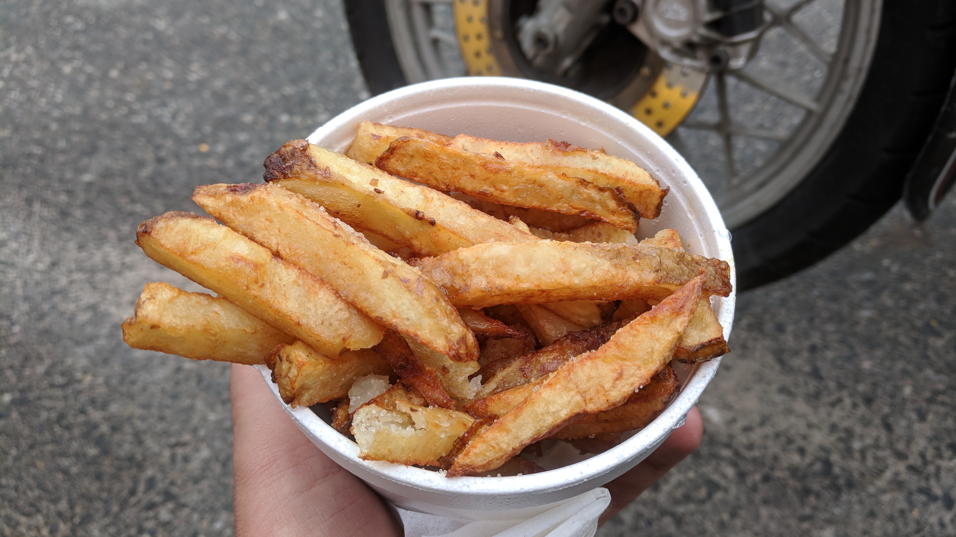
Canada is full of chip trucks, and when I finally have a piping hot, heaping cup of vinegar-soaked fries, they do not disappoint. Most chip trucks also serve lots of other things.
Limited Edition Mott’s Clamato Caesar — The Works with Horseradish.Hot, delicious chips.
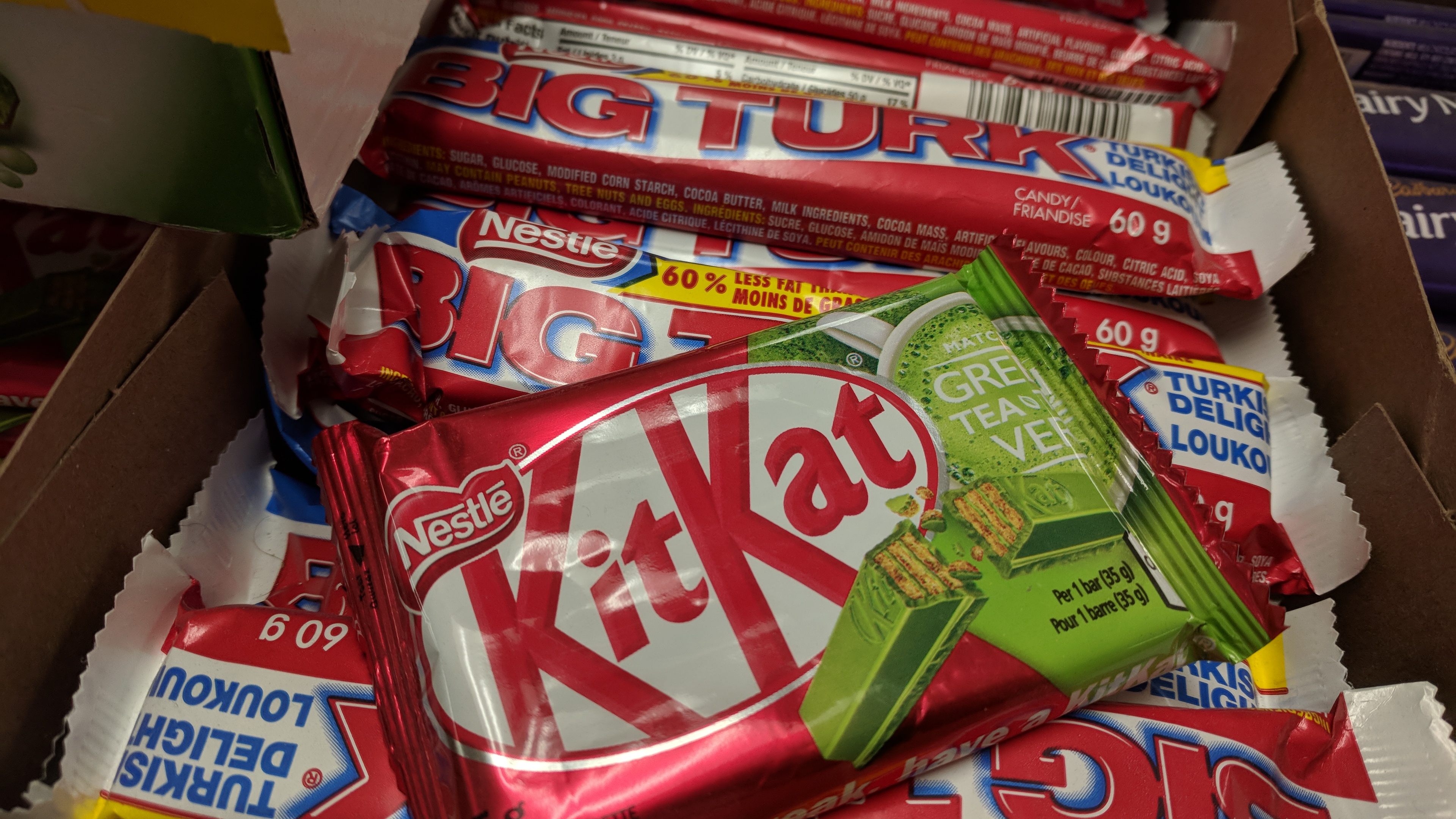
The candy bars of Canada are a delight. There is more variety; the Canadians are not afraid of flavors. The Cadbury Dairy Milk Fruit and Nut is a staple, and while you can get those in the U.S., they only come in the jumbo-size supermarket aisle format, not a regular candy bar size. That’s a shame, because it’s one of the great candy bars of Earth, raisins and almonds in fine milk chocolate. The closest we have is the Chunky, a fine candy bar but considered second tier in America, plus Chunky replaces almonds with peanuts (“dirt-nuts”) since apparently almonds are only for liberal elites.
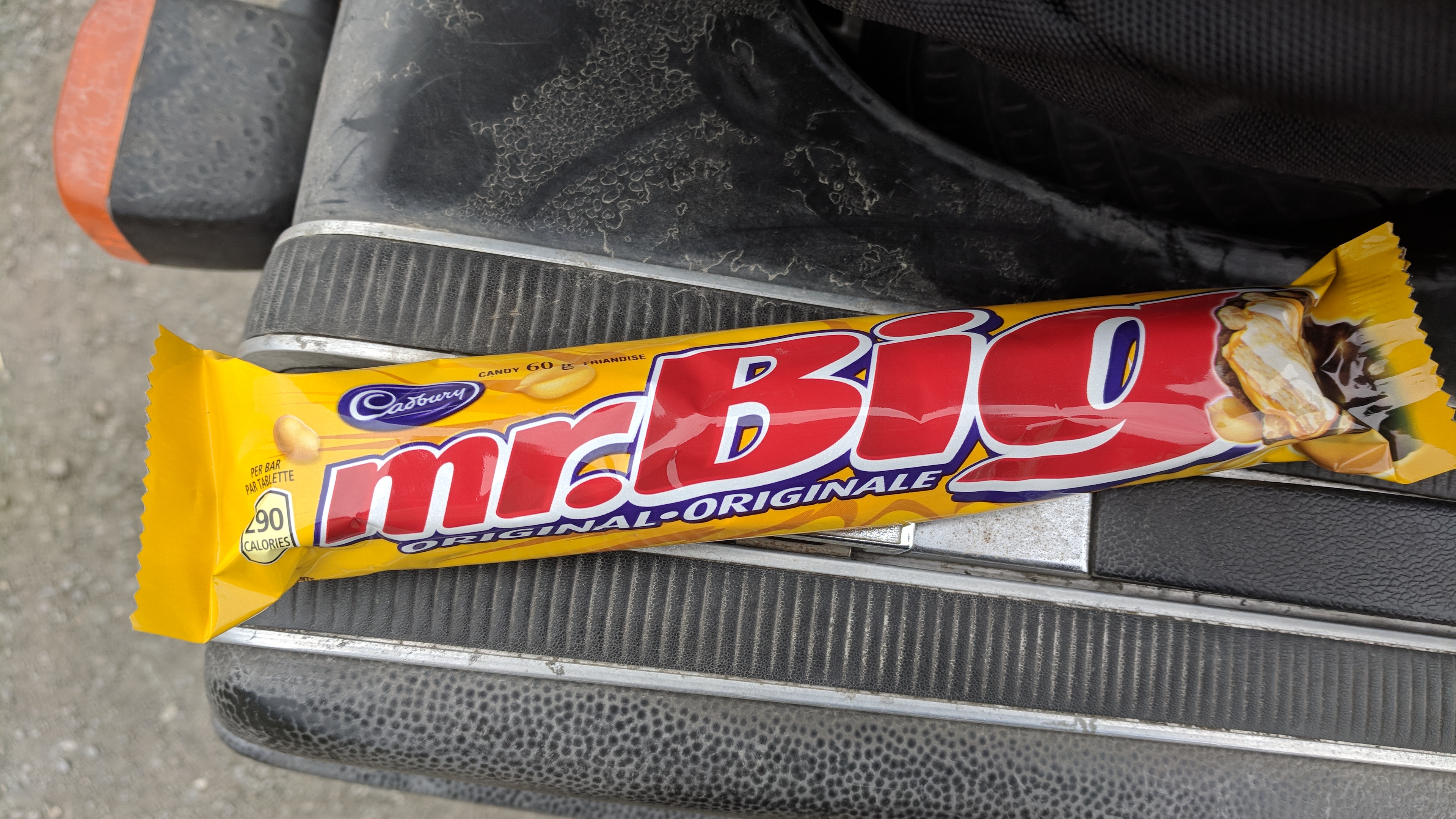
“Mr. Big” is another favorite. It’s essentially a vanilla wafer center, wrapped in a Rice Crispy treat and dipped in chocolate. Yes, it’s a “kitchen sink” approach, but so good.
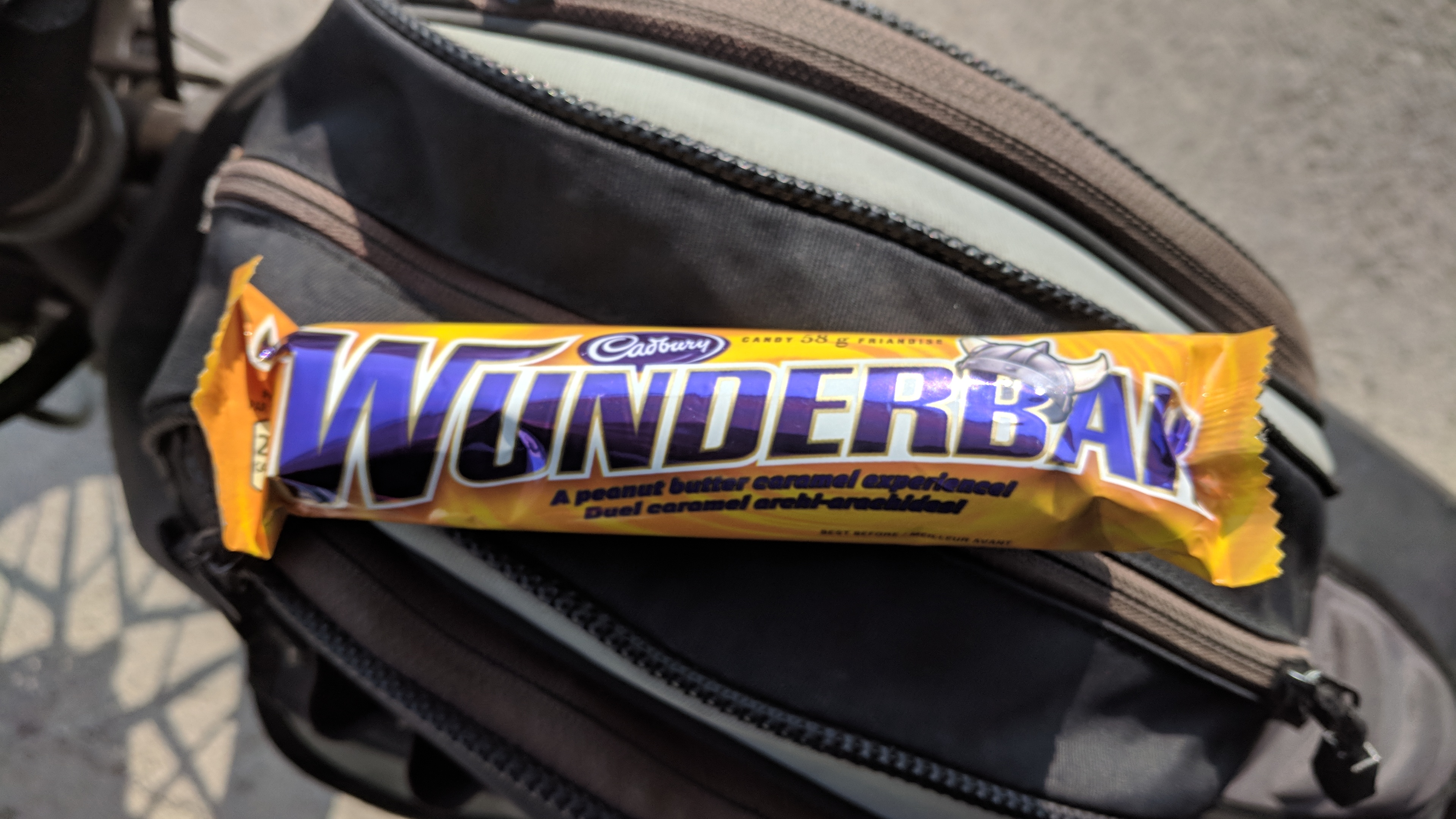
The “Big Turk” is great, with a Turkish Delight center (close to raspberry) wrapped in chocolate. The “Wunderbar” is peanut butter, caramel and chocolate, like a Twix without the cookie, which makes it more substantial.
The “Cherry Blossom” is a big, gooey chocolate-covered cherry with nuts in a square cardboard box. Sure, we’ve all had chocolate-covered cherries before, but I challenge you to find one in a checkout line.
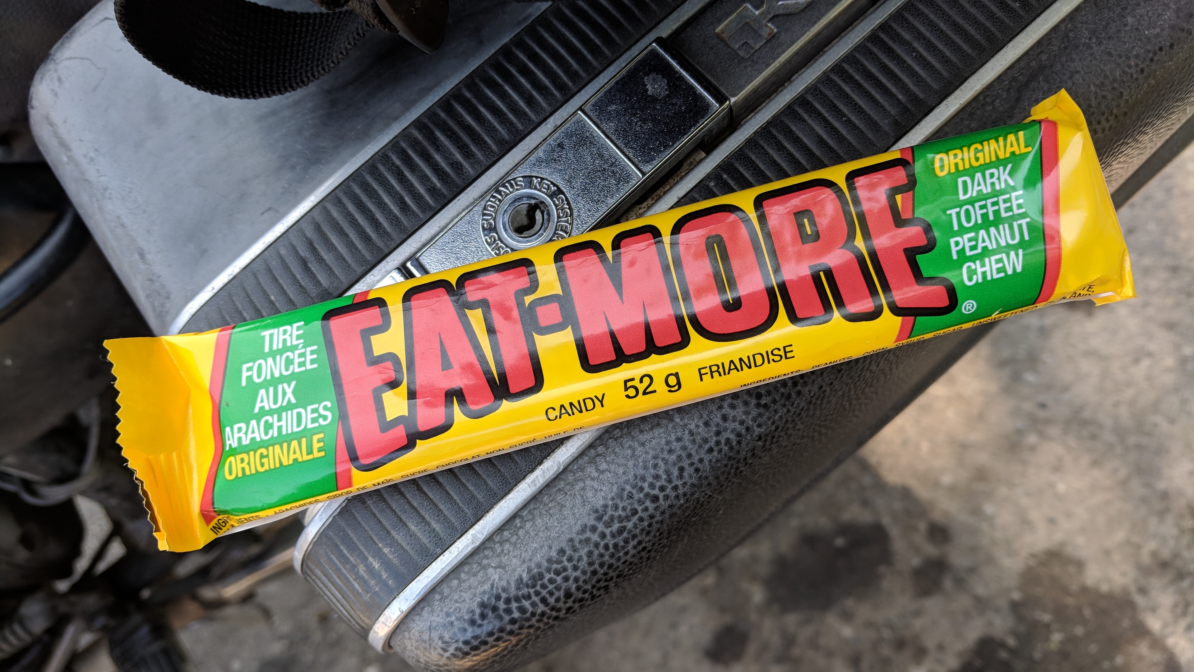
The “Eat-More” was a sleeper hit for me. Despite its aggressively blunt name, it’s a very satisfying bar of peanuts embedded in a dark, soft toffee.
Canada also has Aero Bars and Flakes, proof that not only are they interested in flavors, but textures as well.
Mr. Big: vanilla wafer, crispies, chocolate.Wunderbar: peanut butter, caramel, chocolate.Eat-More: peanuts in toffee, surprisingly good.
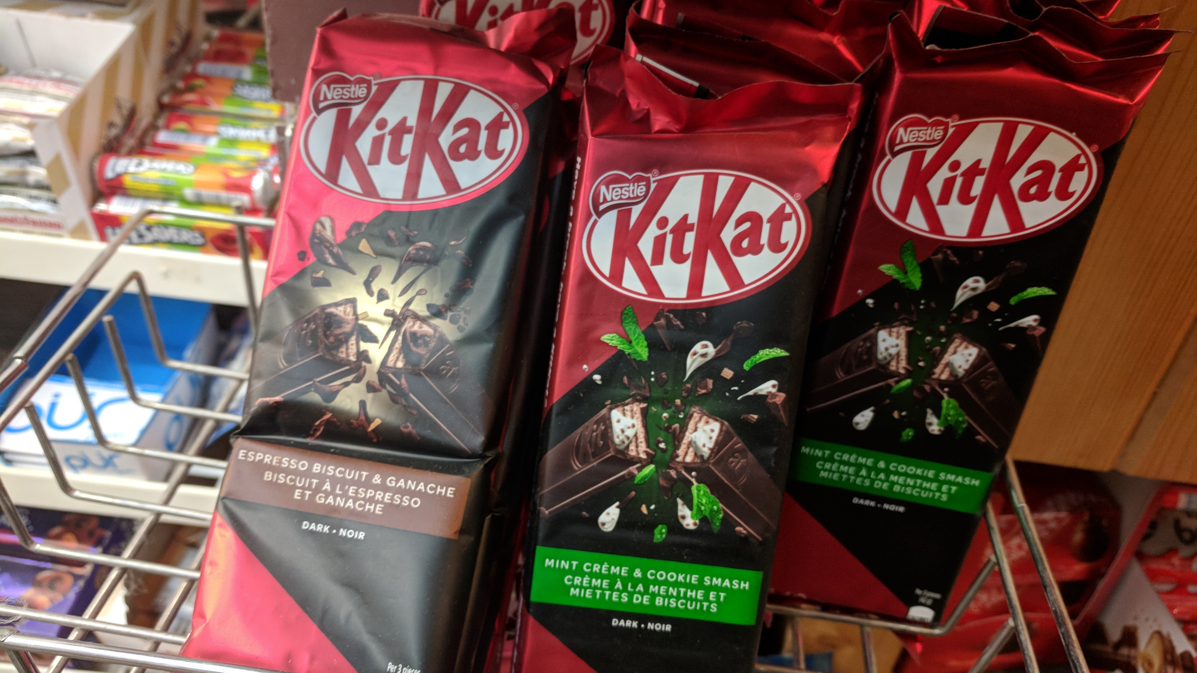
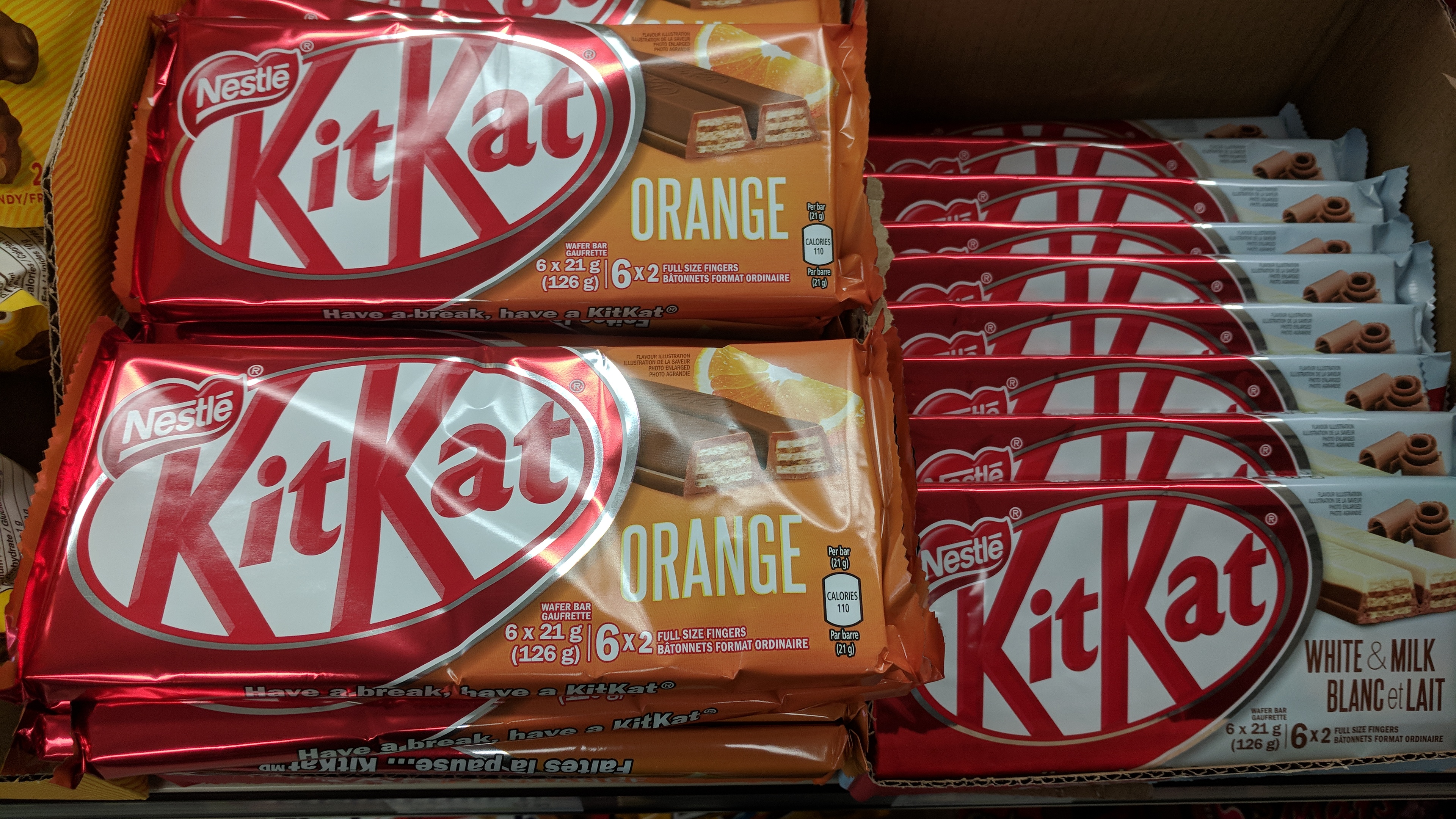
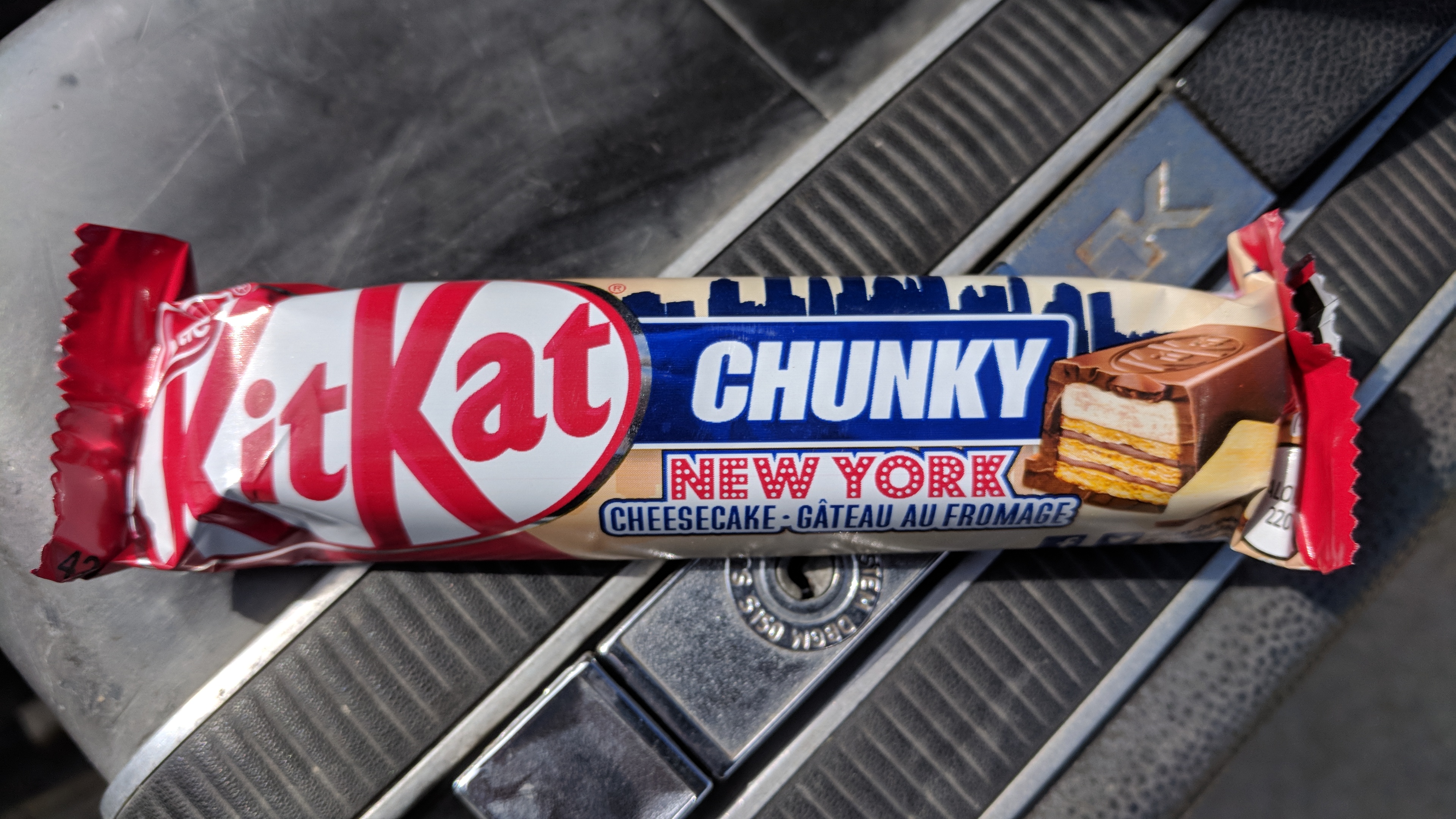
Even American brands are willing to take more risks in Canada. Kit Kat is on the candy bar equivalent of spring break in Canada, apparently doing tequila shots and ready to try anything: “Mint Creme and Cookie Smash,” “Espresso Biscuit and Ganache,” and, confoundingly, “Orange.” Regrettably, I didn’t try all of these, but I did have a “Kit Kat Chunky New York Cheesecake” and am sad to say that it tasted like a motel.
None of which prepared me for the Green Tea Kit Kat. I saw the green and thought it must be a refreshing mint, then the words came into focus and reality melted away. Green Tea Kit Kat is full on alternate-timeline stuff, a sign that you’ve slid into a place where the old rules no longer work, and that you should check the sky for war blimps.
Kit Kat in Canada is on the candy bar equivalent of spring break.Kit Kat Orange.Kit Kat Chunky New York Cheesecake.Kit Kat Green Tea, with Big Turk background.
Cross the border into the U.S., and all of these things disappear, as if the people 100 miles down the road really have completely different tastes. I hate the candy bar cartels.
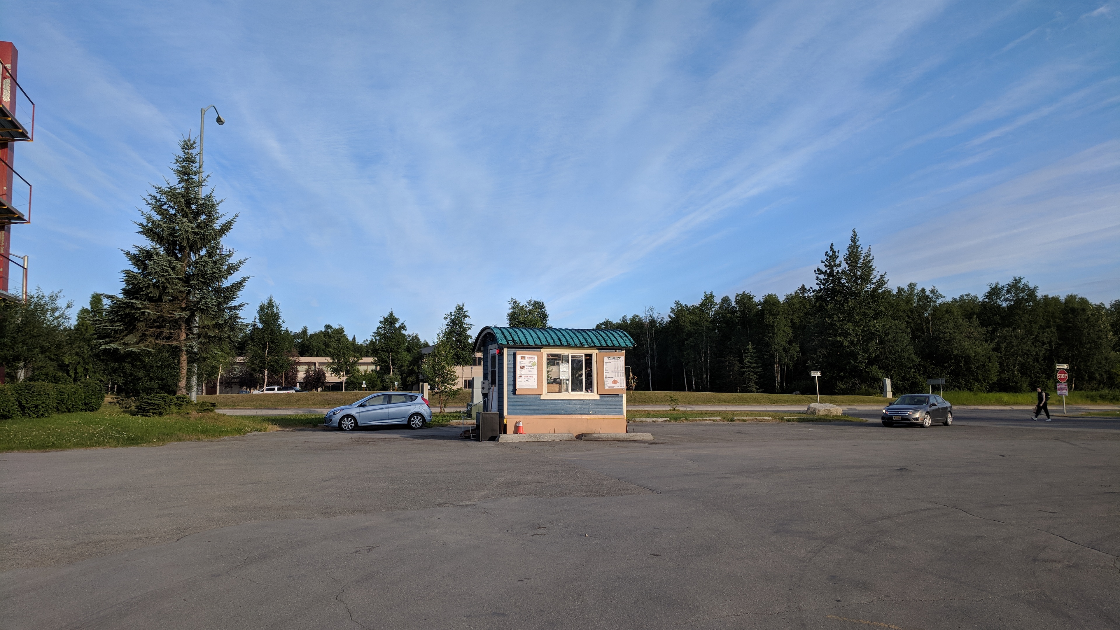
Anchorage, Alaska has a coffee shack in every parking lot, something we don’t have in the east, and they do a booming business. People roar up in their trucks to buy all the coffee or Red Bull smoothies they need to get through the next x hours of unnatural light-or-dark. Almost none of the coffee shacks are chains, or if they are then they’re not recognizable to me.
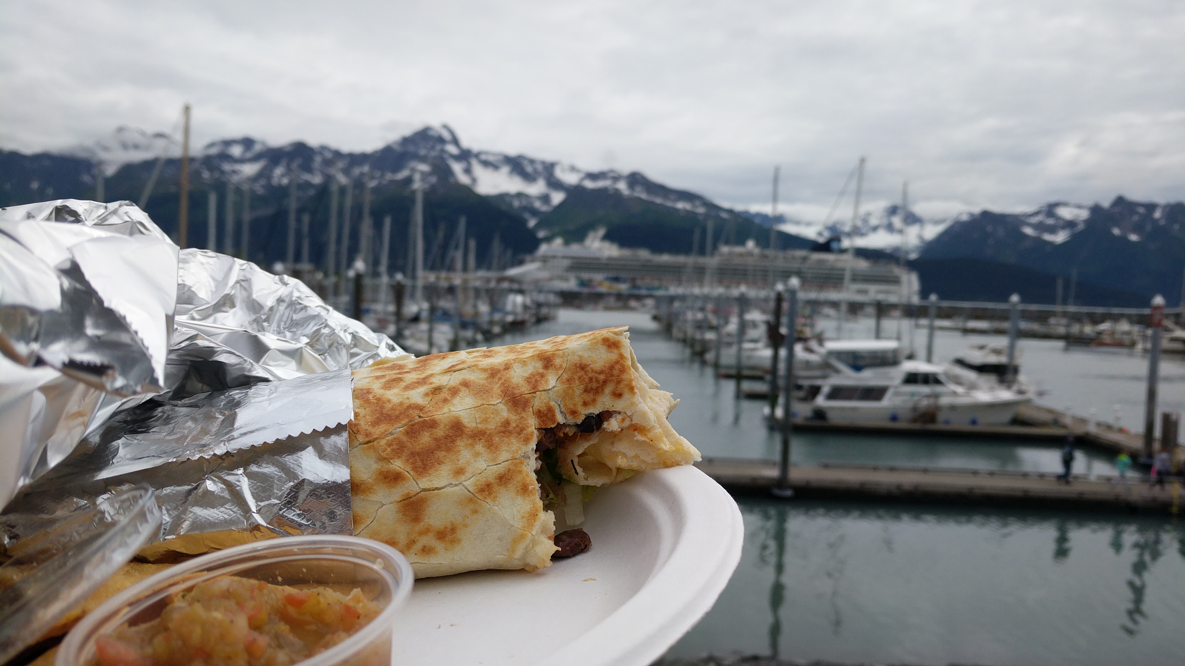
In Seward, Alaska I have a reindeer burrito (Reindeer are just the farmable caribou, so basically the nice caribou.). I’d like to say that it was amazing, but it tasted mostly like hot dogs. Reindeer, like many of the wilder meats, has very little fat, so the meat gets mixed with the fat of another animal and and made into sausages.
A coffee shack of Alaska.Reindeer burrito in Seward, Alaska.
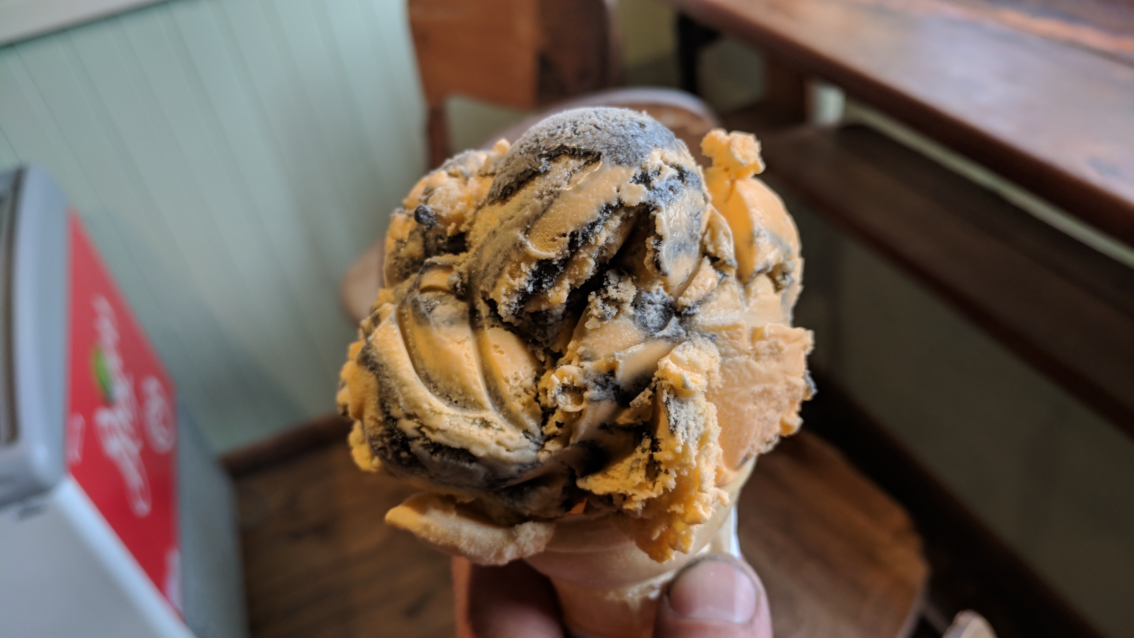
Back in Canada, I discover “Tiger, Tiger” ice cream, which is orange ice cream with licorice swirls. It feels emblematic: it’s bold, delicious, incorporates licorice (another flavor America is trying to forget in our rush-to-homogeneity), and is, I guess, named after a William Blake poem?
Tiger, Tiger: orange and licorice.
“The Tyger” by William Blake
Tyger Tyger, burning bright,
In the forests of the night;
What immortal hand or eye,
Could frame thy fearful symmetry?
In what distant deeps or skies,
Burnt the fire of thine eyes?
On what wings dare he aspire?
What the hand, dare seize the fire?
And what shoulder, & what art,
Could twist the sinews of thy heart?
And when thy heart began to beat,
What dread hand? & what dread feet?
What the hammer? what the chain,
In what furnace was thy brain?
What the anvil? what dread grasp,
Dare its deadly terrors clasp!
When the stars threw down their spears
And water’d heaven with their tears:
Did he smile his work to see?
Did he who made the Lamb make thee?
Tyger Tyger burning bright,
In the forests of the night:
What immortal hand or eye,
Dare frame thy fearful symmetry?
The Top of the World Highway is about 100 miles of road connecting Chicken, Alaska and Dawson City, Yukon Territory. It’s one of only two roads going in and out of Alaska, the other being the Alaska Highway, but since you eventually have to connect back to the Alaska Highway at either end, it seems more like one.
There was no road to Alaska before World War II, but after the bombing of Pearl Harbor the U.S. quickly re-examined its Pacific properties and concluded that the then-Territory of Alaska needed overland access.
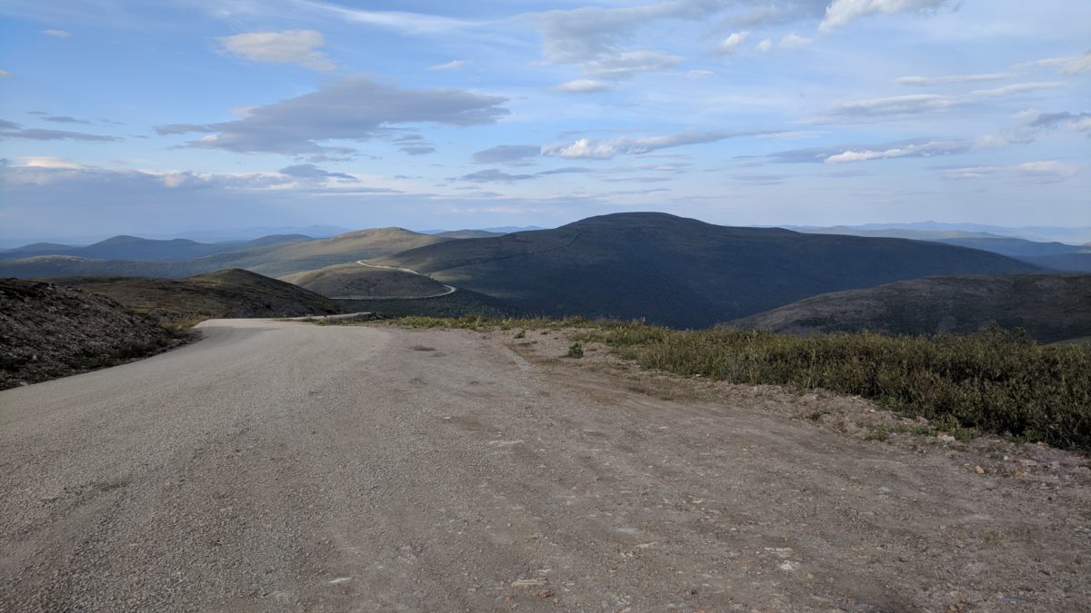
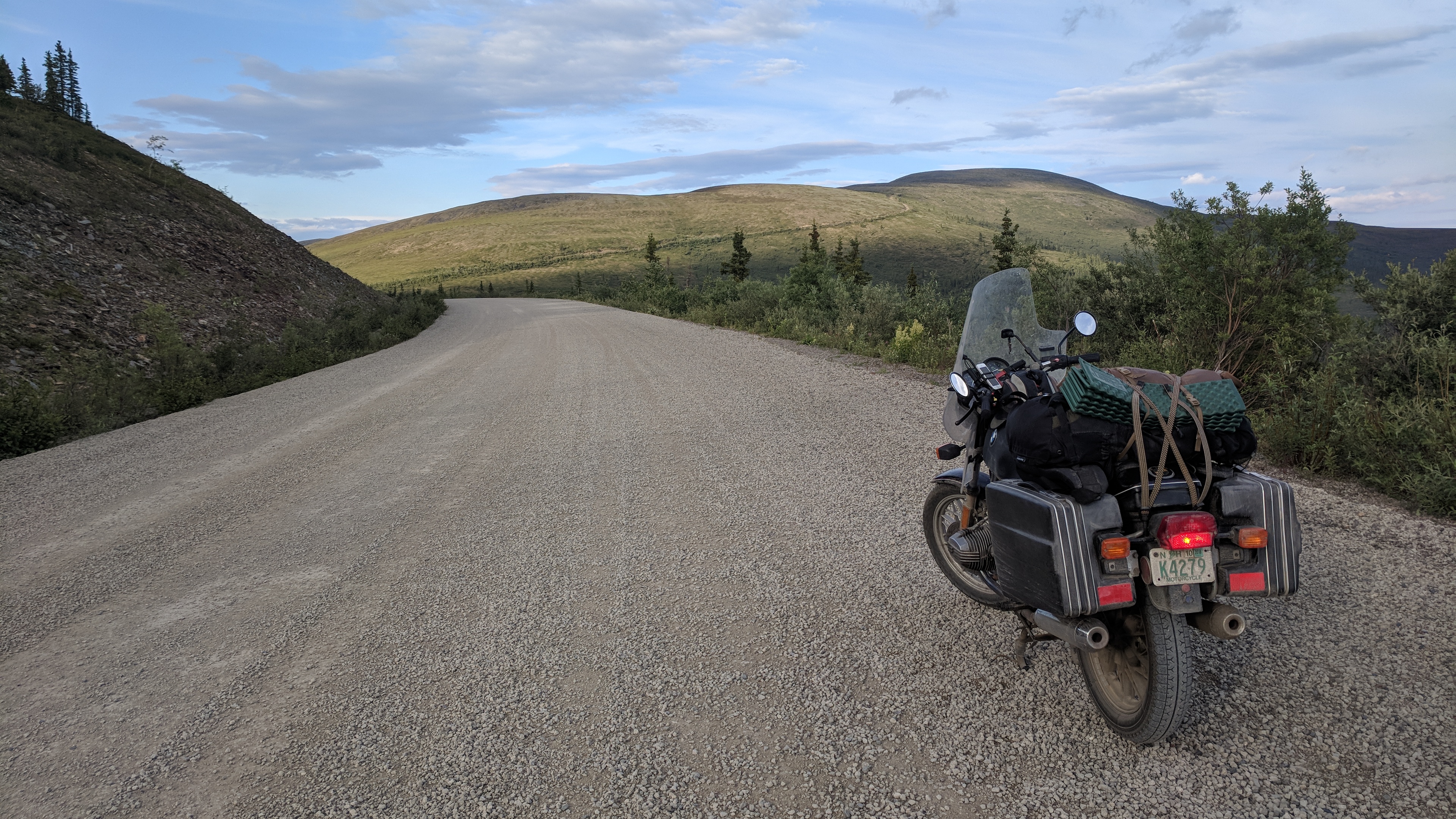
The Top of the World Highway, as far as I can tell, just gets Dawson City in on the fun, as it’s a whole lot shorter than going a few hundred miles down to Whitehorse and then driving 300 miles back up again. It runs along the crest of the highlands at between 3000-4000 feet for most of its length, and the views are spectacular.
The short section on the American side is full of potholes, washboard, wash-outs and big loose rocks, followed by a couple miles right at the border that are paved into a perfect ribbon of tar. The Canadian section of the road is much longer and entirely dirt, but it’s an exemplar of a dirt highway, broad, smooth and reliably hard-packed the whole length, so good that you almost forget you’re on dirt. It’s the same road, just managed by two different governments, and it’s hard not to feel that the difference is meaningful.
As I near the Canadian border, a dark shape looms along the side of the road, a caribou, antlers and all, dark-furred and large and briefly startled toward the road. I start to slow and it re-evaluates and loops back into the brush.
The border guard says the valley is full of caribou tonight, and a little further along I see a whole string of 6 or 8 come up a steep slope and cross the road, then continue up the other side. I look up to see them go, and they are briefly profiled against the sky before disappearing back into it.
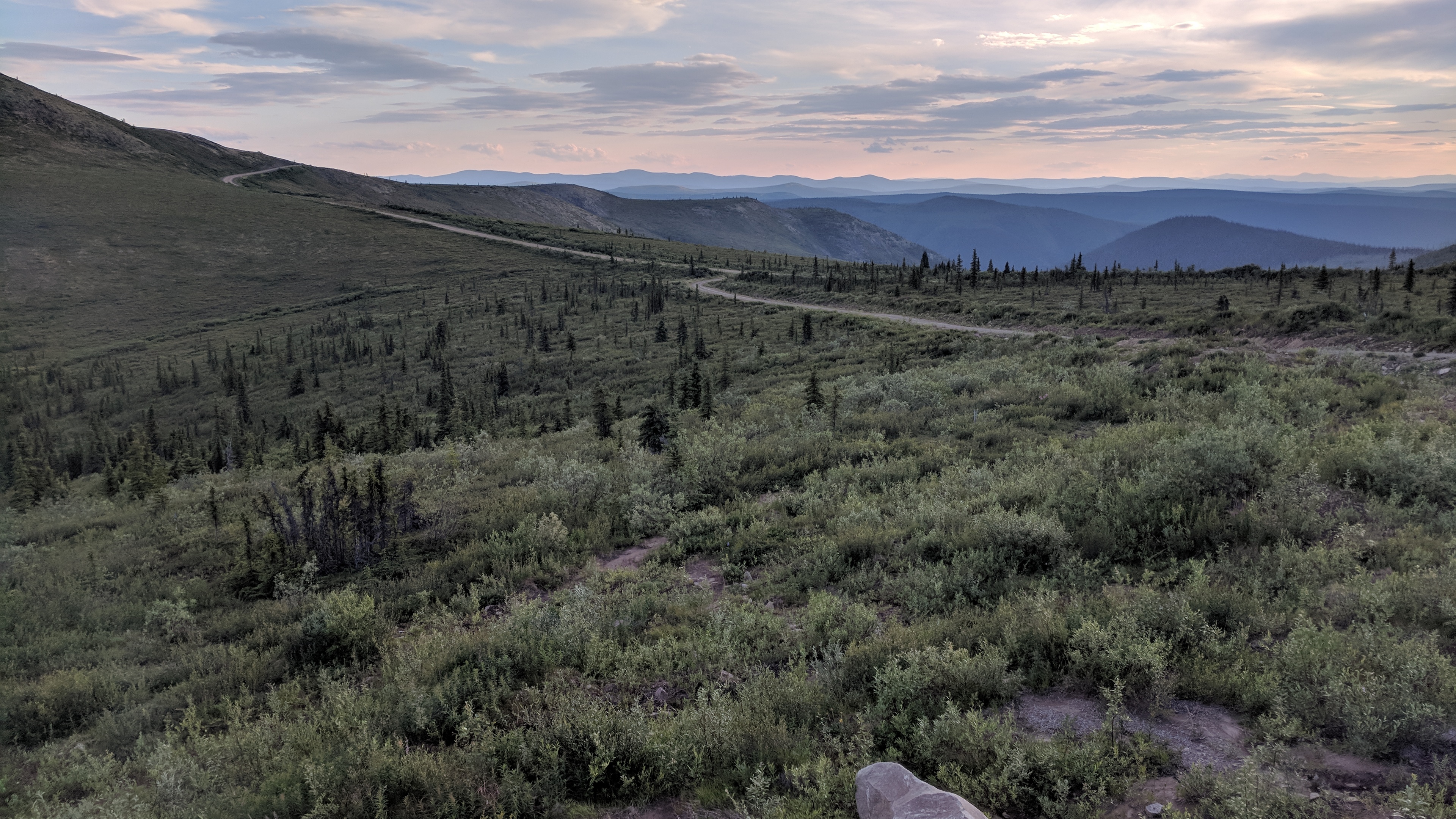
At this latitude, the height of the road vaults the whole habitat north into the the arctic, an open, rolling tundra, a sky-world, a caribou-world. The shadows are long and I have barely slept, and the caribou feel like emissaries from a dream realm.
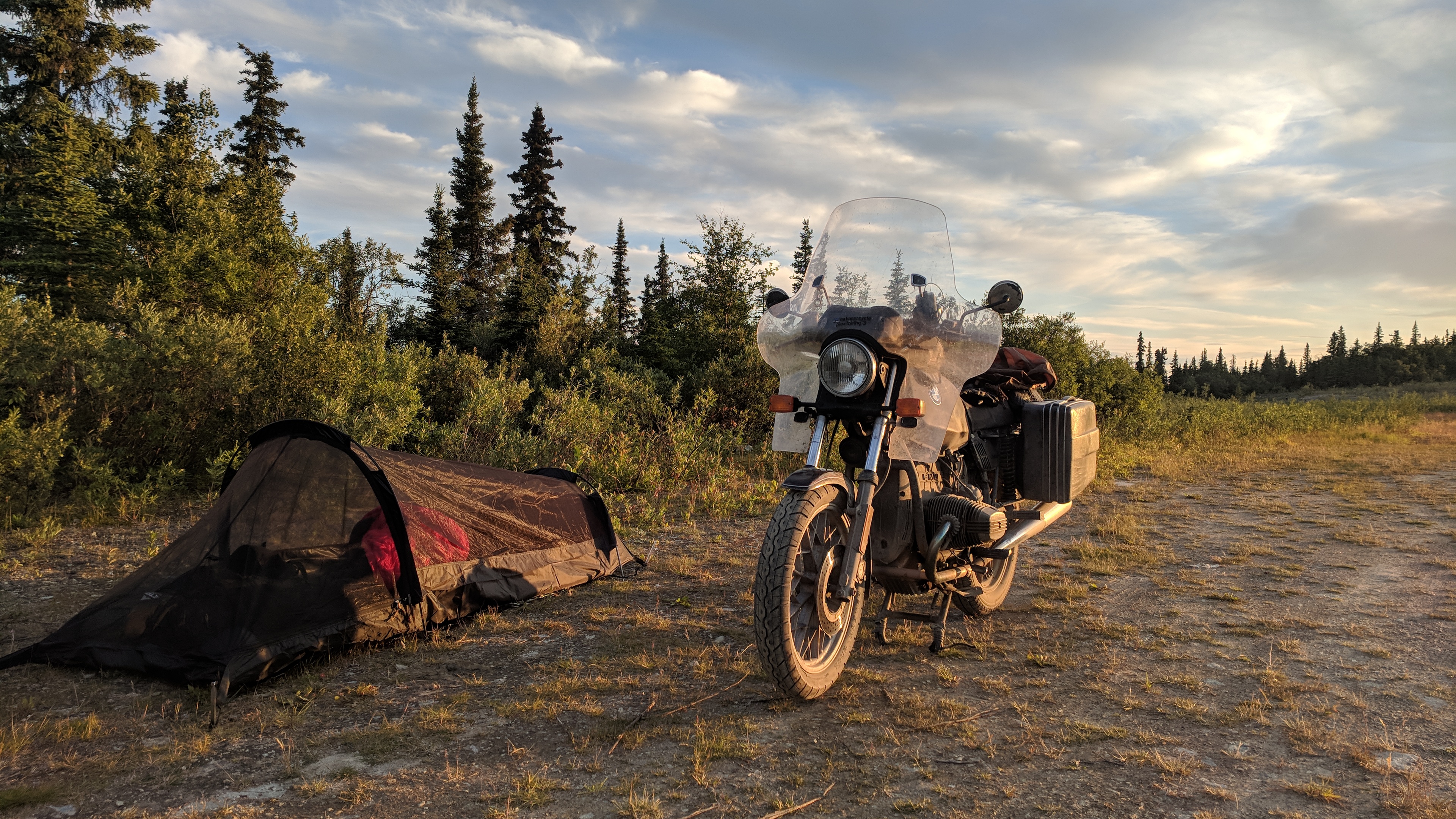
I make camp just short of Dawson City, and a big mountain porcupine comes out near the head of my tent to grumble at me. Except, I am so tired that the next morning I am not really sure if that happened.
The Top of the World Highway.The highway winds over the highlands.Making camp.
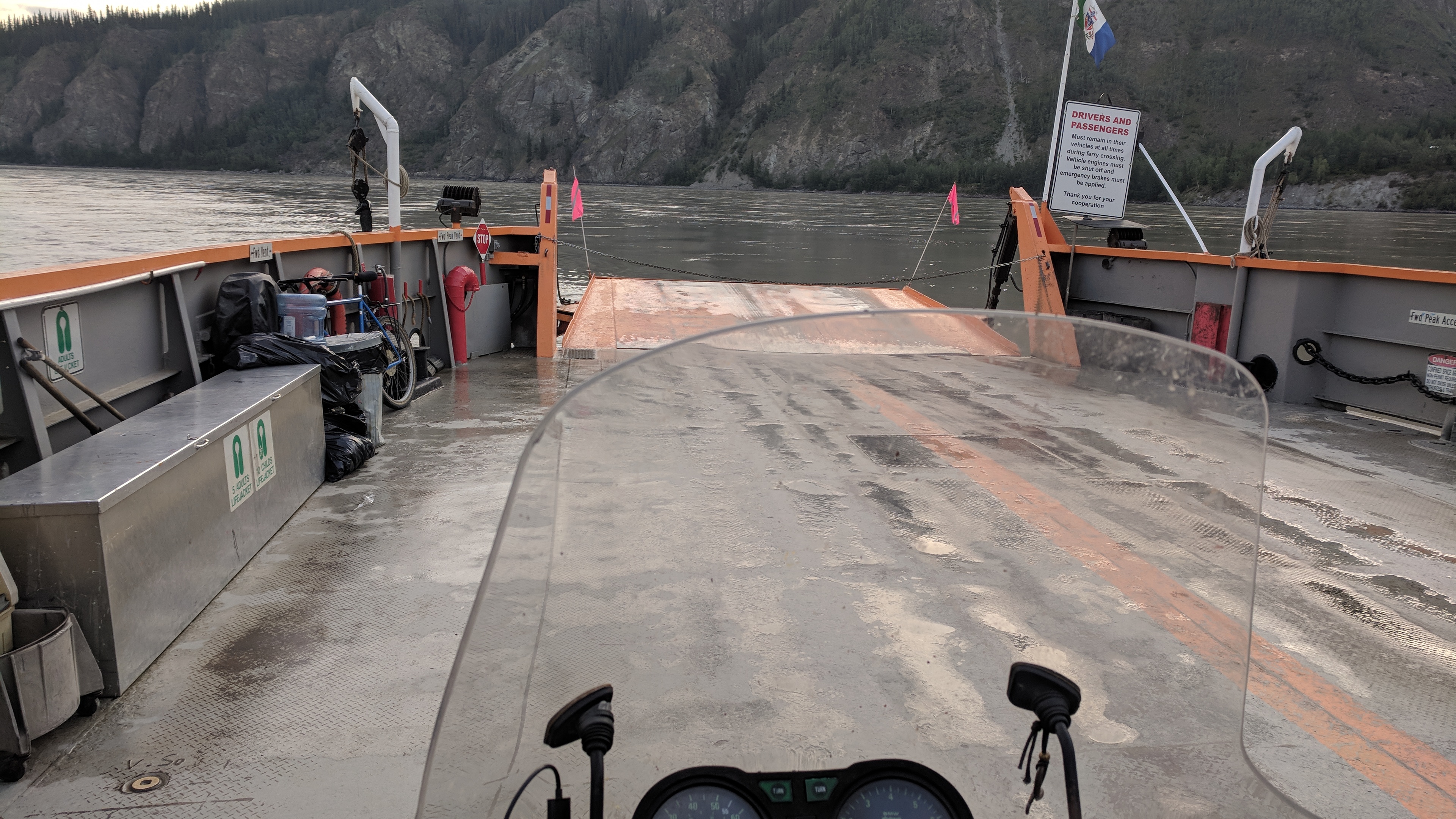
A ferry brings me across the Yukon River into Dawson City at about 7 am.
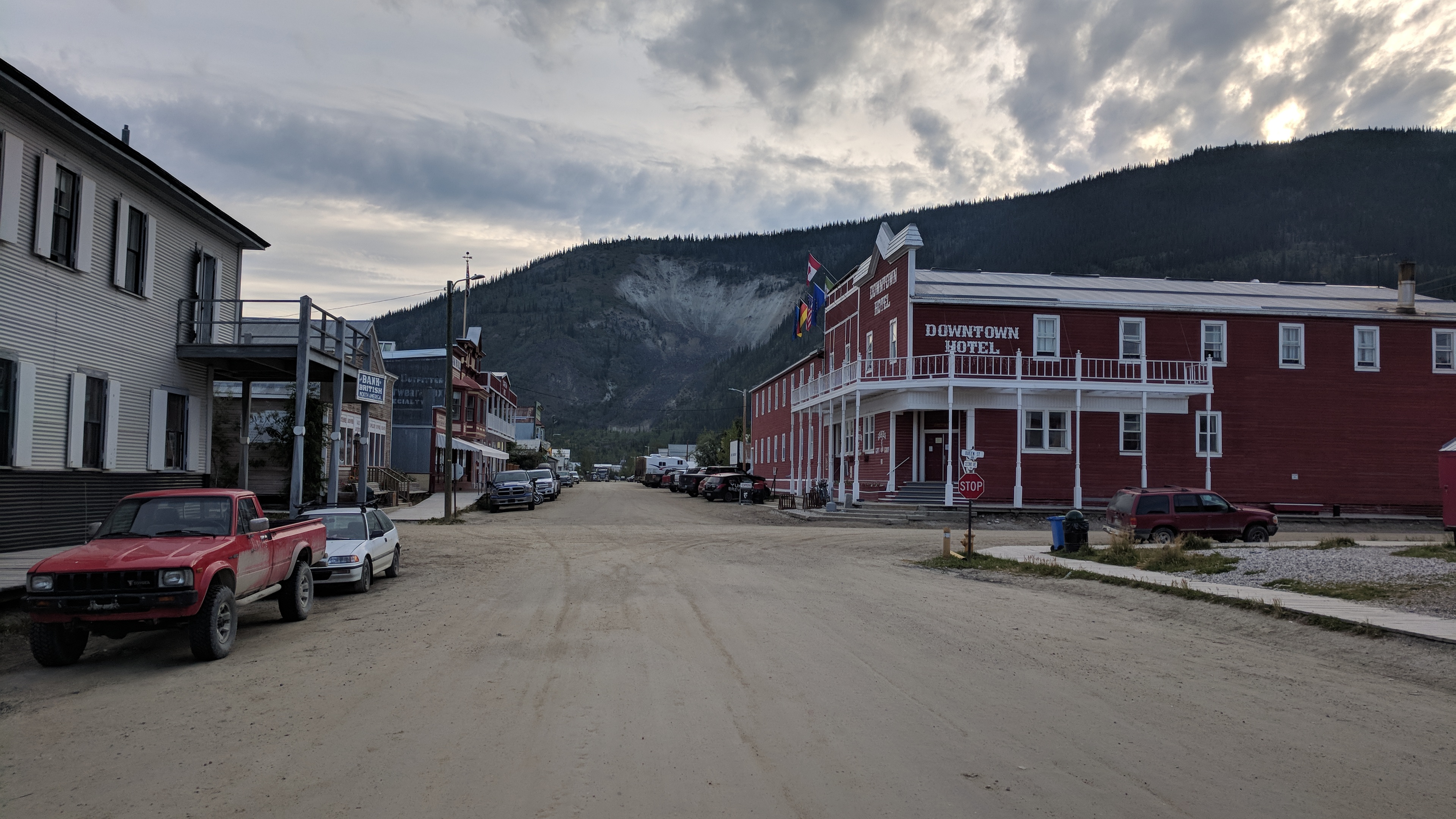
Dawson City has dirt streets and wooden sidewalks, and it’s hard to figure out. On the one hand, it’s clearly some kind of tourist town, with every single sign hand-painted in the same old-timey style; on the other hand, it really is up here at the edge of everything, with only one paved road coming in and the nearest city 300 miles away, so there’s something real going on.
I decide it must be a bit like Portsmouth. Without tourism, our economy would tank, but the touristy veneer isn’t what makes the town interesting; it’s the genuine energy underneath.
Crossing the Yukon River by ferry.
I meet some loud people down by the river who offer to share their booze with me. They have an impressive selection, which they spread out on the grass — full bottles of vodka, rum and something else. I’m looking for a plan, but it’s only 10 am so I don’t think this is it, and I decline. I feel honored by the gesture, though — what could be more truly in the spirit of the old west than innappropriate public drunkenness with lawless people?
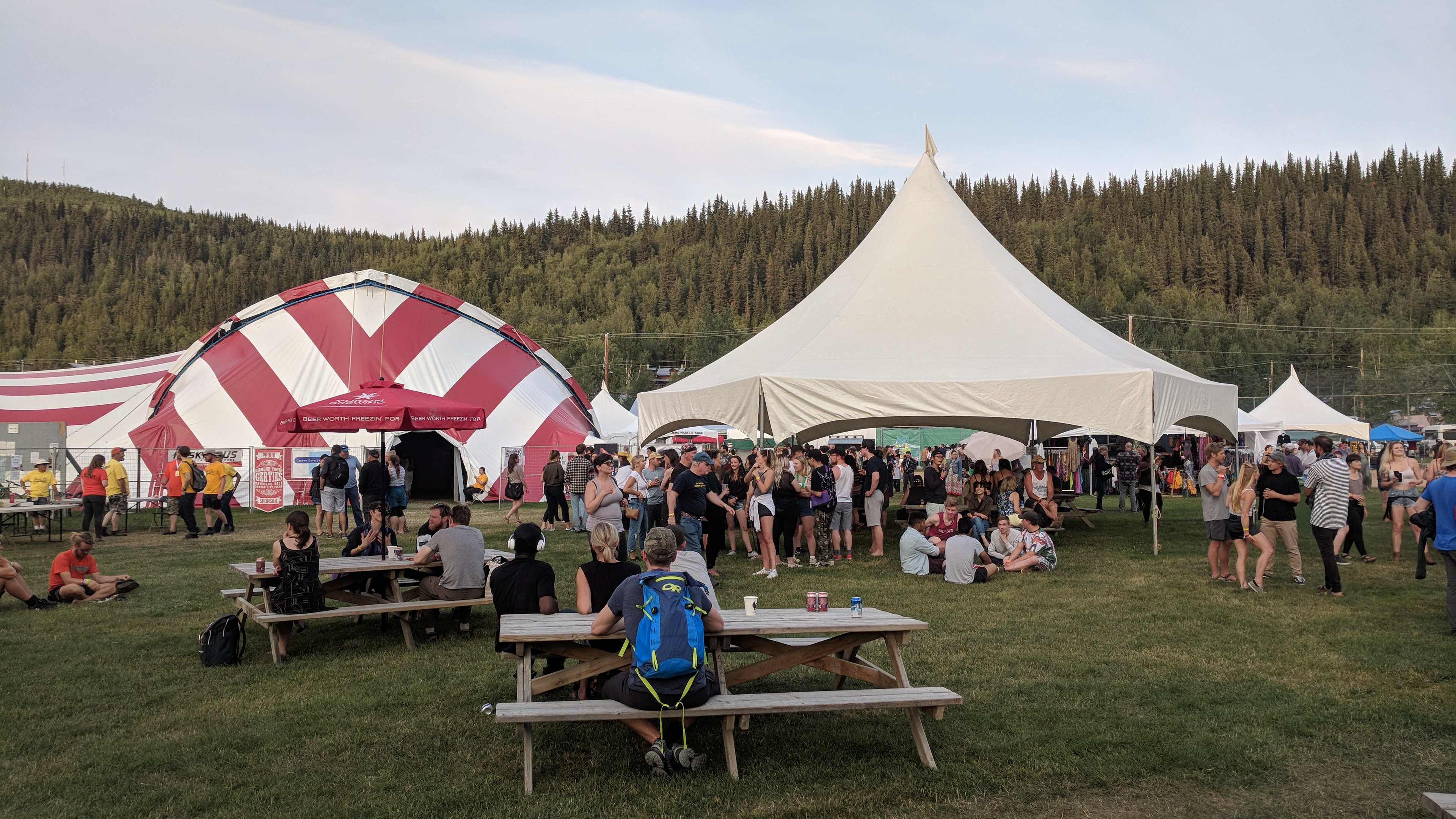
I wander through the town, tinker with the bike (the Top of the World Highway has made a new break in one of the fairing’s mount points), and in the evening I go to a few sets at the Dawson City Music Festival, now in its 40th year. The music is great and the crowd is vibrant and hip and diverse, and it all boggles the mind a bit — where did all these people come from?
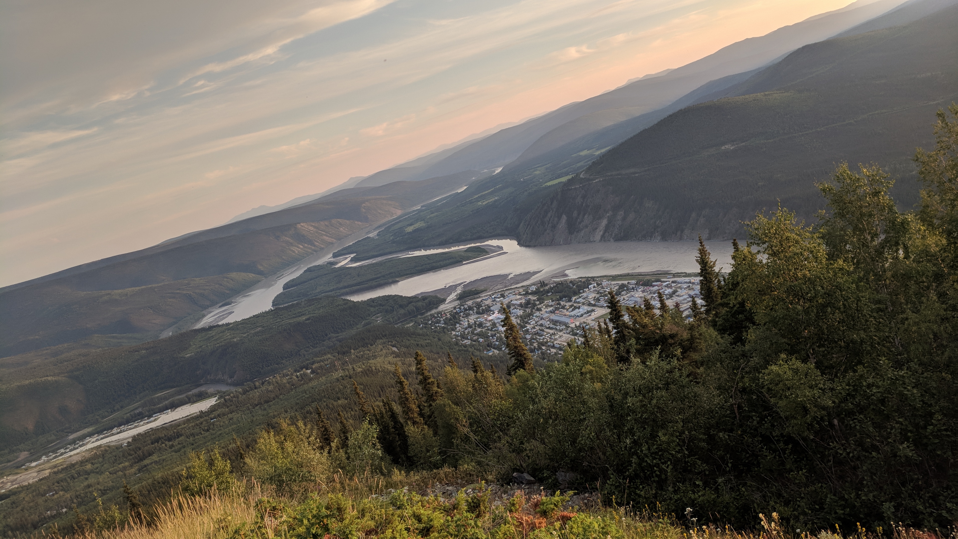
I camp out at Dome Overlook above the city, and watch the sun set over Dawson and the Yukon.
The dirt streets and wooden sidewalks of Dawson City.At the Dawson City Music Festival (an early evening set; the show is in the left tent).Overlooking Dawson City and the Yukon River.
I stop to stretch my legs and use the restroom in Houston, north of Anchorage, but someone has left a turd in the bowl so colossal that it won’t flush. Two inches in diameter and 8 or 10 inches long, it is perfectly rigid — when I flush, the water just cascades around it and it hangs there across the bowl in mid-air, an unflinching bridge to nowhere. I flush twice and it doesn’t budge. Someone’s going to have to come in here with a shovel and break it up.
What was it like to pass that? Was it agony, or ecstasy, or both? Did they have to stand up to get it all the way out? Were they embarrassed by what they had done, or terrified, or proud? Or was this routine for them?
I give up and decide to wait until the next rest stop. I can’t imagine squatting over that thing. It needs its own space. I had started by assuming it had been left by the previous occupant, but really, who knows how long it’s been there, defending its territory? Maybe that toilet is just where it lives now.
An enormous brown bear with two cubs lopes across the road in front of me, an order of magnitude larger than the black bears I’m used to. A brown bear and a grizzly bear are genetically indistinguishable, the difference seeming to be a matter of location, hunger, and opinion. In Alaska, the terms are used interchangeably. There are about 1000 grizzly bears in the lower 48 states; there are 30,000 in Alaska.
Periodically, moose slip off into the woods, huge shadowy refugees from the Pliocene. Rabbits are so numerous they practically line the road — at one point I see four at once.
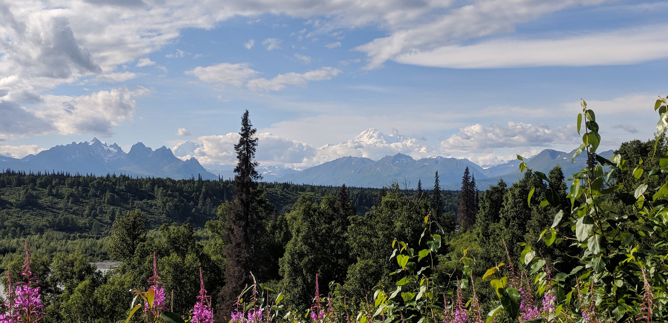
Mount Denali takes a moment to process. I stop at a turn-out and gaze numbly at a huge, wicked-looking peak and think that must be it. But above that peak are clouds, and then above those clouds is a great white shape, something mythic and unreal. That’s Denali, 20,000 feet in the sky.
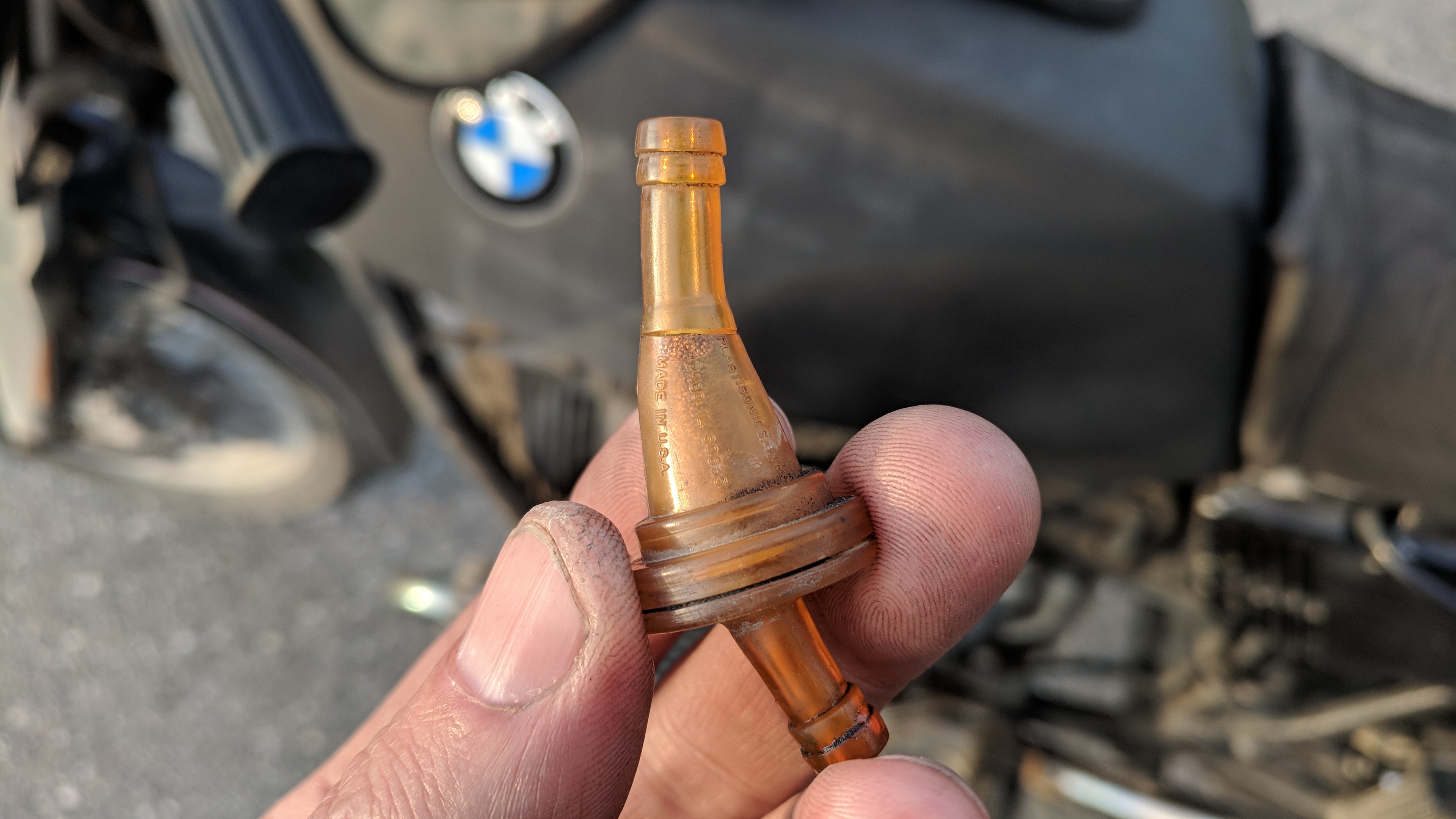
The cork covering the timing window has fallen out, so I fit another. Further down the road, I notice gas leaking down the fuel line over the secondary filter; thinking the fuel line might have become stretched where it attaches to the filter, I put on a clamp, but it doesn’t help. It turns out that the little plastic filter itself has cracked. Remarkably, I have a replacement. Someone gave it to me once because they had extras.
Mount Denali at center right.Cracked.
I’m trying to understand the circles of Earth.
I’ve always taken it for granted that the sun rises in the east, sets in the west and the rest of the time is generally in the south; take the time of day and the position of the sun and you can get a good estimation of the compass directions.
Now much of the time, the sun is in the north, and shadows fall to the south, or wherever. The sun rises and sets just to either side of north. The rest of the day, rather than make an arch overhead from horizon to horizon, it just makes a great slow circle in the sky, a tilted halo where briefly one end dips beneath the ground.
When did that change? At some point when I was riding up here, the sun moved into the north and directions stopped working, and I didn’t even notice. I wasn’t paying attention.
The equator is equidistant between the poles. The Tropic of Cancer is the northernmost latitude at which the sun is directly overhead at the summer solstice — the significance of this one is lost on me. The Arctic Circle, though, is defined as the southernmost latitude at which the midnight sun still shines on the summer solstice, the southernmost circle where there is at least one day a year when the sun never goes down.
I’d love to see the midnight sun, but the solstice was a month ago so it has been leaping northward since then. Additionally, the Dalton Highway to Deadhorse, the Haul Road, is closed for the next four days according to the blinking sign, and that’s the only road. The midnight sun is out of my reach.
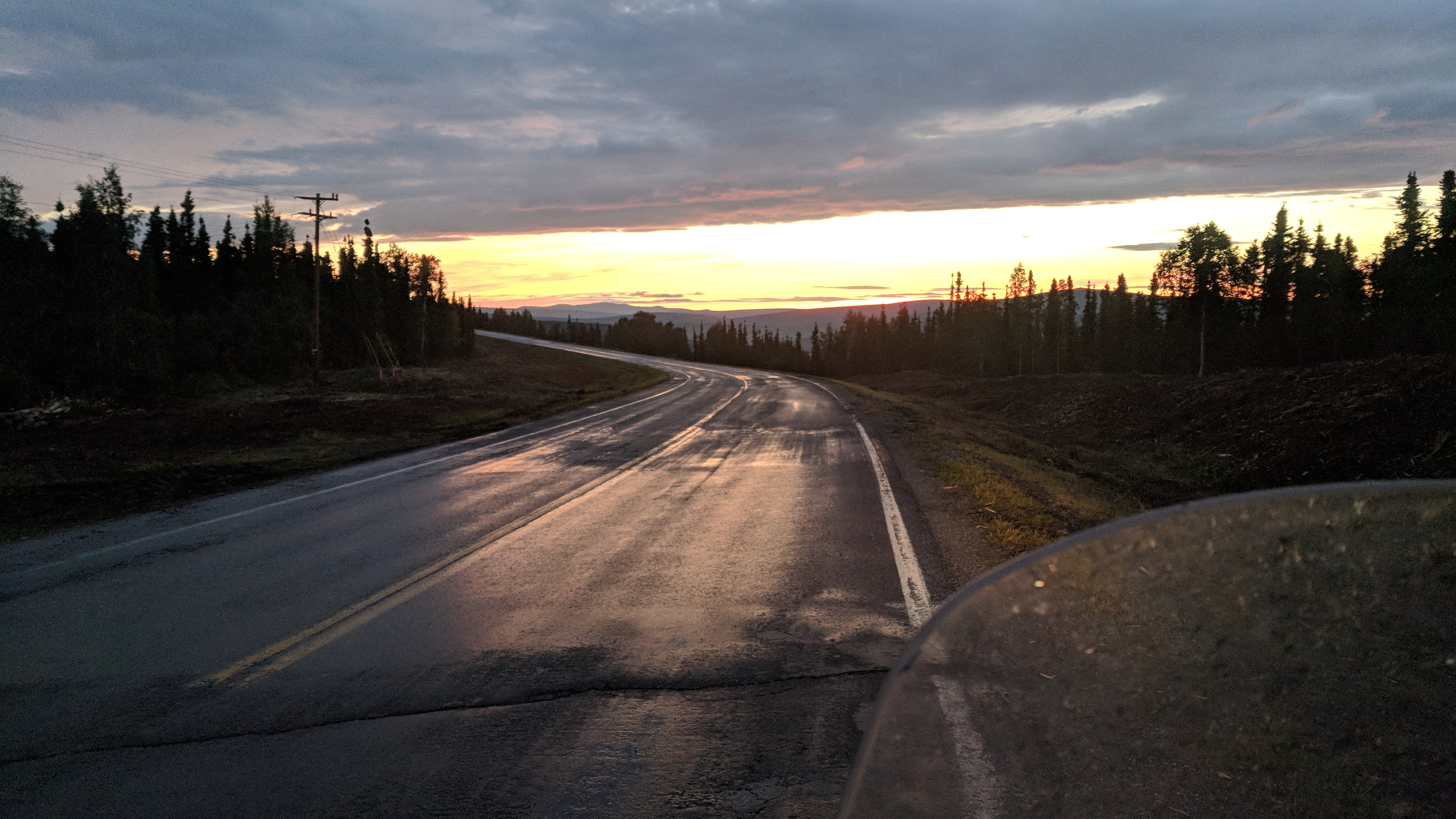
But I want to get as close as possible. By riding from Anchorage to Fairbanks, I’ve gained almost an hour and forty-five minutes of daylight. Because of human oddities like time zones and daylight saving time, sunset is at 11:45 pm and sunrise is at about 4 am, which means true midnight should be around 2 am, right between the two.
I reach Fairbanks at midnight, have breakfast and keep riding north. There’s a bright pink sunset in the north which is also the sunrise, and even though it has been raining and there are some clouds, it never gets dark enough that I can see my headlight on the road. A little after 2 am the clouds lift and the sky turns blue. I turn around and head south again, the sun rising at my back.
1:30 am, north of Fairbanks, Alaska; looking north.
Around midmorning, as I start to fall asleep on the road south of Fairbanks, I realize that this hasn’t been my best plan. I remember that this is exactly what I swore I wouldn’t do, ride when exhausted; somehow the imp of the perverse managed to pitch the plan to me in such a way that I forgot about getting tired. I pull a bug net over my head and pass out by the side of the road for two hours.
The day continues. I see another black bear, and more moose. Huge black beetles with long wavy antennae are falling out of the sky like ash, but they seem harmless enough. A helpful Alaskan explains that they actually have enormous jaws and a terrible bite, which would sound like a put-on except he convincing runs back inside.
A bathing moose.
I’d hoped to spend the night in Chicken, the last town in Alaska on the way to Dawson City, but it turns out not to be a town but just a loose assemblage of take-your-money buildings. Wearily, I begin ascending the Top of the World Highway and cross back into Canada.
By the time I make camp, I’ve been riding for 25 of the past 30 hours.
I had a long and detailed list of projects to accomplish once I had a base of operations in Anchorage, but in the end made progress on only a few. Being surrounded by people has a muddling effect.
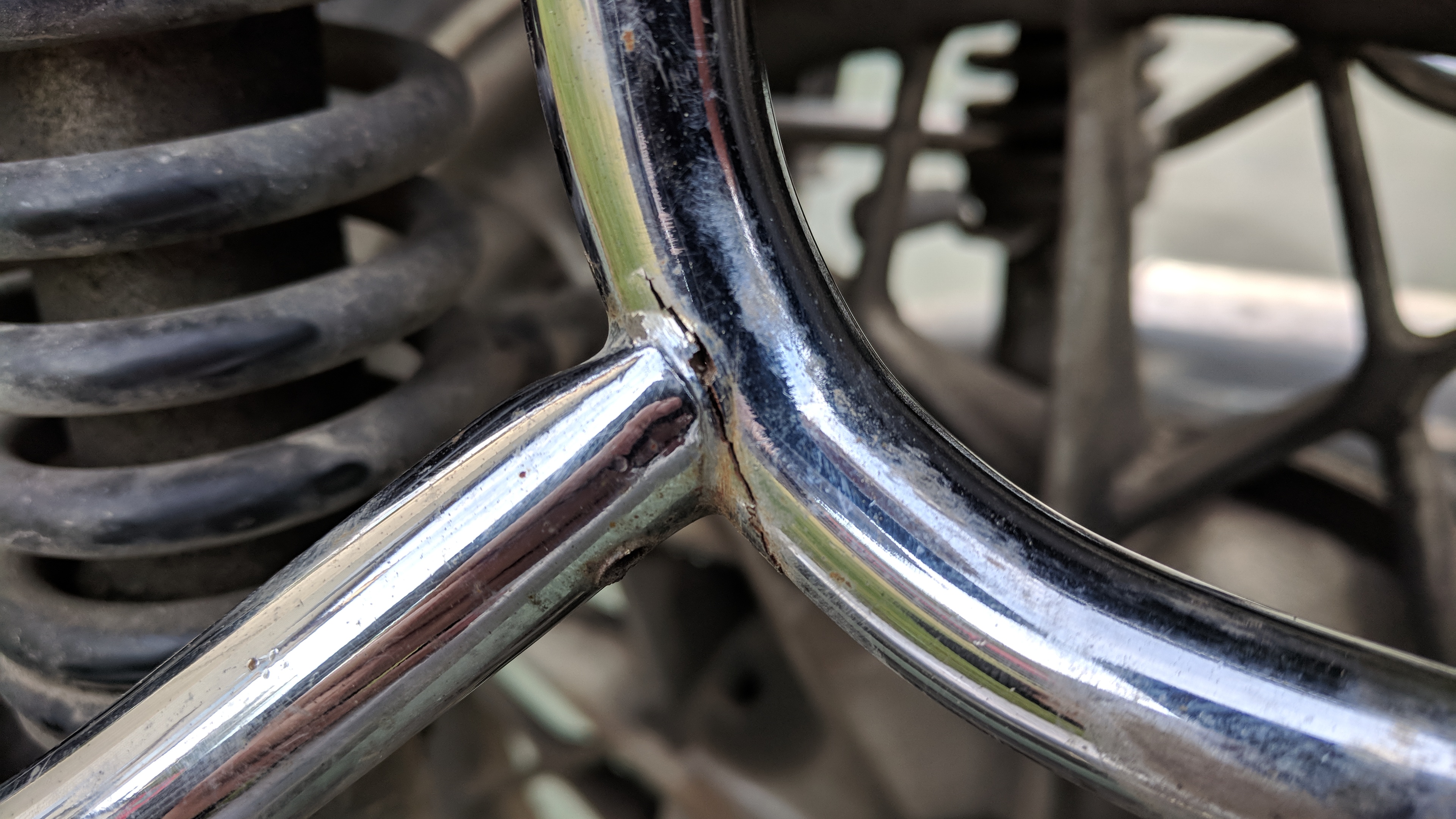
My left saddlebag was sagging, and I thought it needed bracing. In fact, the bracket was cracked right through and barely hanging on. There was nothing to do but get it welded, and Jake at Superior Machine and Welding took care of it in no time at all. What had at first seemed like a daunting problem was resolved in minutes by someone with the right knowledge and tools.
Left-hand saddlebag bracket crack; worse than it looks.
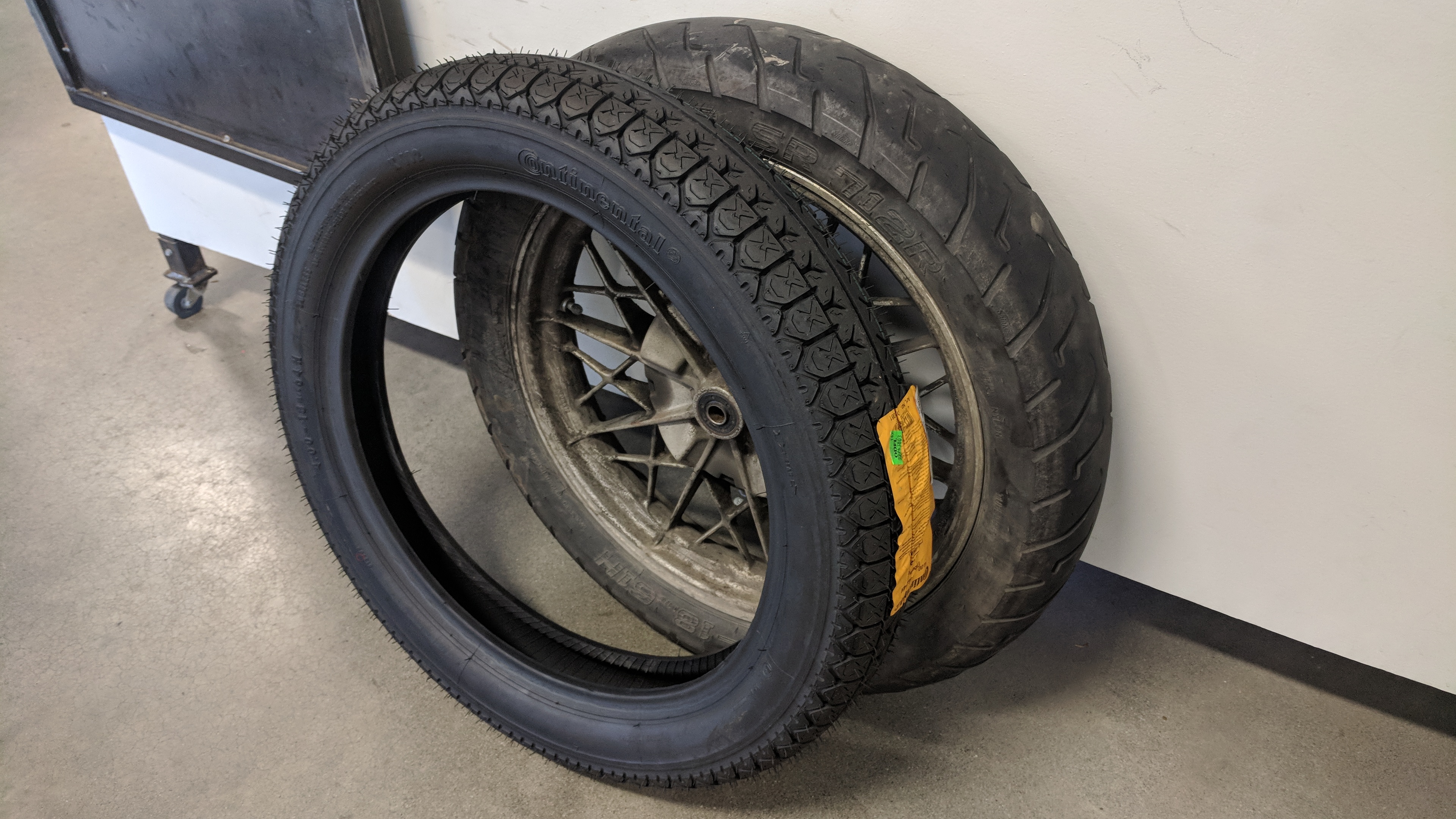
I also needed a new back tire, as the old one was too worn down to face the long trip home, and some of the roads ahead. That problem would not be rushed, though, since no one in Anchorage or Fairbanks had the right size in stock, and ordering a new one would take eight days.
There was nothing to do but wait.
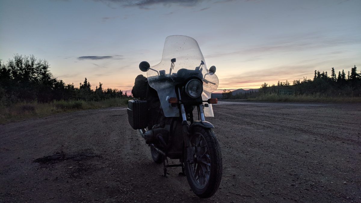
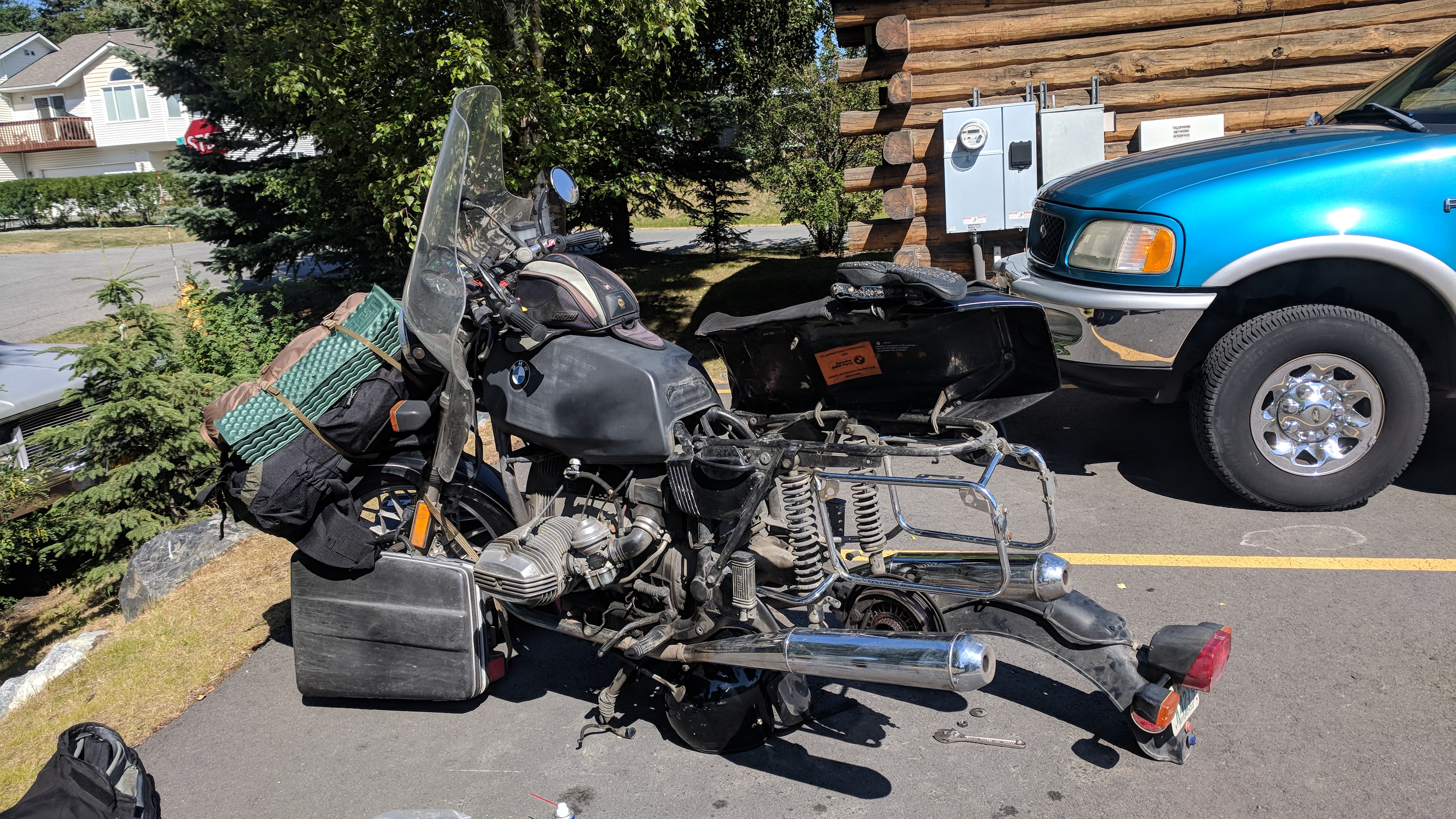
I set about rearranging the weight on the bike again, to bring more of it out of the saddlebags and onto the seat. I had been proud to use the original Krauser bags, but now I feel as though I have been needlessly torturing some lovely museum pieces. Because they have such a large capacity, it’s easy to overload them. Also, seeing thousands of miles of impeccably-outfitted adventure bikes has left me feeling under-geared.
Anchorage has a frenetic energy, fueled by myriad parking-lot coffee shacks and Red Bull smoothies. It makes sense in a place where you can’t count on day and night to mediate your sleep cycle that you have to do it manually. A month after the solstice, the sun still doesn’t set until 11 pm.
It’s not a tall city, but it is diverse, with Korean restaurants piled against sushi shops piled against Indian restaurants, steak houses, liquor stores, payday loan and pull-tab shops, lightly seasoned with strip clubs.
The pull-tab shops puzzle me for a while, but then it’s explained that they are essentially scratch-ticket type gambling; the Alaska gambling laws cause them to be sold only in special, dedicated stores. The bulk of American cultural differences between states can be explained just by the variations in their liquor and gambling laws.
The tire arrives at noon on a Thursday. While I’m wrestling the wheel back on in the parking lot, an older man who turns out to be the owner stops on the way to his truck and says they haven’t seen an R65 up here in 20 years, though they used to sell a lot of them (the shop has been around since 1972). I take this with a grain of salt, since I don’t think he’s handling the day-to-day details any more, but still, he said it, and I wonder what it means.
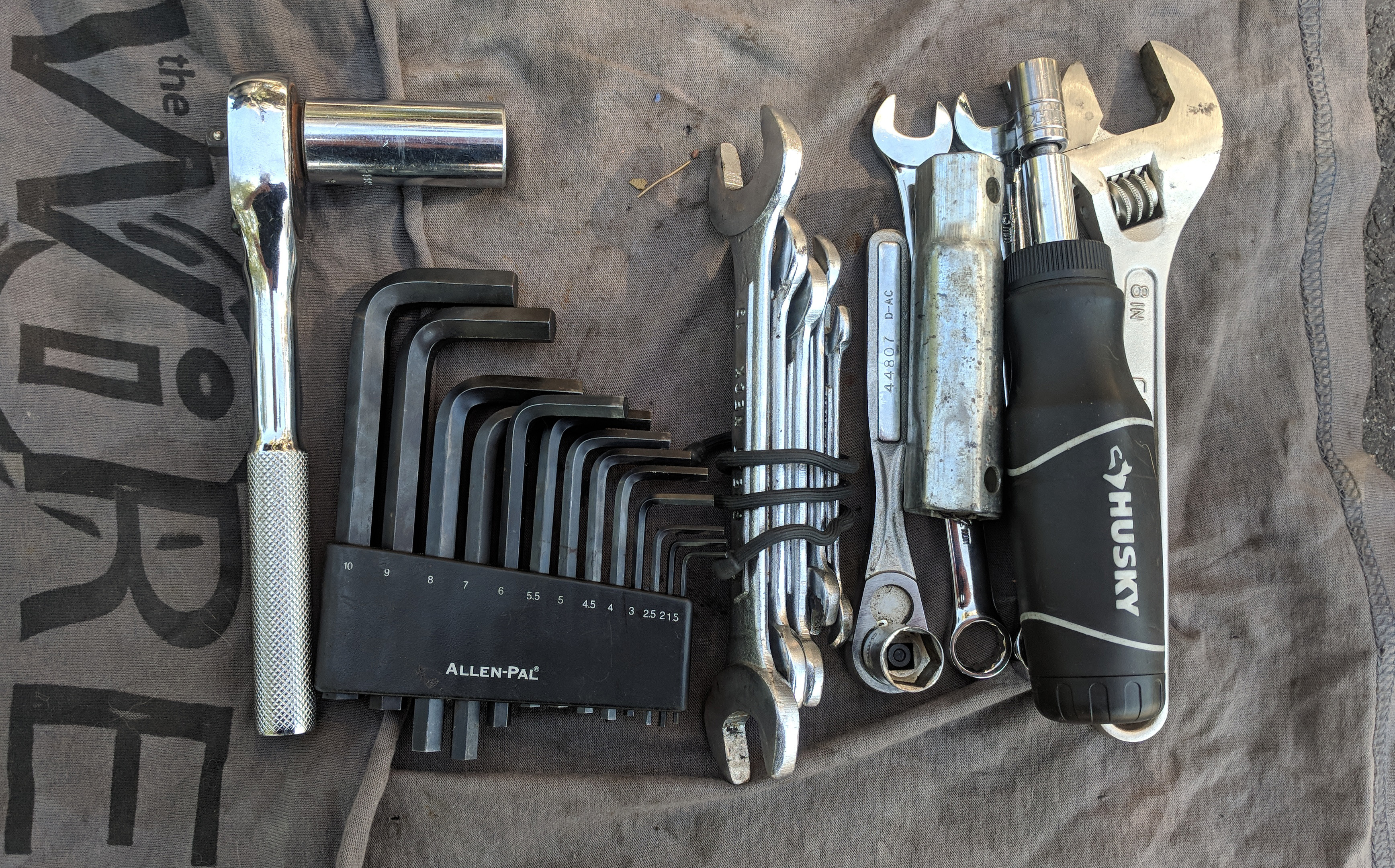
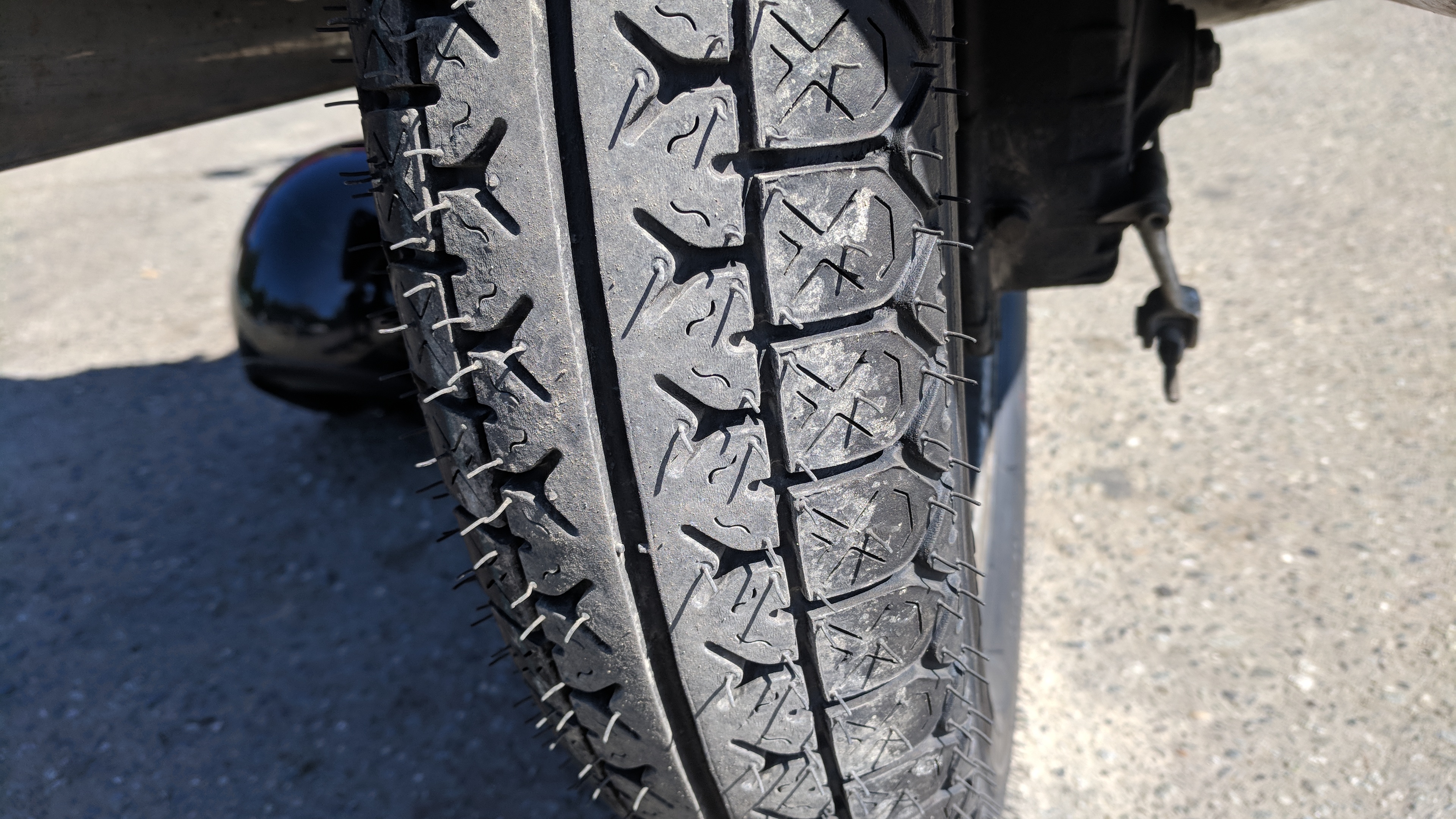
Undignified, we wait. The bags and backpack lashed to the front tire keep the front down so I can work on the back wheel.Tool kit.Almost there.Ready to go.
It’s 2:30 in the afternoon by the time I can get going, a late start. I have a weekend pass to the music festival in Dawson City, 500 miles away, and the route I want to take is even longer than that. But I think I can make up some lost time with a little luck, decent weather, and the full weight and power of astronomy.