Resurrection Bay

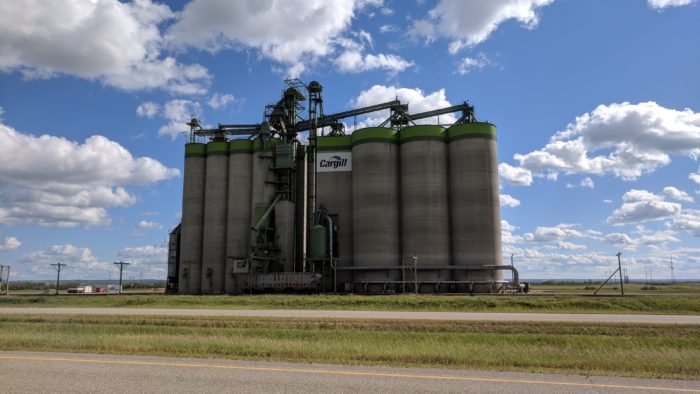
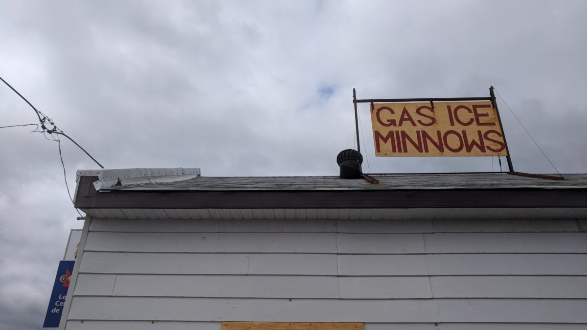
After 14 days and 4706 miles, I rolled in to Anchorage.

Despite arriving a day ahead of schedule, Cullen and Olivia were gracious enough to let me stay with them. After barely talking to anyone for two weeks, I was poor company at best. We went out for Korean BBQ and then ice cream by the water — it was pretty fantastic.

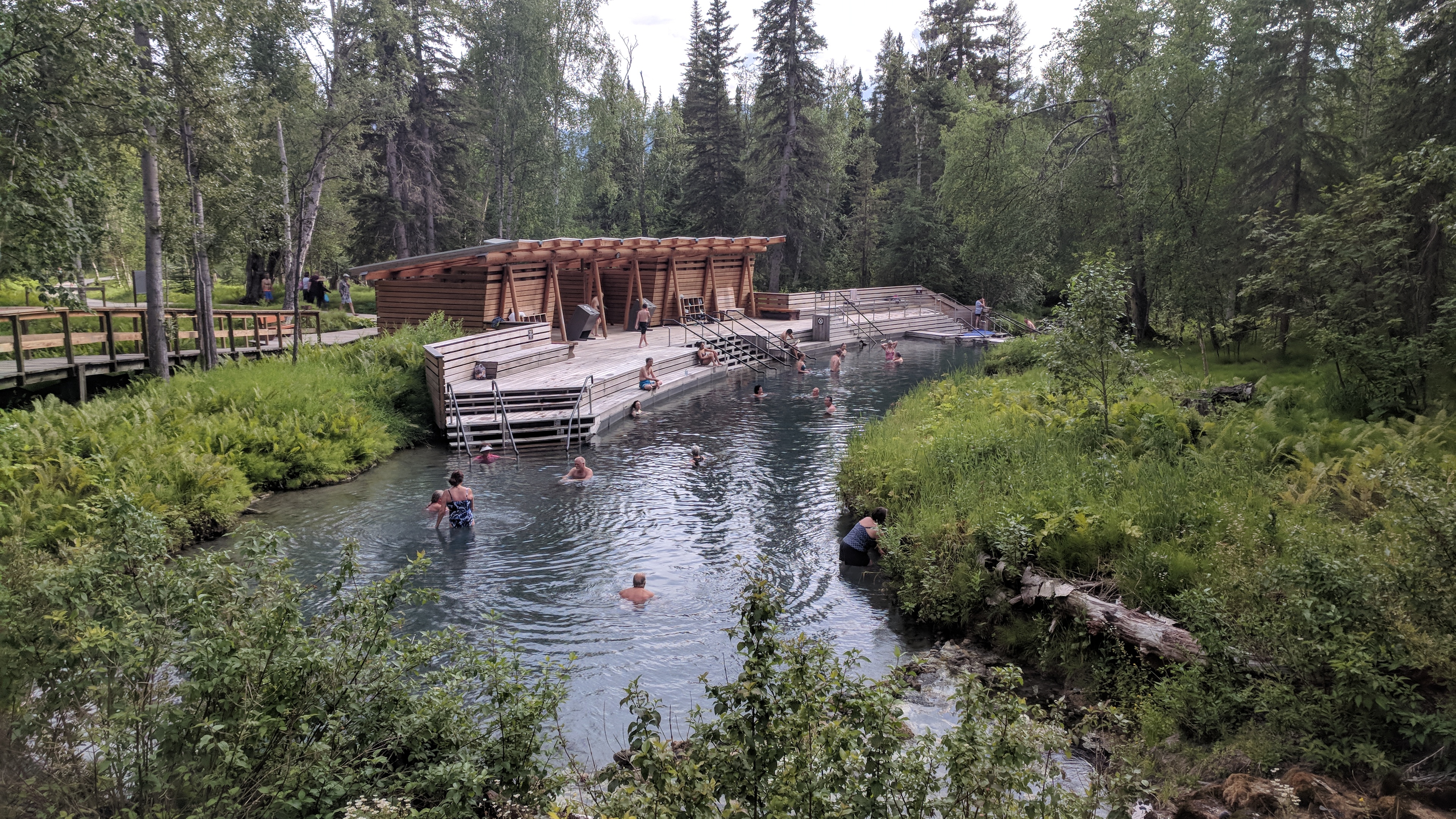
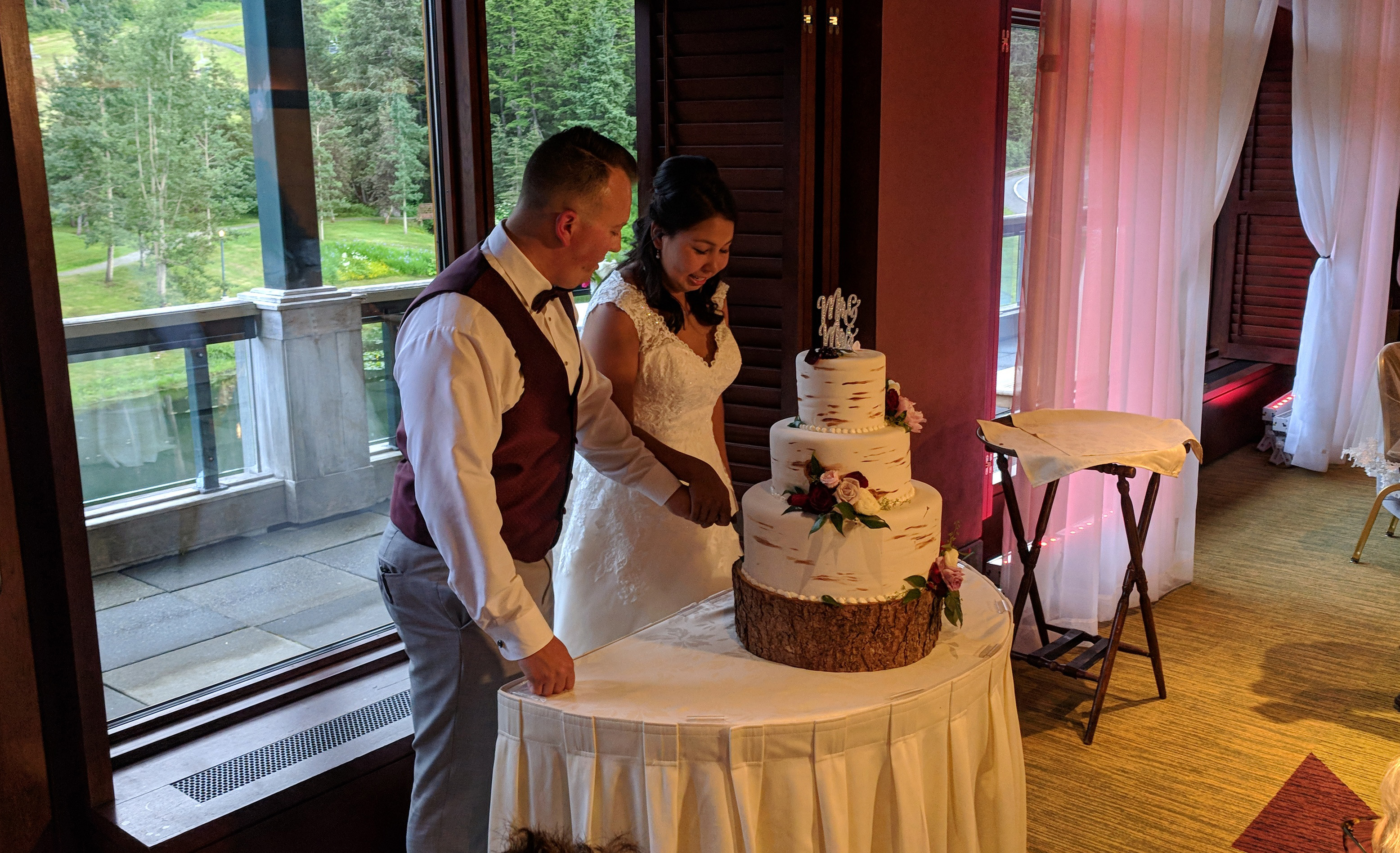
Once the rest of the family arrived, we relocated down to Girdwood on the Kenai Peninsula for the wedding.

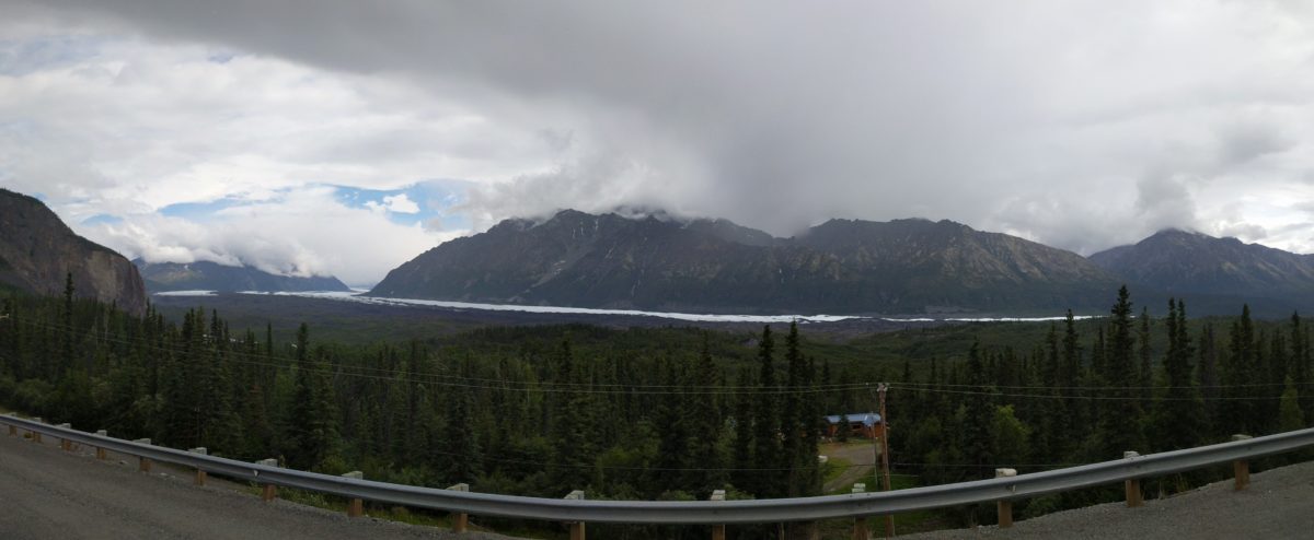
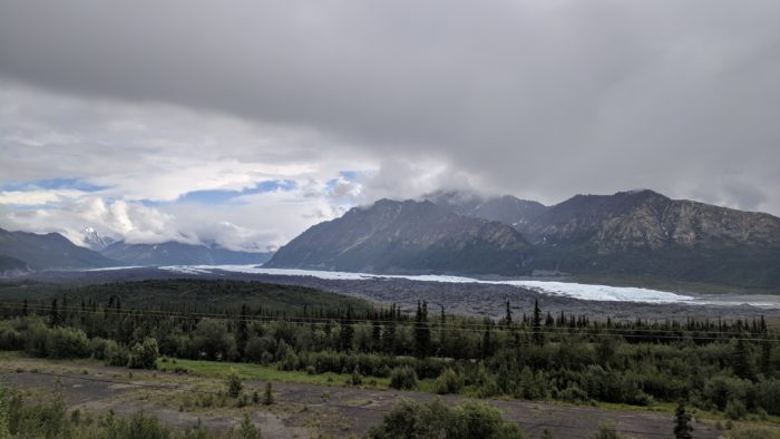
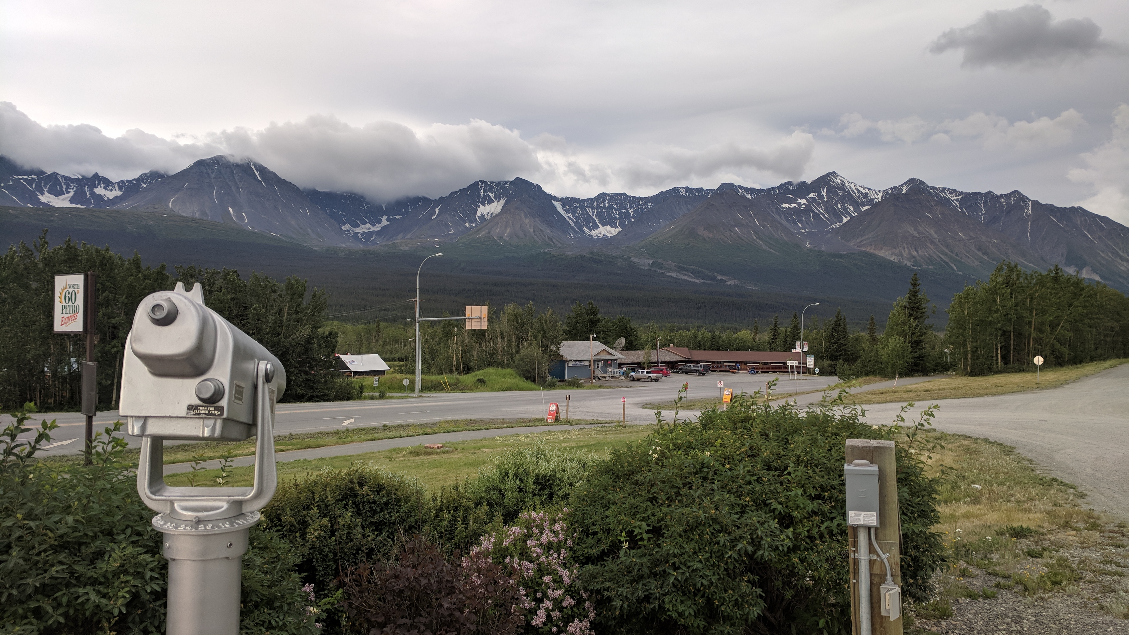
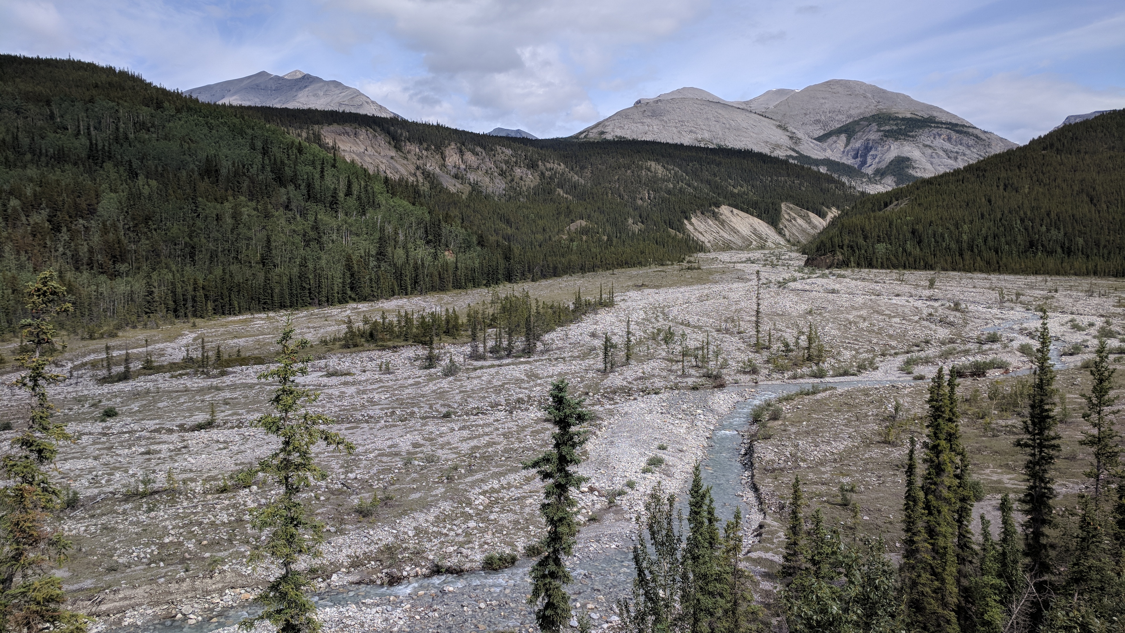
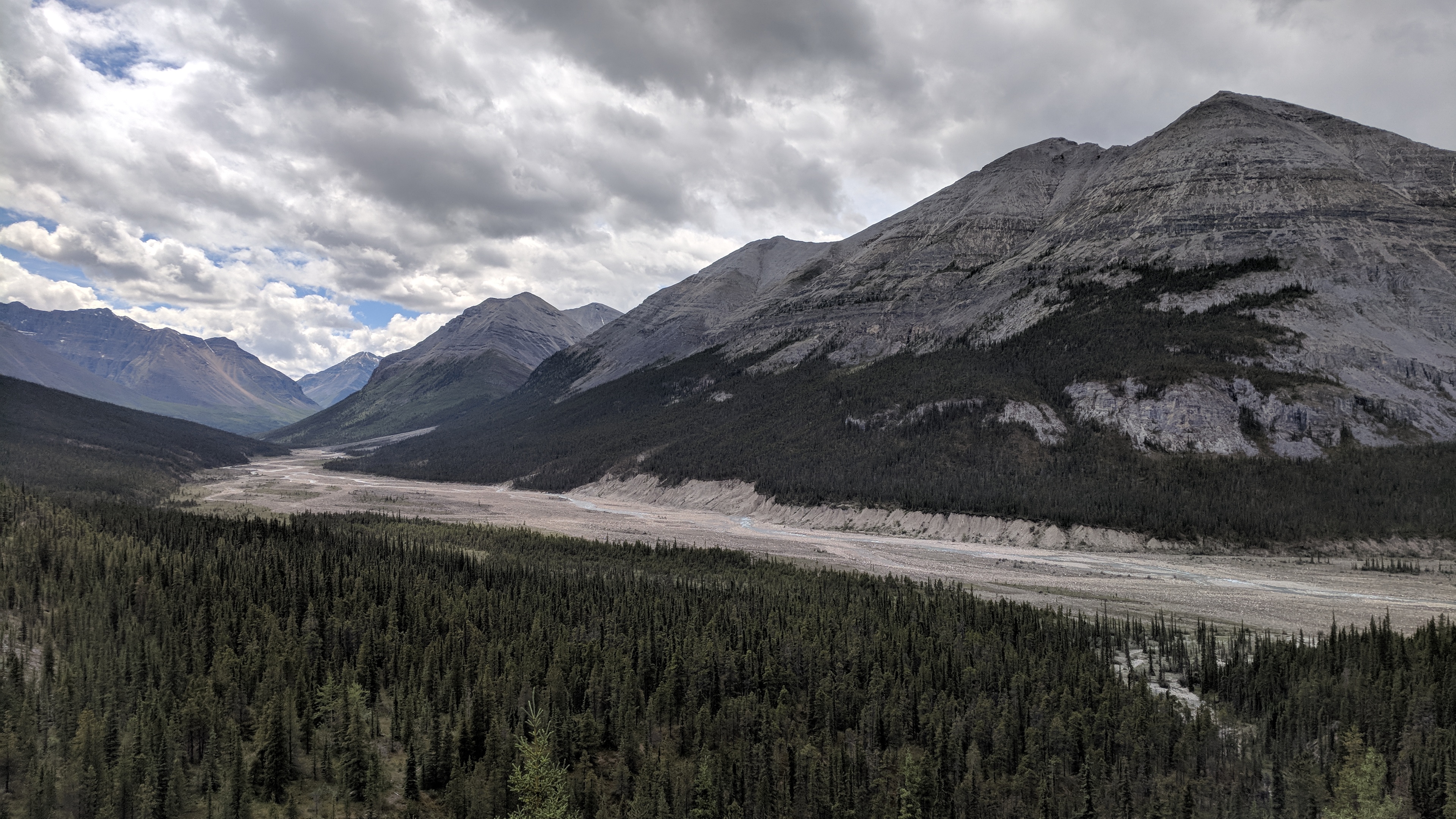
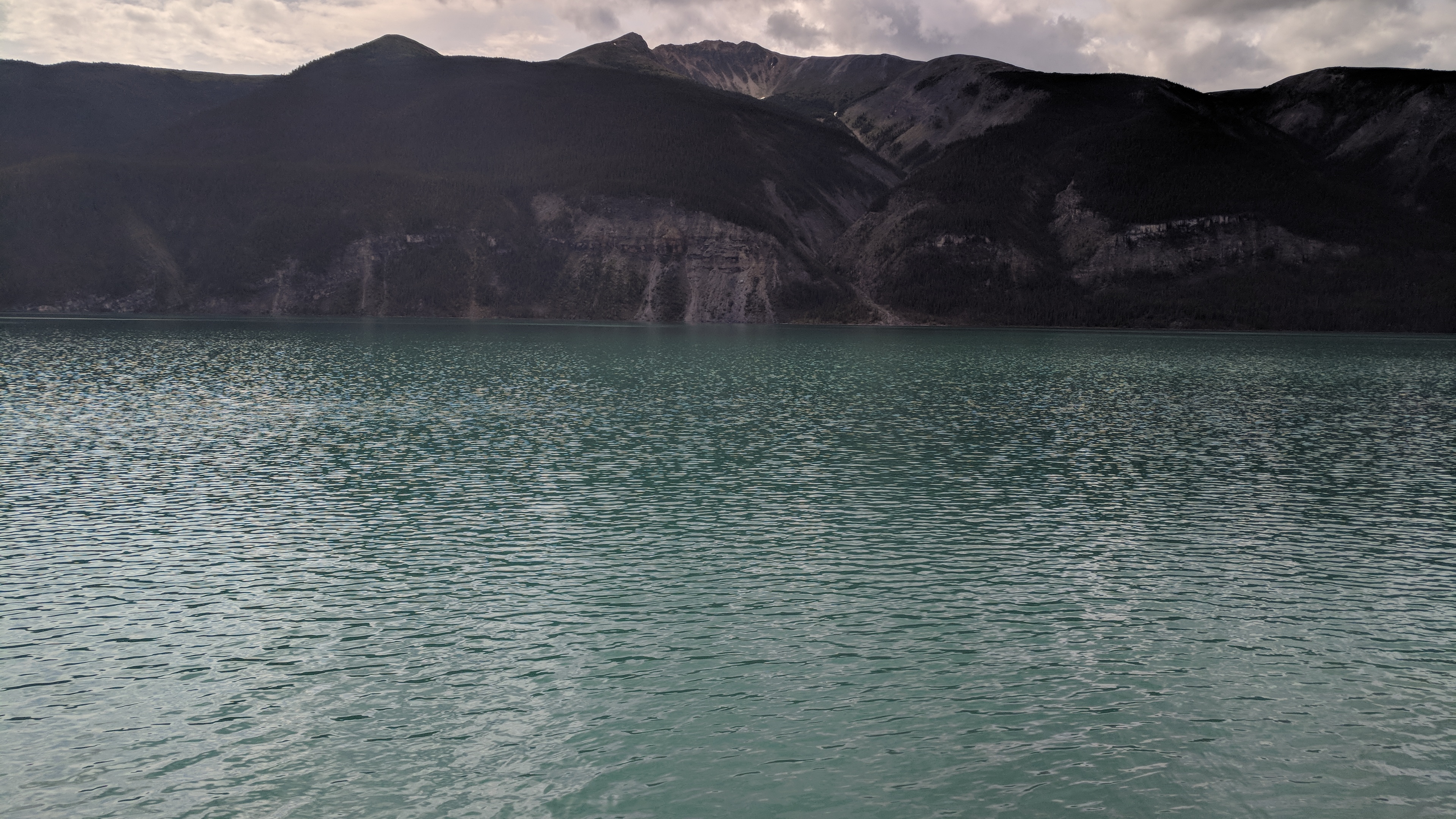
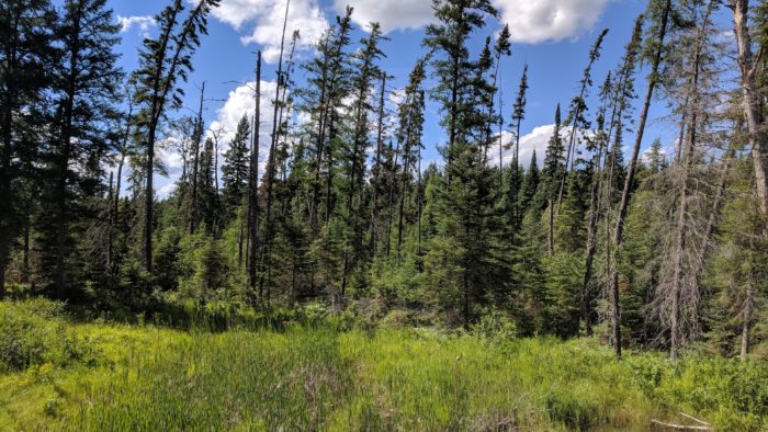
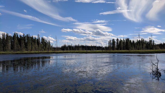
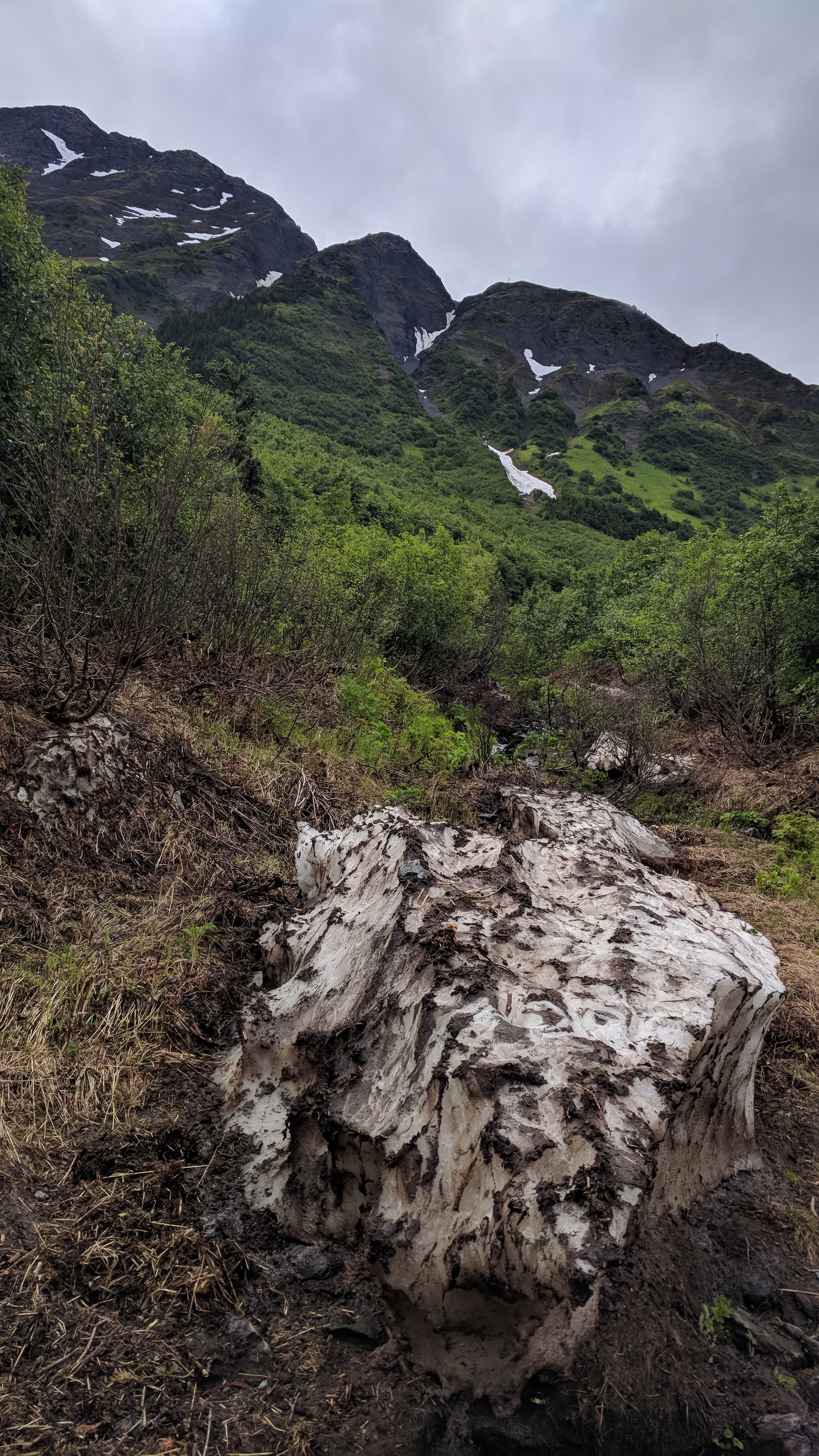
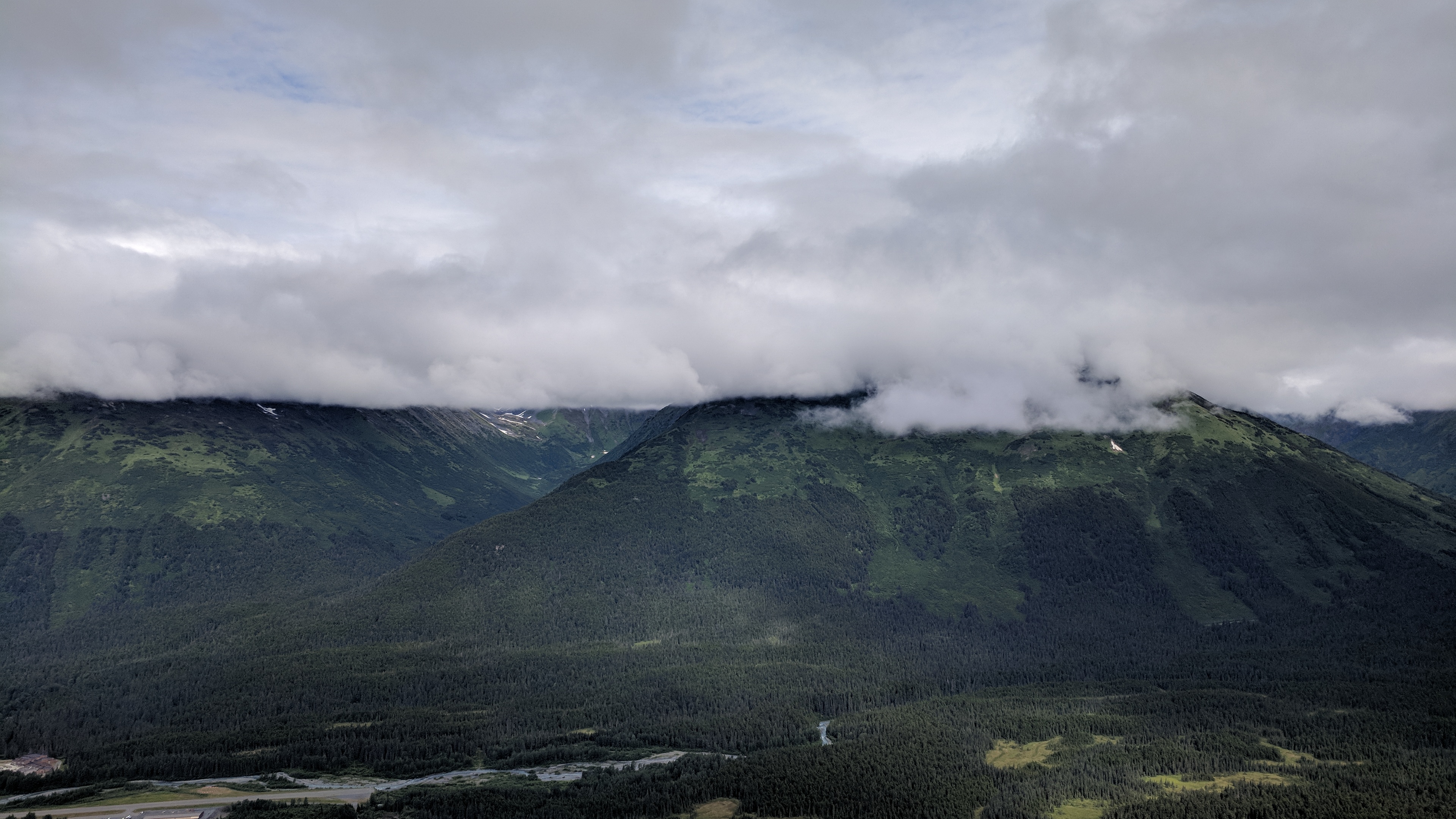
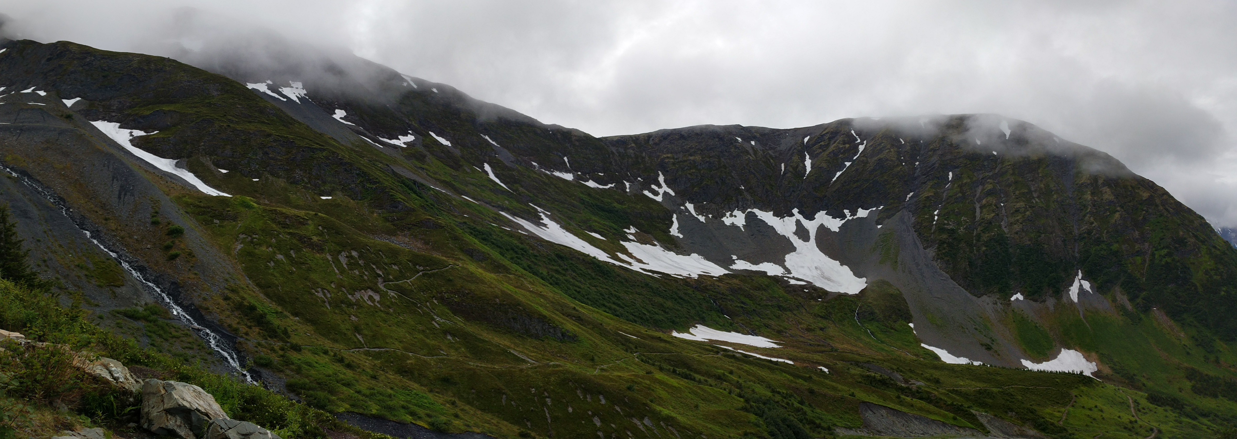
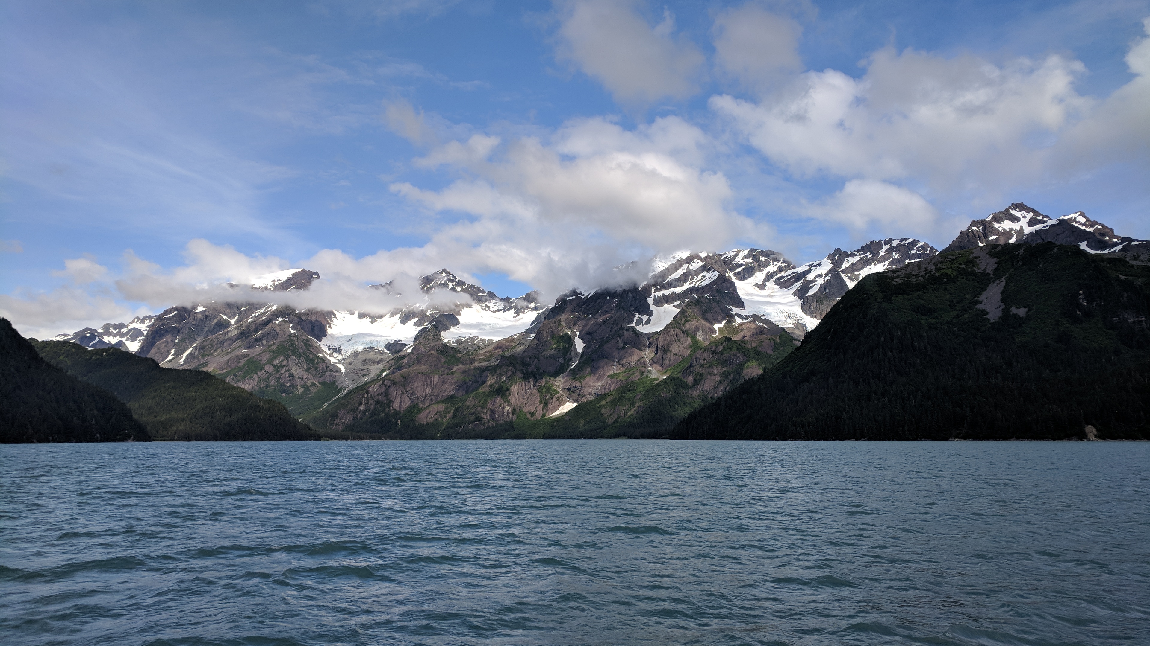
The Kenai Peninsula is where the Chugach mountains spill into the sea. Wickedly folded shoulders of land tumble right to the water, frosted with glaciers and slathered in clouds. Much of it is considered a rain forest, and the clouds stay parked just a few thousand feet up.

Over Girdwood, the clouds were exactly 2000 feet up, and there was a trail that led right to them. At the top of the terrestrial range I was at eye level with the base of the celestial one as it sat like a cap over the valley.

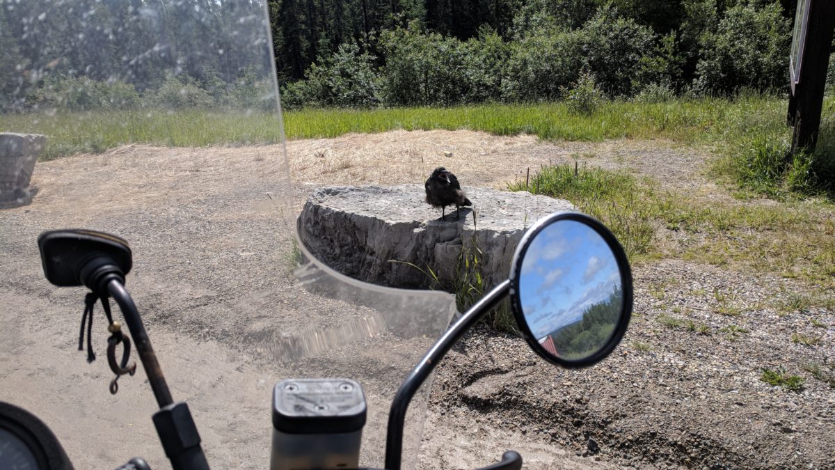
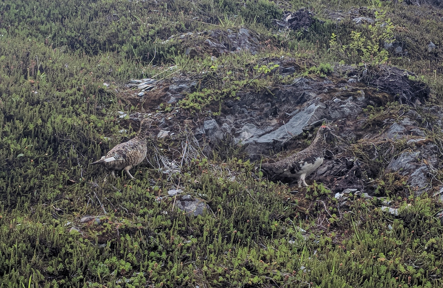
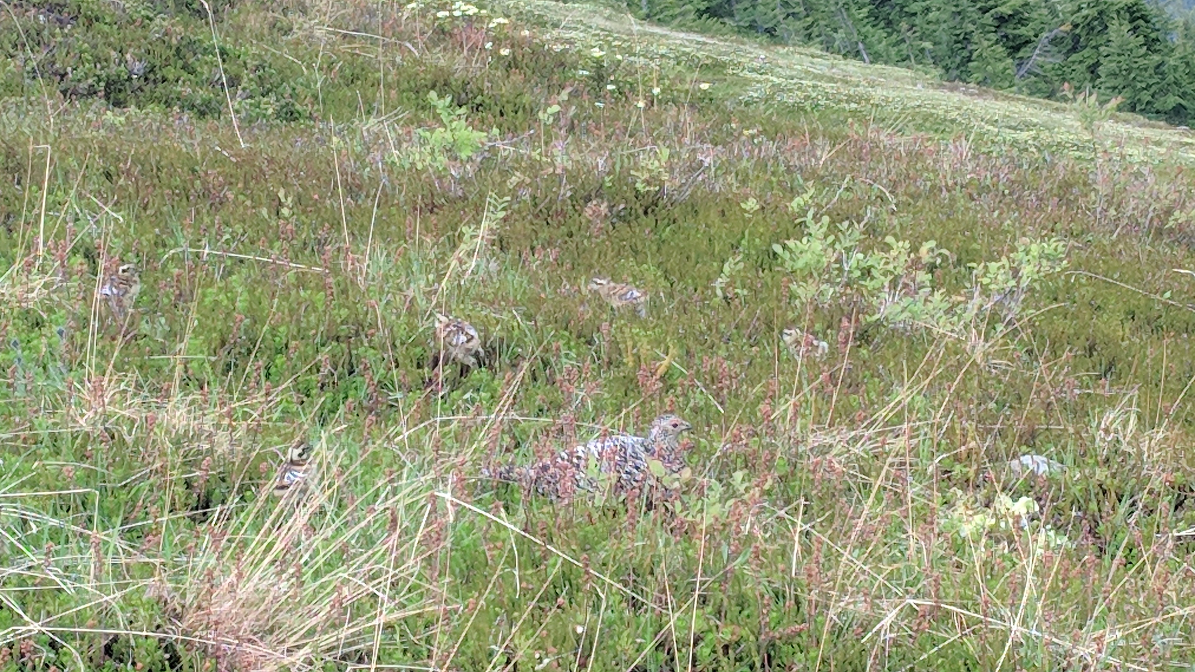
On the way up the trail, I saw my first ptarmigan, a sort of arctic grouse. First I saw a pair, then a few hundred feet further on a mother blocked my way to give her chicks time to scamper. She hunkered down, spread her shoulders wide and hissed at me, then rumbled, then trilled and chirped to the chicks — she went through a whole array of vocalizations, impressive language skills for such a tiny dinosaur.

The tiniest glacier, on the way up to Mount Alyeska.
A ptarmigan pair.
A ptarmigan hen and chicks, poorly hiding from me.
The clouds of the Kenai Peninsula.
Near the top of Mount Alyeska.

Against this backdrop, and with the great people involved, the wedding was a delight, and uninterrupted by moose like one wedding we heard about.

Congratulations and hearty well-wishes for Cullen and Olivia! Deep gratitude, also, for their hospitality.

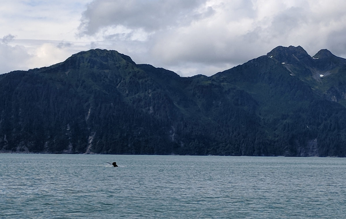
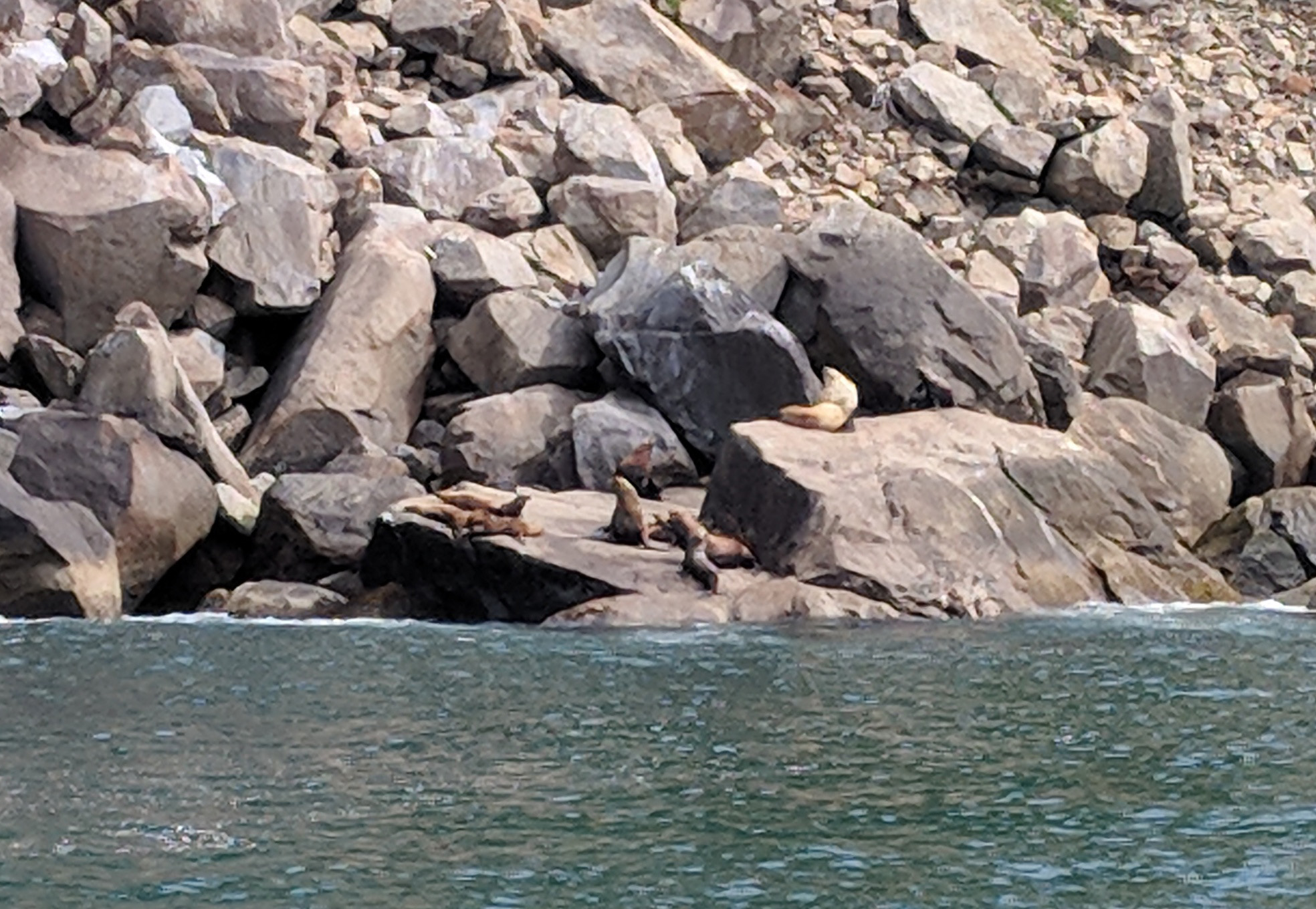
The next day we took a cruise out of Seward, surveying the steep-cut fjord that is Resurrection Bay as we arced toward the Gulf of Alaska. Fifteen-mile-long Bear Glacier touched the sea on one side, while smaller alpine glaciers hung above the whole coastline.

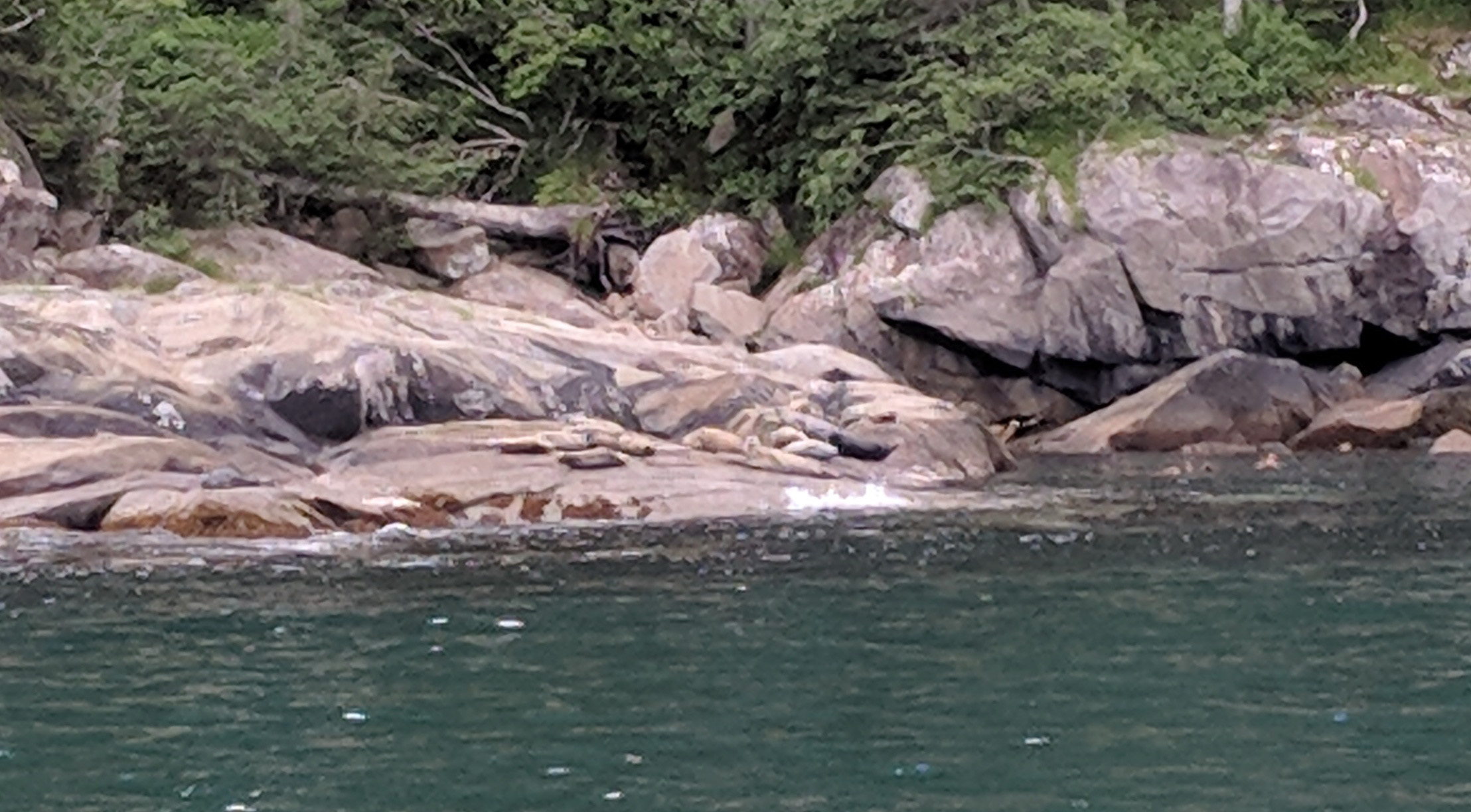
It was like a parade of charismatic megafauna. We saw a humpback whale snacking, a minke whale skulking about, Steller seal lions jostling on a rock, harbor seals lying inert like sausages, sea otters both rolling and tumbling and napping (which looked a lot like being dead), bald eagles here and there and then puffins to boot, both horned and tufted. If we’d just kept sailing, presumably we’d have seen all the famous animals of Earth lined up along the shore, elephants and zebras and ostriches just waiting to pose for us.

We stalked the humpback for a while, which was between us and the land. It looked like it was five feet from the shore, picking its way casually along what was presumably a steep drop-off. Eventually it found a cove full of birds which must also have been full of food, because there it lingered, turning, surfacing and doing whale things.

Blurry Steller sea lions.
A modest breakfast serving of harbor seals.
Prospect, Spoon and Porcupine glaciers.

Here and there along the shore of the peninsula there are small stands of grey, dead tree trunks, ghost forests. They are remnants of the 1964 Alaska earthquake, magnitude 9.2, the largest earthquake ever measured in North America. In some places, it caused the ground to drop 8 feet; patches of coastal forest sunk into the sea and died. It also caused a tsunami which was more than 100 feet high as it came into Seward, but since the bay has three large barrier islands, the surge was broken down to about 30 feet; a lesser disaster.


Matanuska

Ranges rise and fall past me: The Northern Rockies, the Cassiar and St. Elias in British Columbia and Yukon, the Wrangell and Chugach in Alaska.

I have spent days now trying to think of words for mountains, and I might not have it in me. It might not be possible. They are all different, and yet similar; they have tribes and groupings and families, yet each is its own iteration. It is as meaningful and meaningless to say they are alike or not as it is to say that people are all essentially the same, or all unique.

Some are reddish-brown, some are white; some are black, or slate-grey, or cloud-colored. Some are smooth, some are striated, some are wooded. Some seem bent on thrusting upwards, some seem only interested in the downward plunge, the talus slope, valley-building and river-cutting. Some are teeth, some are legs and arms, some are walls. Some tower, some huddle. Some writhe and some rest. Some bring doom. Some bring peace.

Geologists have more words for mountains than the rest of us, but those only go part of the way. The remainder might not be in a language that we actually speak. When we name mountains, we are trying; not the bland, bureaucratic names of presidents, but the older names, the names we couldn’t resist giving them because we needed to say something, to address the mountains somehow.

But the language of rocks is lost to us, as lost as Eden.

The Wrangell Mountains, Alaska.

Each range has more snow than the last, and the clouds get closer. At 3000 feet, Alaska Highway 1 west of Glennallen is almost in the sky. The tops of the Chugach boil away into mist, great plumes of white tumbling off of their peaks as if they were steaming volcanoes. The line between mountain and cloud seems confused, and it’s easy to imagine that if you reached the top you could just keep going, transitioning from mountain range to cloud range and hiking on.

Then Matanuska spills out across the land, a great ruinous white dragon reaching down from sky to earth; Matanuska, land-breaker, earth-shaper, vast and old and sleeping in the valley below the road, 27 miles from tail to nose and boundlessly old, one of the mightiest glaciers on the continent.

Where he has curled back his toes the ground is destroyed, black and blasted and churned.

Off to one side, through cracks in his hide, there is an eerie blue glow. It is the same blue as the magic rivers in the Cassiar Mountains, the color of the soul of water.

This is his land, and we pay him tribute by naming rivers, roads and ships in his honor. In return, he sleeps a little longer.

Matanuska glacier.

The sheep of Thachäl Dhäl

I sleep on the sandy shore of the Coal River, and dream about bears. I dream there is a bear leaning against me so heavily that I wake up; I dream there are bears sleeping in the ground all around me, which mustn’t be disturbed; then I dream some sort of children’s book, and at the end a bear goes on a rampage and kills the child’s mother.

The sky is bright at 3:30 a.m., and there’s a dim ray of light shooting straight up out of the woods where the sun will eventually rise. I pack up and start riding, and see four bears in 30 minutes. Nearly-harmless black bears the size of dogs, they appear regular as mileposts along the road, studiously munching on whatever bear salad grows on the shoulder.

It’s windy and a slog, but I manage 400 miles because of the long day.

The signpost forest.
Words to live by.

The motel bar in Haines Junction is just about all I could want out of a motel bar. The menu is a mix of traditional Canadian food and Chinese and the bar is half full of drunk locals, some of them First Nation. One of them corners me at the bar, shakes my hand as though to destroy it, then tells me that God created an objective for all his subjects, and asks — do I know what my objective is? He sounds angry and accusatory; threatening.

The mountains of Kluane National Park dwarf the town, looming over it like a black wall streaked with silver snow. In the morning, the road runs right along them, a beautiful ride. Purple flowers flow along the sides of the road like a festive fog.

Haines Junction, Yukon Territory.
Some toilet paper at the motel.
Kluane National Park and Preserve.

Around one great corner, a huge brown mountain looms. It is mostly barren, flecked sparsely with trees and rocks, and it has a visitor center, so I stop to find out why.

It turns out that Thachäl Dhäl is one of the few places along the Alaska Highway where Dall sheep can be seen from the road. A white mountain sheep, they tend to stay up high on the slopes to avoid lazy predators. I scan the mountain, but there are no sheep today.

But then a park staffer finishes fiddling with a nearby telescope and offers it to me, and microscopic sheep swim into view like high mountain tardigrades. It is astonishing; they are so far away you can’t see them with the naked eye, they might as well be tiny sheep on Mars, living in the sky with the comets and nebulae. It reminds me of the Great Moon Hoax of the 1800’s, in which it was purported that an astronomer had created a telescope powerful enough to see inhabitants living on the moon, an assortment of beaver-people and bat-men. With a strong enough telescope, anything seems possible.

Below Thachäl Dhäl, Kluane Lake is otherworldly. Dark, empty beaches ring slate grey waters; a stony island rises in the middle, and great plumes of mist tumble across it. It’s a Ralph McQuarrie landscape, something not quite from here.

The sheep of Taco Bell.
Kluane Lake.

The Alaska Highway

The first leg of the Alaska Highway is rough, dusty and barren. I cross a long metal-grate bridge high over a river, wobbling in the wind and imagining the effect if I stumbled. Facing a gap between gas stations, I fuel up at one of the card-lock systems, a giant automated pod with diesel at one end and regular at the other.

I’m in a grim mood. Though it has been a great ride, I wanted it to be more than that. Mostly, though, I have brought myself with me, and I can ruin almost anything. I am a black meteorite of bitterness hurtling across the landscape, pulled down from the Oort cloud to be judgy about everything.

At Stone Mountain, the trees fall away and great grey rock faces leap upward. I stop and Raven has words for me. He hops over and jumps up on a rock, then yells at me for five minutes straight. He does not sound pleased.

But I can’t quite get what he is saying. Eventually he gives up on me, snags a wormy bug from near my tire, and flies away.

Fueling up at an autonomous gas pod.

Mountains scrape the sky above while tiny rivers wriggle through the valleys far below; it’s the whole package, in one vertical panorama. The water is gloriously clear, a rippling liquid lens for viewing rocks, but with a crazy blue-green gemtone tint.

The more water, the more the color deepens. Summit Lake has a supernatural hue, like a lake in a Japanese video game. I stop again and prance along the shore’s edge taking pictures of flowers like an elf.

I am riding down off a mountain for several miles, and the river beside the road is running the other direction, behind me. If I’m going downhill, then the river must be going up. I can’t make sense of it. Maybe that’s how things work here, with a bit of magic.

A while in the mountains can be disorienting, though, and at one point I find myself using a lot of throttle to go down a slope, only to dimly realize that I’m not. I’ve just briefly lost track of which way is up.

Stone Mountain Provincial Park.

I keep trying to photograph the water, but the color does not come through. This is only a pale imitation.
Bluebells at Summit Lake.

The road is riddled with devil goats. At one point, a mother and two kids are in the road, water on one side and a sheer, 90-degree rock face on the other. There is nowhere for them to go. I stop the bike, not wanting to chase them into the lake; they dawdle for a bit, and then go 10 feet straight up the rock and hang there in the air, watching me. I can’t see what they are standing on; it’s as if they are levitating. Magic goats.

A bison comes out of the woods. He rolls around, urinates, eats some grass. I spend ten minutes trying to get a good picture in case I never see another one, then around the next corner is a herd of 30, mothers and calves grazing along both sides of the road as if it’s theirs.

They’re wood bison, distinct from the plains bison of the U.S., but alike in that they, too, were almost hunted to extinction, until a herd of 200 was discovered in Alberta in 1957. They’re doing better now, but not by much in the grand scheme of things; they are a long way from the days when their name meant “multitude” and their kind spanned the continent, shaping the land and cutting the paths that would one day become the roads of men.

The devil goats of the Alaska Highway are actually Stone sheep, seen here levitating.
Rogue wood bison.
Wood bison in numbers.

I stop at Liard Hot Springs, and it is spectacular. I almost didn’t stop, it seemed like such an indulgence but then there I am, paddling around in 100-degree hot tub water coming right out of the ground. The vegetation is weird, lush and exotic near the spring, and it feels otherworldly. I have been riding for days and days and now I am floating in a glen amid the gentle smell of minerals, surrounded by smiling people and rare snails and I want to laugh. I am all happiness, complete bliss, no future needed or past required. More magic water.

Liard River Hot Springs Provincial Park.

They admit that they don’t entirely know how the hot water is made. I’ve heard that about Yellowstone, too. It’s a reminder that, taken as a whole, what we don’t know may yet outweigh what we do, and that just might be a reason for hope.

I float down out of the mountains, coasting most of the way. Stormbreaker purrs.

Advances, none miraculous

Great colossi graze the plains of Saskatchewan, each stamped with a name in an alien tongue: Cargill, Viterra, Broadgrain, Weyland-Yutani. It’s hard to gauge their size until you spot the tiny train or truck against their ankles, and then the scale of their metal digestive tubes and exoskeletons becomes clear. They move so slowly that they seem almost still.

The world has to eat, but the sheer scope of the endeavor begs suspicion. It blurs the line between mere harvesting and something more malicious, strip mining life-energy itself, the fundamental processes of Earth’s organisms being bought, sold and manipulated in massive bulk transactions.

Saskatoon catches me off guard. After hundreds upon hundreds of miles of bleak northern industrial agriculture tended by giant machines, I fully expected a hard farmer’s town; instead, it’s lovely and modern, thoroughly populated by bright, familiar chain stores and restaurants, awash in young professionals buying coffee like fairies sprouted up after a rainstorm. Waterlogged, wind-beaten and dirt-encrusted, I get back on my bike.

A province later, I don’t even try to get into Edmonton, but it’s another prairie city that just rises straight up out of nowhere, as if it had been dropped there. Back home there is an organic sense to cities, they coalesce out of areas of denser population; you can tell when one is getting close. Here it’s all or nothing, grass or skyscraper, 0 or 1, Tron cities on a grid made of chlorophyll.

If jump starting is to be a regular part of the process, I want it to go more smoothly. I wire an extension cord to the battery and tie it to the frame where I can reach it, then cut the matching plug wires so I can clip the jump starting device to it. This means I can keep the jump starter in the tank bag, then just connect the plug in order to complete the circuit and get back up to full power, which I can do without getting off the bike. This should streamline charging, also.

However, reading through my Haynes manual has had me looking for a short, and a dim little bulb has gone on in my brain. A couple weeks ago, the starter button had been sticking and causing the starter to stick and grind in the engaged position, so I had sprayed some goo in there to free it up. I might have used the wrong kind of goo, so I clean out the contacts with a piece of paper and the next two days I get a solid seven and a half hours of charge. That’s something I can work with.

I wash the whole switch out with alcohol that I brought for my stove. The next day I ride  for ten hours with no problem, and at the end of it the instrument lights still come on as bright as twin red suns. I have fixed the problem which I’d created.

Somewhere out on the Road, an idiot gets their wings.

It’s just in time, since mile zero of the Alaska Highway is just ahead in British Columbia, the beginning of 1300-plus miles of legendary road.

A modification to the electrical system.


Manitoba

The land changes completely as soon as I pass into Manitoba, smoothing and leveling. The trees become round and leafy, the jagged woods turn into farms and golf courses, cars multiply and the highway becomes two lanes in both directions.  We’re feeding into Winnipeg, a city of 800,000.

The fields in Manitoba are yellow. I don’t know what the crop is, but it’s a brilliant, luminous yellow lying in great panels across the earth, a vast colorful monoculture.

I have a decision to make. There’s a BMW service place in Winnipeg, so if I want a professional to get my electrical system working, this might be my last chance in a long while. It would be great to have this resolved.

But it’s a beautiful day, and the bike sounds great, so I put all my chips on fuck it and keep riding. Whether it’s actually fixing the problem or just settling on a charging schedule that works, I have the tools, it’s time to stop whining and make my systems work.

Route 16 northwest from Winnipeg is a beautiful prairie highway, flat and smooth across the farmland and with no one else on it. As the day grows late, the yellow from the fields starts to bleed out into the grass, the trees, the road. Everything becomes golden. The sky swells and grows deeper, and the clouds build palaces, peninsulas, ranges.

The day before I’d been fighting the wind all day, but now, with a light tail wind, I go faster and faster, skimming over the pavement. The bike runs smooth and true, no wobbles or shakes. I am a jet-age spider hurtling down a perfect strand of silk. Not only is my battery charged and electrons, for the moment, dance around me doing exactly what they should, but my soul is on fire. I could go full Ghost Rider at any moment.

500 miles today. Tomorrow I’ll ride for Saskatoon.

I fall like a dagger of light across Manitoba, plunging toward the sun.


17 – 11 – 17

Vars to Temagami, Temagami to Longlac, Longlac to Ignace; three days in northern Ontario, route 17 to 11, then back to 17.

Three days on the Canadian Shield, the Laurentian Plateau, a vast mantle of metamorphic rock; literally a hard land.  There are lakes everywhere but they seem haphazard, just splatters of water collected in crevices.  Viewed from above, Lake Temagami has the profile of an octopus that has hit a windshield at high speed.

The endless and unchanging evergreen forest is just a thin froth of life on the surface of the Shield, like lichen on a boulder, the same thing at a different scale.

The map is almost empty. My ignorance of Canada is profound anyway, but the vast blank spaces on the map make it feel like I’m riding right out of everything. Trees and water and 100 miles between towns.

The two faces of northern Ontario: trees straight up, and trees with water.

Every 50 or 100 miles I pass a long-distance bicyclist and think, Now those people are crazy. The shoulder is only about 18 inches wide, the forest beyond is impenetrable and full of vicious flies, the traffic hurtles by at high speed and it’s stunningly far between outposts, surely a day’s ride each. Then I pass a long-distance unicyclist. I didn’t know that was possible, but there he is, one wheel laden with brightly colored bags, spinning along in the middle of nowhere.

This is what happens to motorcyclists with dead batteries. (Hearst, ON)

The new battery is all over the place, dead after 2 hours, dead after three and a half, dead after half a day. I can tell it’s almost gone when my turn signal indicators start to dim. At least I have the fast charger now.

The rubber stopper that covers the timing hole disappears, lost somewhere across 1000 miles of trees and lakes. I pour the last of the Jameson into a small jar and carve a plug out of the cork.

Jameson Black Barrel.

Canada Day

Even with the electrolyte topped up and a fresh charge, the battery only holds out through the morning. I lurch north into Ontario, then stop at the Canadian Tire in Cochrane to look for answers.

They test it again, and again it comes up good. The young guy at the battery desk offers to go ahead and charge it up for me, which would be great except that a few minutes later the battery boils over. He comes out to the parking lot to tell me; he doesn’t know why it did that, and he asked around and no one else knows either. He is self admittedly part of the B-team, since today is Canada Day and most of the North is closed, so his analysis doesn’t run very deep, but neither does mine. A new battery is a reasonable next step in this process of elimination, anyway.

Canadian Tire.

The battery doesn’t quite fit, but it’s close enough. It’s too thick for the tray, which is probably why I have two R65 battery trays at home which have either had the back lip sawed off or smashed flat. But it’s shorter than the original battery, so it perches on top of the tray edge and there’s still room to fit the tool tray in above it.

Two of the four mounting points on the fairing are broken: the top left one is cracked, and the lower right one is completely shattered. The JB Weld I’d applied at home has not held. Two mounting points doesn’t seem like enough.

A zip tie cinches the top one, but the bottom one is trickier. I’ve finally settled on a c-clamp/zip tie combo, and I am hopeful about the results.

I am very happy with this fix.

My odometer does not work. I have four R65 speedometers at home with broken odometers. A new one costs crazy money, and the used ones are probably broken anyway. For now, my solution is to go digital, an old iPhone running an app called “Speedometer.” It doesn’t need internet because all it uses is GPS, and it gives you speed, distance, altitude and  a few other functions. GPS still drains the phone’s battery pretty quickly, but with a booster battery strapped on it goes all day.

It’s a weirdly simple/complicated fix. How many satellites do I need to invoke to tell this slug the number of inches I’ve crawled across the earth?

I figure out where to put the bolt cutter, and then attach a $10 watch to it so I can finally tell the time.

The troll ward is rusting quickly. I will rub it down with oil eventually, but for now it serves as an additional instrument, measuring my rate of oxidation.